Maps of Longstock

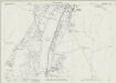
SU33 - OS 1:25,000 Provisional Series Map
1 : 25000 Topographic maps Ordnance Survey Ordnance Survey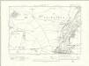
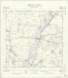
Hampshire & Isle of Wight XXXI.SE - OS Six-Inch Map
1 : 10560 Topographic maps Ordnance Survey Ordnance Survey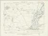
Hampshire & Isle of Wight XXXI.SE - OS Six-Inch Map
1 : 10560 Topographic maps Ordnance Survey Ordnance Survey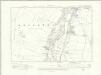
Hampshire & Isle of Wight XXXIX.NE - OS Six-Inch Map
1 : 10560 Topographic maps Ordnance Survey Ordnance Survey
Hampshire & Isle of Wight XXXIX.NE - OS Six-Inch Map
1 : 10560 Topographic maps Ordnance Survey Ordnance Survey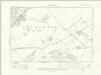
Hampshire & Isle of Wight XXXII.SW - OS Six-Inch Map
1 : 10560 Topographic maps Ordnance Survey Ordnance Survey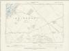
Hampshire & Isle of Wight XXXII.SW - OS Six-Inch Map
1 : 10560 Topographic maps Ordnance Survey Ordnance Survey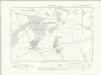
Hampshire & Isle of Wight XL.NW - OS Six-Inch Map
1 : 10560 Topographic maps Ordnance Survey Ordnance Survey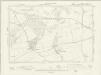
Hampshire & Isle of Wight XL.NW - OS Six-Inch Map
1 : 10560 Topographic maps Ordnance Survey Ordnance Survey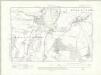
Hampshire & Isle of Wight XXXIX.SE - OS Six-Inch Map
1 : 10560 Topographic maps Ordnance Survey Ordnance Survey
Hampshire & Isle of Wight XXXIX.SE - OS Six-Inch Map
1 : 10560 Topographic maps Ordnance Survey Ordnance Survey
Hampshire and Isle of Wight XXXI.7 (includes: Goodworth Clatford; Longstock; Nether Wallop; Upper Clatford; Wherwell) - 25 Inch Map
1 : 2500 Topographic maps Ordnance Survey Ordnance Survey
Hampshire and Isle of Wight XXXI.7 (includes: Goodworth Clatford; Longstock; Nether Wallop; Upper Clatford; Wherwell) - 25 Inch Map
1 : 2500 Topographic maps Ordnance Survey Ordnance Survey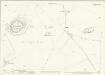
Hampshire and Isle of Wight XXXI.11 (includes: Longstock; Nether Wallop) - 25 Inch Map
1 : 2500 Topographic maps Ordnance Survey Ordnance Survey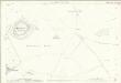
Hampshire and Isle of Wight XXXI.11 (includes: Longstock; Nether Wallop) - 25 Inch Map
1 : 2500 Topographic maps Ordnance Survey Ordnance Survey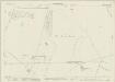
Hampshire and Isle of Wight XXXI.15 (includes: Broughton; Houghton; Longstock; Nether Wallop) - 25 Inch Map
1 : 2500 Topographic maps Ordnance Survey Ordnance Survey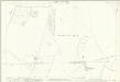
Hampshire and Isle of Wight XXXI.15 (includes: Broughton; Houghton; Longstock; Nether Wallop) - 25 Inch Map
1 : 2500 Topographic maps Ordnance Survey Ordnance Survey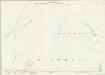
Hampshire and Isle of Wight XXXIX.3 (includes: Broughton; Houghton) - 25 Inch Map
1 : 2500 Topographic maps Ordnance Survey Ordnance Survey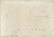
Hampshire and Isle of Wight XXXIX.3 (includes: Broughton; Houghton) - 25 Inch Map
1 : 2500 Topographic maps Ordnance Survey Ordnance Survey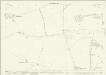
Hampshire and Isle of Wight XXXI.8 (includes: Goodworth Clatford; Longstock; Wherwell) - 25 Inch Map
1 : 2500 Topographic maps Ordnance Survey Ordnance Survey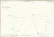
Hampshire and Isle of Wight XXXI.8 (includes: Goodworth Clatford; Longstock; Wherwell) - 25 Inch Map
1 : 2500 Topographic maps Ordnance Survey Ordnance Survey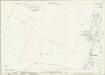
Hampshire and Isle of Wight XXXIX.7 (includes: Broughton; Houghton; Kings Somborne) - 25 Inch Map
1 : 2500 Topographic maps Ordnance Survey Ordnance Survey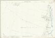
Hampshire and Isle of Wight XXXIX.7 (includes: Broughton; Houghton; Kings Somborne) - 25 Inch Map
1 : 2500 Topographic maps Ordnance Survey Ordnance Survey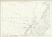
Hampshire and Isle of Wight XXXI.12 (includes: Leckford; Longstock) - 25 Inch Map
1 : 2500 Topographic maps Ordnance Survey Ordnance Survey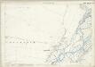
Hampshire and Isle of Wight XXXI.12 (includes: Leckford; Longstock) - 25 Inch Map
1 : 2500 Topographic maps Ordnance Survey Ordnance Survey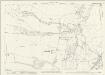
Hampshire and Isle of Wight XXXIX.11 (includes: Bossington; Broughton; Houghton; Kings Somborne) - 25 Inch Map
1 : 2500 Topographic maps Ordnance Survey Ordnance Survey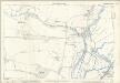
Hampshire and Isle of Wight XXXIX.11 (includes: Bossington; Broughton; Houghton; Kings Somborne) - 25 Inch Map
1 : 2500 Topographic maps Ordnance Survey Ordnance Survey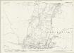
Hampshire and Isle of Wight XXXI.16 (includes: Houghton; Leckford; Longstock; Stockbridge) - 25 Inch Map
1 : 2500 Topographic maps Ordnance Survey Ordnance Survey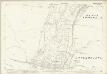
Hampshire and Isle of Wight XXXI.16 (includes: Houghton; Leckford; Longstock; Stockbridge) - 25 Inch Map
1 : 2500 Topographic maps Ordnance Survey Ordnance Survey