Maps of Worcestershire

SP05 - OS 1:25,000 Provisional Series Map
1 : 25000 Topographic maps Ordnance Survey Ordnance Survey
Warwickshire XLII.NE - OS Six-Inch Map
1 : 10560 Topographic maps Ordnance Survey Ordnance Survey
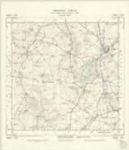
Worcestershire XXXV.NE - OS Six-Inch Map
1 : 10560 Topographic maps Ordnance Survey Ordnance Survey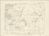
Warwickshire XLII.SE - OS Six-Inch Map
1 : 10560 Topographic maps Ordnance Survey Ordnance Survey
Warwickshire XLII.SE - OS Six-Inch Map
1 : 10560 Topographic maps Ordnance Survey Ordnance Survey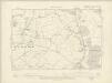
Warwickshire XXXVI.SE - OS Six-Inch Map
1 : 10560 Topographic maps Ordnance Survey Ordnance Survey
Worcestershire XXX.SE - OS Six-Inch Map
1 : 10560 Topographic maps Ordnance Survey Ordnance Survey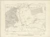
Warwickshire XLIII.NW - OS Six-Inch Map
1 : 10560 Topographic maps Ordnance Survey Ordnance Survey
Warwickshire XLIII.NW - OS Six-Inch Map
1 : 10560 Topographic maps Ordnance Survey Ordnance Survey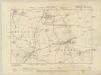
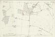
Gloucestershire I.SW - OS Six-Inch Map
1 : 10560 Topographic maps Ordnance Survey Ordnance Survey
Warwickshire XLIII.SW - OS Six-Inch Map
1 : 10560 Topographic maps Ordnance Survey Ordnance Survey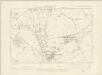
Warwickshire XXXVII.SW - OS Six-Inch Map
1 : 10560 Topographic maps Ordnance Survey Ordnance Survey
Warwickshire XXXVII.SW - OS Six-Inch Map
1 : 10560 Topographic maps Ordnance Survey Ordnance Survey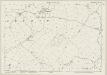
Worcestershire XXX.15 (includes: Inkberrow) - 25 Inch Map
1 : 2500 Topographic maps Ordnance Survey Ordnance Survey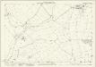
Worcestershire XXXV.3 (includes: Abbots Morton; Inkberrow; Rous Lench) - 25 Inch Map
1 : 2500 Topographic maps Ordnance Survey Ordnance Survey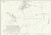
Worcestershire XXXV.7 (includes: Abbots Morton; Inkberrow; Rous Lench) - 25 Inch Map
1 : 2500 Topographic maps Ordnance Survey Ordnance Survey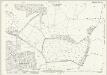
Worcestershire XXXV.11 (includes: Abbots Morton; Church Lench; Rous Lench; Salford Priors) - 25 Inch Map
1 : 2500 Topographic maps Ordnance Survey Ordnance Survey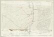
Warwickshire XXXVI.16 (includes: Alcester; Arrow; Inkberrow) - 25 Inch Map
1 : 2500 Topographic maps Ordnance Survey Ordnance Survey
Worcestershire XXX.16 (includes: Alcester; Arrow; Inkberrow) - 25 Inch Map
1 : 2500 Topographic maps Ordnance Survey Ordnance Survey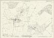
Worcestershire XXXV.15 (includes: Church Lench; Harvington; Salford Priors) - 25 Inch Map
1 : 2500 Topographic maps Ordnance Survey Ordnance Survey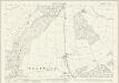
Worcestershire XXXV.4 (includes: Abbots Morton; Arrow; Inkberrow; Weethley) - 25 Inch Map
1 : 2500 Topographic maps Ordnance Survey Ordnance Survey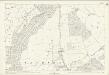
Worcestershire XXXV.4 (includes: Abbots Morton; Arrow; Inkberrow; Weethley) - 25 Inch Map
1 : 2500 Topographic maps Ordnance Survey Ordnance Survey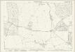
Worcestershire XXXV.8 (includes: Abbots Morton; Arrow; Salford Priors; Weethley) - 25 Inch Map
1 : 2500 Topographic maps Ordnance Survey Ordnance Survey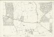
Warwickshire XLII.8 (includes: Abbots Morton; Arrow; Salford Priors; Weethley) - 25 Inch Map
1 : 2500 Topographic maps Ordnance Survey Ordnance Survey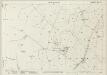
Worcestershire XXXV.12 (includes: Abbots Morton; Church Lench; Salford Priors) - 25 Inch Map
1 : 2500 Topographic maps Ordnance Survey Ordnance Survey
Warwickshire XLII.12 (includes: Abbots Morton; Church Lench; Salford Priors) - 25 Inch Map
1 : 2500 Topographic maps Ordnance Survey Ordnance Survey
Warwickshire XXXVII.13 (includes: Alcester; Arrow) - 25 Inch Map
1 : 2500 Topographic maps Ordnance Survey Ordnance Survey
Warwickshire XXXVII.13 (includes: Alcester; Arrow) - 25 Inch Map
1 : 2500 Topographic maps Ordnance Survey Ordnance Survey
Warwickshire XXXVII.13 (includes: Alcester; Arrow) - 25 Inch Map
1 : 2500 Topographic maps Ordnance Survey Ordnance Survey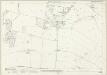
Worcestershire XXXV.16 (includes: Church Lench; Harvington; Salford Priors) - 25 Inch Map
1 : 2500 Topographic maps Ordnance Survey Ordnance Survey