Maps of Gringley on the Hill

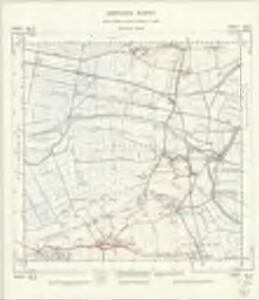
SK79 - OS 1:25,000 Provisional Series Map
1 : 25000 Topographic maps Ordnance Survey Ordnance Survey
Yorkshire 292 - OS Six-Inch Map
1 : 10560 Topographic maps Ordnance Survey Ordnance Survey
Lincolnshire XXXIV.NW - OS Six-Inch Map
1 : 10560 Topographic maps Ordnance Survey Ordnance Survey
Lincolnshire XXXIV.NW - OS Six-Inch Map
1 : 10560 Topographic maps Ordnance Survey Ordnance Survey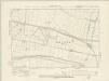
Lincolnshire XXXIV.NW - OS Six-Inch Map
1 : 10560 Topographic maps Ordnance Survey Ordnance Survey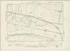
Nottinghamshire IV.NW - OS Six-Inch Map
1 : 10560 Topographic maps Ordnance Survey Ordnance Survey
Lincolnshire XXXIV.NW - OS Six-Inch Map
1 : 10560 Topographic maps Ordnance Survey Ordnance Survey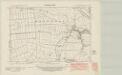
Nottinghamshire IV.SW - OS Six-Inch Map
1 : 10560 Topographic maps Ordnance Survey Ordnance Survey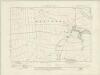
Nottinghamshire IV.SW - OS Six-Inch Map
1 : 10560 Topographic maps Ordnance Survey Ordnance Survey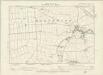
Nottinghamshire IV.SW - OS Six-Inch Map
1 : 10560 Topographic maps Ordnance Survey Ordnance Survey
Nottinghamshire IV.SW - OS Six-Inch Map
1 : 10560 Topographic maps Ordnance Survey Ordnance Survey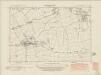
Nottinghamshire VII.NW - OS Six-Inch Map
1 : 10560 Topographic maps Ordnance Survey Ordnance Survey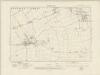
Nottinghamshire VII.NW - OS Six-Inch Map
1 : 10560 Topographic maps Ordnance Survey Ordnance Survey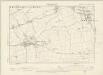
Nottinghamshire VII.NW - OS Six-Inch Map
1 : 10560 Topographic maps Ordnance Survey Ordnance Survey
Nottinghamshire VII.NW - OS Six-Inch Map
1 : 10560 Topographic maps Ordnance Survey Ordnance Survey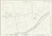
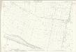
Lincolnshire XXXIV.3 (includes: Haxey; Owston Ferry) - 25 Inch Map
1 : 2500 Topographic maps Ordnance Survey Ordnance Survey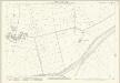
Lincolnshire XXXIV.3 (includes: Haxey; Owston Ferry) - 25 Inch Map
1 : 2500 Topographic maps Ordnance Survey Ordnance Survey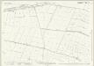
Lincolnshire XXXIV.7 (includes: Haxey; Misterton; Owston Ferry; West Stockwith) - 25 Inch Map
1 : 2500 Topographic maps Ordnance Survey Ordnance Survey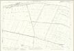
Nottinghamshire IV.7 (includes: Haxey; Misterton; Owston Ferry; West Stockwith) - 25 Inch Map
1 : 2500 Topographic maps Ordnance Survey Ordnance Survey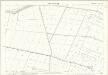
Lincolnshire XXXIV.7 (includes: Haxey; Misterton; Owston Ferry; West Stockwith) - 25 Inch Map
1 : 2500 Topographic maps Ordnance Survey Ordnance Survey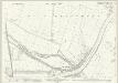
Lincolnshire XXXIV.11 (includes: Blyton; East Stockwith; Misterton; Owston Ferry; West Stockwith) - 25 Inch Map
1 : 2500 Topographic maps Ordnance Survey Ordnance Survey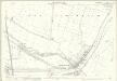
Nottinghamshire IV.11 (includes: Blyton; East Stockwith; Misterton; Owston Ferry; West Stockwith) - 25 Inch Map
1 : 2500 Topographic maps Ordnance Survey Ordnance Survey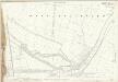
Nottinghamshire IV.11 (includes: Blyton; East Stockwith; Misterton; Owston Ferry; West Stockwith) - 25 Inch Map
1 : 2500 Topographic maps Ordnance Survey Ordnance Survey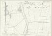
Lincolnshire XXXIV.15 (includes: Blyton; East Stockwith; Misterton; Morton; Walkeringham; Walkerith) - 25 Inch Map
1 : 2500 Topographic maps Ordnance Survey Ordnance Survey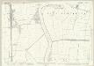
Nottinghamshire IV.15 (includes: Blyton; East Stockwith; Misterton; Morton; Walkeringham; Walkerith) - 25 Inch Map
1 : 2500 Topographic maps Ordnance Survey Ordnance Survey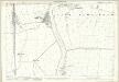
Nottinghamshire IV.15 (includes: Blyton; East Stockwith; Misterton; Morton; Walkeringham; Walkerith) - 25 Inch Map
1 : 2500 Topographic maps Ordnance Survey Ordnance Survey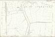
Lincolnshire XXXIV.15 (includes: Blyton; East Stockwith; Misterton; Morton; Walkeringham; Walkerith) - 25 Inch Map
1 : 2500 Topographic maps Ordnance Survey Ordnance Survey
Lincolnshire XXXIV.2 (includes: Haxey) - 25 Inch Map
1 : 2500 Topographic maps Ordnance Survey Ordnance Survey
Lincolnshire XXXIV.2 (includes: Haxey) - 25 Inch Map
1 : 2500 Topographic maps Ordnance Survey Ordnance Survey