Maps of Shropshire

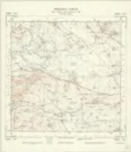
SJ31 - OS 1:25,000 Provisional Series Map
1 : 25000 Topographic maps Ordnance Survey Ordnance Survey
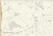
Shropshire XXVII.SW - OS Six-Inch Map
1 : 10560 Topographic maps Ordnance Survey Ordnance Survey
Shropshire XXVII.SW - OS Six-Inch Map
1 : 10560 Topographic maps Ordnance Survey Ordnance Survey
Shropshire XXXIII.NW - OS Six-Inch Map
1 : 10560 Topographic maps Ordnance Survey Ordnance Survey
Shropshire XXXIII.NW - OS Six-Inch Map
1 : 10560 Topographic maps Ordnance Survey Ordnance Survey
Shropshire XXXIII.SW - OS Six-Inch Map
1 : 10560 Topographic maps Ordnance Survey Ordnance Survey
Shropshire XXXIII.SW - OS Six-Inch Map
1 : 10560 Topographic maps Ordnance Survey Ordnance Survey
Shropshire XXVI.SE - OS Six-Inch Map
1 : 10560 Topographic maps Ordnance Survey Ordnance Survey
Shropshire XXVI.SE - OS Six-Inch Map
1 : 10560 Topographic maps Ordnance Survey Ordnance Survey
Shropshire XXXII.NE - OS Six-Inch Map
1 : 10560 Topographic maps Ordnance Survey Ordnance Survey
Montgomeryshire XVI.NE - OS Six-Inch Map
1 : 10560 Topographic maps Ordnance Survey Ordnance Survey
Shropshire XXXII.SE - OS Six-Inch Map
1 : 10560 Topographic maps Ordnance Survey Ordnance Survey
Shropshire XXXII.SE - OS Six-Inch Map
1 : 10560 Topographic maps Ordnance Survey Ordnance Survey
Shropshire XXVII.10 (includes: Great Ness) - 25 Inch Map
1 : 2500 Topographic maps Ordnance Survey Ordnance Survey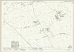
Shropshire XXVII.14 (includes: Great Ness; Montford) - 25 Inch Map
1 : 2500 Topographic maps Ordnance Survey Ordnance Survey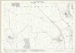
Shropshire XXXIII.2 (includes: Alberbury With Cardeston; Montford) - 25 Inch Map
1 : 2500 Topographic maps Ordnance Survey Ordnance Survey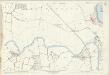
Shropshire XXXIII.2 (includes: Alberbury With Cardeston; Montford) - 25 Inch Map
1 : 2500 Topographic maps Ordnance Survey Ordnance Survey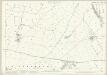
Shropshire XXXIII.6 (includes: Alberbury With Cardeston; Montford) - 25 Inch Map
1 : 2500 Topographic maps Ordnance Survey Ordnance Survey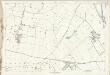
Shropshire XXXIII.6 (includes: Alberbury With Cardeston; Montford) - 25 Inch Map
1 : 2500 Topographic maps Ordnance Survey Ordnance Survey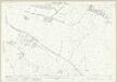
Shropshire XXVII.9 (includes: Great Ness; Kinnerley) - 25 Inch Map
1 : 2500 Topographic maps Ordnance Survey Ordnance Survey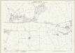
Shropshire XXXIII.10 (includes: Alberbury With Cardeston) - 25 Inch Map
1 : 2500 Topographic maps Ordnance Survey Ordnance Survey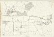
Shropshire XXXIII.10 (includes: Alberbury With Cardeston) - 25 Inch Map
1 : 2500 Topographic maps Ordnance Survey Ordnance Survey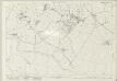
Shropshire XXVII.13 (includes: Alberbury With Cardeston; Great Ness; Kinnerley; Montford) - 25 Inch Map
1 : 2500 Topographic maps Ordnance Survey Ordnance Survey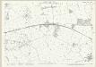
Shropshire XXXIII.14 (includes: Alberbury With Cardeston; Westbury) - 25 Inch Map
1 : 2500 Topographic maps Ordnance Survey Ordnance Survey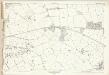
Shropshire XXXIII.14 (includes: Alberbury With Cardeston; Westbury) - 25 Inch Map
1 : 2500 Topographic maps Ordnance Survey Ordnance Survey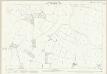
Shropshire XXXIII.1 (includes: Alberbury With Cardeston; Bausley; Montford) - 25 Inch Map
1 : 2500 Topographic maps Ordnance Survey Ordnance Survey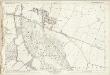
Shropshire XXXIII.5 (includes: Alberbury With Cardeston; Bausley) - 25 Inch Map
1 : 2500 Topographic maps Ordnance Survey Ordnance Survey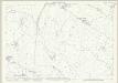
Shropshire XXVI.12 (includes: Great Ness; Kinnerley; Melverley) - 25 Inch Map
1 : 2500 Topographic maps Ordnance Survey Ordnance Survey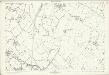
Shropshire XXVI.12 (includes: Great Ness; Kinnerley; Melverley) - 25 Inch Map
1 : 2500 Topographic maps Ordnance Survey Ordnance Survey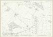
Shropshire XXXIII.9 (includes: Alberbury With Cardeston) - 25 Inch Map
1 : 2500 Topographic maps Ordnance Survey Ordnance Survey