Maps of Cumbria

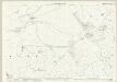
NY00 & Parts of NX90 - OS 1:25,000 Provisional Series Map
1 : 25000 Topographic maps Ordnance Survey Ordnance Survey
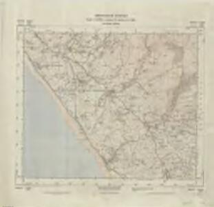
Cumberland LXXVIII - OS Six-Inch Map
1 : 10560 Topographic maps Ordnance Survey Ordnance Survey
Cumberland LXXIII.SW - OS Six-Inch Map
1 : 10560 Topographic maps Ordnance Survey Ordnance Survey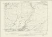
Cumberland LXXIII.SW - OS Six-Inch Map
1 : 10560 Topographic maps Ordnance Survey Ordnance Survey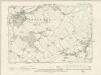
Cumberland LXXVIII.NW - OS Six-Inch Map
1 : 10560 Topographic maps Ordnance Survey Ordnance Survey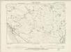
Cumberland LXXVIII.SW - OS Six-Inch Map
1 : 10560 Topographic maps Ordnance Survey Ordnance Survey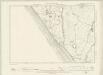
Cumberland LXXVII.NE - OS Six-Inch Map
1 : 10560 Topographic maps Ordnance Survey Ordnance Survey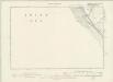
Cumberland LXXVII.SE - OS Six-Inch Map
1 : 10560 Topographic maps Ordnance Survey Ordnance Survey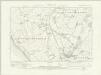
Cumberland LXXII.SE - OS Six-Inch Map
1 : 10560 Topographic maps Ordnance Survey Ordnance Survey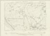
Cumberland LXXII.SE - OS Six-Inch Map
1 : 10560 Topographic maps Ordnance Survey Ordnance Survey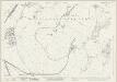
Cumberland LXXII.12 (includes: Beckermet St John) - 25 Inch Map
1 : 2500 Topographic maps Ordnance Survey Ordnance Survey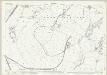
Cumberland LXXII.12 (includes: Beckermet St John) - 25 Inch Map
1 : 2500 Topographic maps Ordnance Survey Ordnance Survey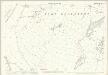
Cumberland LXXII.12 (includes: Beckermet St John) - 25 Inch Map
1 : 2500 Topographic maps Ordnance Survey Ordnance Survey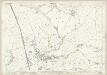
Cumberland LXXII.16 (includes: Beckermet St Bridget) - 25 Inch Map
1 : 2500 Topographic maps Ordnance Survey Ordnance Survey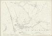
Cumberland LXXII.16 (includes: Beckermet St Bridget) - 25 Inch Map
1 : 2500 Topographic maps Ordnance Survey Ordnance Survey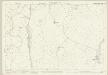
Cumberland LXXVII.4 (includes: Beckermet St Bridget) - 25 Inch Map
1 : 2500 Topographic maps Ordnance Survey Ordnance Survey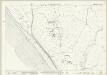
Cumberland LXXVII.8 (includes: Beckermet St Bridget) - 25 Inch Map
1 : 2500 Topographic maps Ordnance Survey Ordnance Survey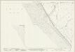
Cumberland LXXVII.12 & 16 (includes: Beckermet St Bridget; Seascale) - 25 Inch Map
1 : 2500 Topographic maps Ordnance Survey Ordnance Survey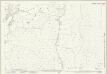
Cumberland LXXIII.9 (includes: Beckermet St Bridget) - 25 Inch Map
1 : 2500 Topographic maps Ordnance Survey Ordnance Survey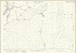
Cumberland LXXIII.9 (includes: Beckermet St Bridget) - 25 Inch Map
1 : 2500 Topographic maps Ordnance Survey Ordnance Survey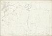
Cumberland LXXIII.9 (includes: Beckermet St Bridget) - 25 Inch Map
1 : 2500 Topographic maps Ordnance Survey Ordnance Survey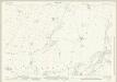
Cumberland LXXIII.13 (includes: Beckermet St Bridget) - 25 Inch Map
1 : 2500 Topographic maps Ordnance Survey Ordnance Survey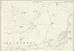
Cumberland LXXIII.13 (includes: Beckermet St Bridget) - 25 Inch Map
1 : 2500 Topographic maps Ordnance Survey Ordnance Survey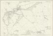
Cumberland LXXVIII.1 (includes: Beckermet St Bridget) - 25 Inch Map
1 : 2500 Topographic maps Ordnance Survey Ordnance Survey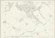
Cumberland LXXVIII.5 (includes: Beckermet St Bridget) - 25 Inch Map
1 : 2500 Topographic maps Ordnance Survey Ordnance Survey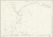
Cumberland LXXIII.10 (includes: Beckermet St Bridget) - 25 Inch Map
1 : 2500 Topographic maps Ordnance Survey Ordnance Survey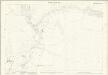
Cumberland LXXIII.10 (includes: Beckermet St Bridget) - 25 Inch Map
1 : 2500 Topographic maps Ordnance Survey Ordnance Survey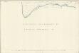
Cumberland LXXIII.10 (includes: Beckermet St Bridget) - 25 Inch Map
1 : 2500 Topographic maps Ordnance Survey Ordnance Survey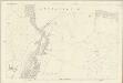
Cumberland LXXIII.10 (includes: Beckermet St Bridget) - 25 Inch Map
1 : 2500 Topographic maps Ordnance Survey Ordnance Survey