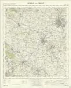
Maps of Derby

Burton upon Trent - OS One-Inch Map
1 : 63360 Topographic maps Ordnance Survey Ordnance Survey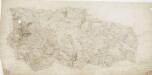
Lichfield
1 : 31680 This plan covers part of East Staffordshire and its neighbouring counties. County borders are highlighted by coloured pecked lines. The large heath of Cannock Chase, once an expansive sweep of a great medieval royal hunting forest, is depicted at lower left. A section of the Ryknild Street is shown in buff down the middle of the sheet. This Roman road ran from the Fosse Way in Gloucestershire to Little Chester (Derby). Triangles used by Dawson to plot the survey are clearly visible outside the plan, with triangulations reported in a table at bottom right. Dawson, Robert
Sudbury Park
1 : 31680 The county boundary of Derbyshire and Staffordshire is indicated by a red pecked line. The boundary closely follows the River Dove. In the margins of the drawing several dots annotated with place names indicate observation stations. This is where the surveyor stood to take triangulation measurements. No indications of relief are given, suggesting that this is an outline plan, the midpoint between the original protraction and the finished drawing. The road network is precisely delineated. Major communication routes are coloured yellow, following military cartographic convention. Stevens, Henry
Hartshorn
1 : 31680 .The attention to communications routes shown on this map conforms well to the military and cartographic standards employed by the Survey. Sections of the Grand Trunk and Derby Canals are shown in blue, with individual locks distinguishable around Newton Solney. Woods are indicated,on this plan,by the use of a green tint, meadows by a lighter green and arable land by a brown shade. Some fields are named. This drawing is formally titled and the area of the land is recorded at the top left margin as,totalling 88 square miles. Stevens, Henry
Burton upon Trent (Hills) - OS One-Inch Revised New Series
1 : 63360 Topographic maps Ordnance Survey Ordnance Survey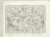
Burton upon Trent (Outline) - OS One-Inch Revised New Series
1 : 63360 Topographic maps Ordnance Survey Ordnance Survey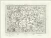
Lichfield (Outline) - OS One-Inch Revised New Series
1 : 63360 Topographic maps Ordnance Survey Ordnance Survey
Lichfield (Hills) - OS One-Inch Revised New Series
1 : 63360 Topographic maps Ordnance Survey Ordnance Survey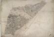
Tutbury
1 : 31680 A section of the River Dove bisects this plan from left to right. The Grand Trent Canal is shown in blue running alongside the Ryknild Street, a famous Roman road, to the bottom right. An area calculation table survives in black ink in the right margin. Stevens, Henry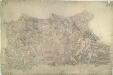
Sutton Coldfield
1 : 31680 This drawing of the area north-east of Birmingham was executed by Robert Dawson, who used different shades of green to distinguish land uses. Sutton Coldfield is depicted at lower right. Now a residential suburb of Birmingham, it was originally a market town with Sutton Park. The 970-hectare site was a private estate and one of Henry VIII's favourite hunting grounds. Areas of woodland, heathland and wetland make up the landscape of the park. Dawson, Robert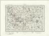
Ashbourne (Outline) - OS One-Inch Revised New Series
1 : 63360 Topographic maps Ordnance Survey Ordnance Survey
Ashbourne (Hills) - OS One-Inch Revised New Series
1 : 63360 Topographic maps Ordnance Survey Ordnance Survey
Derby 13
1 : 31680 To the left of the plan, highlighted in buff, is a section,of the Ryknild Street, a Roman road which ran from the Fosse Way in Gloucestershire to 'Little Chester' (Derby). The attention paid to communications routes conforms well to the military and cartographic standards employed by the Survey. Stretches of the Grand Trunk and Derby Canals are shown in blue with individual locks distinguished. Woodlands are,indicated,by a green tint. Stevens, Henry
Atherstone (Hills) - OS One-Inch Revised New Series
1 : 63360 Topographic maps Ordnance Survey Ordnance Survey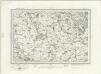
Atherstone (Outline) - OS One-Inch Revised New Series
1 : 63360 Topographic maps Ordnance Survey Ordnance Survey
Loughborough (Hills) - OS One-Inch Revised New Series
1 : 63360 Topographic maps Ordnance Survey Ordnance Survey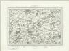
Loughborough (Outline) - OS One-Inch Revised New Series
1 : 63360 Topographic maps Ordnance Survey Ordnance Survey
Detail from OSD,334 (Sudbury Park), showing Sudbury Hall
1 : 31680 A detail from OSD Map 334, showing Sudbury Hall in Derbyshire, surveyed in 1832-33. The county boundary,of Derbyshire and Staffordshire is indicated by a red pecked line. The boundary closely follows the River Dove, to the south of Sudbury Hall. No indications of relief are given, suggesting that this is an outline plan,,the midpoint,between the original protraction and the finished drawing. The road network is precisely delineated. Major communication routes are coloured yellow, following military cartographic convention. Stephens, Henry
SK34 - OS 1:25,000 Provisional Series Map
1 : 25000 Topographic maps Ordnance Survey Ordnance Survey
SK33 - OS 1:25,000 Provisional Series Map
1 : 25000 Topographic maps Ordnance Survey Ordnance Survey
SK32 - OS 1:25,000 Provisional Series Map
1 : 25000 Topographic maps Ordnance Survey Ordnance Survey
SK31 - OS 1:25,000 Provisional Series Map
1 : 25000 Topographic maps Ordnance Survey Ordnance Survey
SK23 - OS 1:25,000 Provisional Series Map
1 : 25000 Topographic maps Ordnance Survey Ordnance Survey
SK30 - OS 1:25,000 Provisional Series Map
1 : 25000 Topographic maps Ordnance Survey Ordnance Survey
SK22 - OS 1:25,000 Provisional Series Map
1 : 25000 Topographic maps Ordnance Survey Ordnance Survey
SK21 - OS 1:25,000 Provisional Series Map
1 : 25000 Topographic maps Ordnance Survey Ordnance Survey
SK13 - OS 1:25,000 Provisional Series Map
1 : 25000 Topographic maps Ordnance Survey Ordnance Survey
SK20 - OS 1:25,000 Provisional Series Map
1 : 25000 Topographic maps Ordnance Survey Ordnance Survey
SK12 - OS 1:25,000 Provisional Series Map
1 : 25000 Topographic maps Ordnance Survey Ordnance Survey