Maps of Staffordshire Moorlands

Buxton and Matlock - OS One-Inch Map
1 : 63360 Topographic maps Ordnance Survey Ordnance Survey
Chapel en le Frith (Hills) - OS One-Inch Revised New Series
1 : 63360 Topographic maps Ordnance Survey Ordnance Survey
Chapel en le Frith (Outline) - OS One-Inch Revised New Series
1 : 63360 Topographic maps Ordnance Survey Ordnance Survey
Buxton (Outline) - OS One-Inch Revised New Series
1 : 63360 Topographic maps Ordnance Survey Ordnance Survey
Buxton (Hills) - OS One-Inch Revised New Series
1 : 63360 Topographic maps Ordnance Survey Ordnance Survey
Ashbourne
1 : 31680 The absence of hill sketching on this drawing suggests it is an incomplete or 'rough' copy. A triangulation diagram appears on the reverse. This enabled the draughtsman to plot prominent features of the landscape. Major lines of communication are coloured yellow, following standard military cartographic convention. Notes in the margins of the drawing record the date it was received at the "Ord[nance] Map Office" and that it has been reduced and drawn for the engravers. Drawings were reduced to a scale of one inch to the mile for the final engraved sheets.
Ashbourne (Outline) - OS One-Inch Revised New Series
1 : 63360 Topographic maps Ordnance Survey Ordnance Survey
Ashbourne (Hills) - OS One-Inch Revised New Series
1 : 63360 Topographic maps Ordnance Survey Ordnance Survey
Longnor
1 : 31680 The right-hand portion of this drawing has pencil annotations that are now too faint to read. A triangulation diagram appears on the reverse. This enabled the draughtsman to plot topographical features of the landscape. There is no hill sketching, suggesting that this is an intermediate version of the plan. Major lines of communication are coloured yellow, following military cartographic convention. Stevens, Henry
Cheadle
1 : 31680 A triangulation diagram appears on the reverse of this drawing. This enabled the draughtsman to plot topographical features of the landscape. There is no hill sketching on this drawing, suggesting that it is a rough copy. Major lines of communication are coloured yellow, following standard military cartographic procedure. Stevens, Henry
Belper
1 : 31680 There is no hill sketching on this drawing, suggesting it is an intermediate version. Yellow lines represent the area that would be covered by the final plan. A triangulation diagram appears on the reverse of this drawing. This enabled the draughtsman to plot prominent features of the landscape. Major lines of communication are coloured yellow, following standard military cartographic convention.
Chesterfield (Hills) - OS One-Inch Revised New Series
1 : 63360 Topographic maps Ordnance Survey Ordnance Survey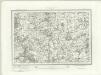
Chesterfield (Outline) - OS One-Inch Revised New Series
1 : 63360 Topographic maps Ordnance Survey Ordnance Survey
Sheffield (Hills) - OS One-Inch Revised New Series
1 : 63360 Topographic maps Ordnance Survey Ordnance Survey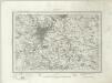
Sheffield (Outline) - OS One-Inch Revised New Series
1 : 63360 Topographic maps Ordnance Survey Ordnance Survey
Derby (Hills) - OS One-Inch Revised New Series
1 : 63360 Topographic maps Ordnance Survey Ordnance Survey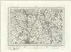
Derby (Outline) - OS One-Inch Revised New Series
1 : 63360 Topographic maps Ordnance Survey Ordnance Survey
SK38 - OS 1:25,000 Provisional Series Map
1 : 25000 Topographic maps Ordnance Survey Ordnance Survey
SK37 - OS 1:25,000 Provisional Series Map
1 : 25000 Topographic maps Ordnance Survey Ordnance Survey
SK36 - OS 1:25,000 Provisional Series Map
1 : 25000 Topographic maps Ordnance Survey Ordnance Survey
SK28 - OS 1:25,000 Provisional Series Map
1 : 25000 Topographic maps Ordnance Survey Ordnance Survey
SK35 - OS 1:25,000 Provisional Series Map
1 : 25000 Topographic maps Ordnance Survey Ordnance Survey
SK27 - OS 1:25,000 Provisional Series Map
1 : 25000 Topographic maps Ordnance Survey Ordnance Survey
SK34 - OS 1:25,000 Provisional Series Map
1 : 25000 Topographic maps Ordnance Survey Ordnance Survey
SK26 - OS 1:25,000 Provisional Series Map
1 : 25000 Topographic maps Ordnance Survey Ordnance Survey
SK18 - OS 1:25,000 Provisional Series Map
1 : 25000 Topographic maps Ordnance Survey Ordnance Survey
SK25 - OS 1:25,000 Provisional Series Map
1 : 25000 Topographic maps Ordnance Survey Ordnance Survey
SK17 - OS 1:25,000 Provisional Series Map
1 : 25000 Topographic maps Ordnance Survey Ordnance Survey
SK24 - OS 1:25,000 Provisional Series Map
1 : 25000 Topographic maps Ordnance Survey Ordnance Survey