Maps of Dundee
Forfar, Sheet XLIII.4 (Glamis) - OS 25 Inch map
1 : 2500 Topographic maps Ordnance Survey Ordnance Survey
Forfarshire, Sheet 043.04 - 25 Inch Map
1 : 2500 Topographic maps Ordnance Survey Ordnance Survey
Forfarshire, Sheet 043.04 - 25 Inch Map
1 : 2500 Topographic maps Ordnance Survey Ordnance Survey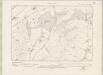
Forfarshire Sheet XLIII.NE - OS 6 Inch map
1 : 10560 Topographic maps Ordnance Survey Ordnance Survey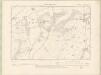
Forfarshire Sheet XLIII.NE - OS 6 Inch map
1 : 10560 Topographic maps Ordnance Survey Ordnance Survey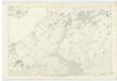
Forfarshire, Sheet XLIII - OS 6 Inch map
1 : 10560 Topographic maps Ordnance Survey Ordnance Survey
NO34 - OS 1:25,000 Provisional Series Map
1 : 25000 Topographic maps Ordnance Survey Ordnance Survey
Blairgowrie - OS One-Inch map
1 : 63360 Topographic maps Ordnance Survey Ordnance Survey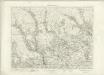
Blairgowrie - OS One-Inch map
1 : 63360 Topographic maps Ordnance Survey Ordnance Survey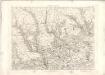
Blairgowrie - OS One-Inch map
1 : 63360 Topographic maps Ordnance Survey Ordnance Survey
Forfar & Dundee (57) - OS One-Inch map
1 : 63360 Topographic maps Ordnance Survey Ordnance Survey
Forfar & Dundee (57) - OS One-Inch map
1 : 63360 Topographic maps Ordnance Survey Ordnance Survey
Arbroath & Montrose (58) - OS One-Inch map
1 : 63360 Topographic maps Ordnance Survey Ordnance Survey
Arbroath & Montrose (58) - OS One-Inch map
1 : 63360 Topographic maps Ordnance Survey Ordnance Survey
Forfar - OS One-Inch Map
1 : 63360 Topographic maps Ordnance Survey Ordnance Survey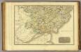
Angusshire S.
1 : 100000 Thomson, John
Angusia Provincia Scotiae sive The Shire of Angus. Shire of Angus.
Edward, Robert, ca. 1616-1696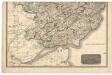
Southern Part of Angus Shire.
Thomson, John, 1777- ca. 1840 Johnson, William, fl. 1806-1840
Northern Part of Angus Shire.
Thomson, John, 1777- ca. 1840 Johnson, William, fl. 1806-1840
Dunkeld - Bartholomew's 'Survey Atlas of Scotland'
1 : 126720 Topographic maps John Bartholomew & Son, Ltd John Bartholomew & Son, Ltd
The Shire of Angus or Forfar / by H. Moll.
Moll, Herman, d. 1732
Angusia provincia scotiæ sive the shire of Angus
1 Karte : Kupferdruck ; 42 x 50 cm Valck; Schenk sumptibus Gerardi Valk et Petri Schenk
Map of the County of Forfar or Shire of Angus.
Ainslie, John, 1745-1828
Map of the County of Forfar or Shire of Angus.
Ainslie, John, 1745-1828
Map of the County of Forfar or Shire of Angus.
Ainslie, John, 1745-1828
Map of the County of Forfar or Shire of Angus.
Ainslie, John, 1745-1828
Map of the Basin of the Tay, including the greater part of Perth Shire, Strathmore and the Braes of Angus or Forfar.
Knox, James, fl. 1800-1856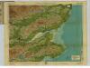
Fife & Angus, Sheet 13 - Bartholomew's "Half Inch to the Mile Maps" of Scotland
1 : 126720 Topographic maps John Bartholomew & Son, Ltd John Bartholomew & Son, Ltd
Perth & Dundee, Sheet 13 - Bartholomew's "Half Inch to the Mile Maps" of Scotland
1 : 126720 Topographic maps Bartholomew, John George John Bartholomew & Co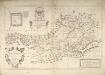
The Mapp of Straithern, Stormount, and Cars of Gourie, with the Rivers Tay and Jern / surveighed and designed by J. Adair ; James Moxon sculp.
Adair, John, ca. 1650-1722 Moxon, J. (James) fl. 1671-1700,