Maps of Peterborough
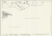
Northamptonshire VIII.16 (includes: Fletton; Peterborough; Stanground North; Stanground South) - 25 Inch Map
1 : 2500 Topographic maps Ordnance Survey Ordnance Survey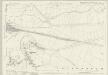
Northamptonshire VIII.16 (includes: Fletton; Peterborough; Stanground North; Stanground South) - 25 Inch Map
1 : 2500 Topographic maps Ordnance Survey Ordnance Survey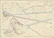
Northamptonshire VIII.16 (includes: Fletton; Peterborough; Stanground North; Stanground South) - 25 Inch Map
1 : 2500 Topographic maps Ordnance Survey Ordnance Survey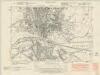
Northamptonshire VIII.SE - OS Six-Inch Map
1 : 10560 Topographic maps Ordnance Survey Ordnance Survey
Northamptonshire VIII.SE - OS Six-Inch Map
1 : 10560 Topographic maps Ordnance Survey Ordnance Survey
Northamptonshire VIII.SE - OS Six-Inch Map
1 : 10560 Topographic maps Ordnance Survey Ordnance Survey
Northamptonshire VIII.SE - OS Six-Inch Map
1 : 10560 Topographic maps Ordnance Survey Ordnance Survey
Northamptonshire VIII.SE - OS Six-Inch Map
1 : 10560 Topographic maps Ordnance Survey Ordnance Survey
Cambridgeshire IX.16 (includes: Fletton; Peterborough; Stanground North; Stanground South; Woodston) - 25 Inch Map
1 : 2500 Topographic maps Ordnance Survey Ordnance Survey
Huntingdonshire II.16 (includes: Fletton; Peterborough; Stanground North; Stanground South; Woodston) - 25 Inch Map
1 : 2500 Topographic maps Ordnance Survey Ordnance Survey
Huntingdonshire II.16 (includes: Fletton; Peterborough; Stanground North; Stanground South; Woodston) - 25 Inch Map
1 : 2500 Topographic maps Ordnance Survey Ordnance Survey
Cambridgeshire X.13 (includes: Peterborough; Stanground North; Stanground South; Thorney; Whittlesey) - 25 Inch Map
1 : 2500 Topographic maps Ordnance Survey Ordnance Survey
Cambridgeshire X.13 (includes: Peterborough; Stanground North; Stanground South; Thorney; Whittlesey) - 25 Inch Map
1 : 2500 Topographic maps Ordnance Survey Ordnance Survey
Cambridgeshire X.13 (includes: Peterborough; Stanground North; Stanground South; Thorney; Whittlesey) - 25 Inch Map
1 : 2500 Topographic maps Ordnance Survey Ordnance Survey
Cambridgeshire IX.SE - OS Six-Inch Map
1 : 10560 Topographic maps Ordnance Survey Ordnance Survey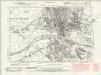
Cambridgeshire IX.SE - OS Six-Inch Map
1 : 10560 Topographic maps Ordnance Survey Ordnance Survey
Cambridgeshire IX.SE - OS Six-Inch Map
1 : 10560 Topographic maps Ordnance Survey Ordnance Survey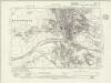
Cambridgeshire IX.SE - OS Six-Inch Map
1 : 10560 Topographic maps Ordnance Survey Ordnance Survey
Huntingdonshire II.SE - OS Six-Inch Map
1 : 10560 Topographic maps Ordnance Survey Ordnance Survey
Cambridgeshire IX.SE - OS Six-Inch Map
1 : 10560 Topographic maps Ordnance Survey Ordnance Survey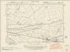
Cambridgeshire X.SW - OS Six-Inch Map
1 : 10560 Topographic maps Ordnance Survey Ordnance Survey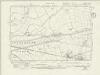
Cambridgeshire X.SW - OS Six-Inch Map
1 : 10560 Topographic maps Ordnance Survey Ordnance Survey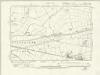
Cambridgeshire X.SW - OS Six-Inch Map
1 : 10560 Topographic maps Ordnance Survey Ordnance Survey
Huntingdonshire III.SW - OS Six-Inch Map
1 : 10560 Topographic maps Ordnance Survey Ordnance Survey
Cambridgeshire X.SW - OS Six-Inch Map
1 : 10560 Topographic maps Ordnance Survey Ordnance Survey
Peterborough (Hills) - OS One-Inch Revised New Series
1 : 63360 Topographic maps Ordnance Survey Ordnance Survey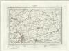
Peterborough (Outline) - OS One-Inch Revised New Series
1 : 63360 Topographic maps Ordnance Survey Ordnance Survey
Whittlesea
1 : 31680 This drawing covers the fens of Cambridgeshire, Huntingdonshire, Lincolnshire and Northamptonshire with the county borders indicated by a red dotted line. Characteristic fenland features such as dykes, canals and ancient cattle droves are clearly depicted on the plan. In the 17th century, the Dutch engineer Cornelius Vermuyden was appointed by James I to direct the drainage of the wetlands. As a result of Vermuyden's work, the fens took on a very different appearance, changing from an area of flooded marshes to one of extensively farmed agricultural land. Yeakell, T.
Hvntingdonensis comitatvs
1 Karte : Kupferdruck ; 38 x 48 cm Blaeu Joan Blaeu


