Maps of Haringey
Essex nLXXVII - OS Six-Inch Map
1 : 10560 Topographic maps Ordnance Survey Ordnance Survey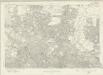
London Sheet G - OS Six-Inch Map
1 : 10560 Topographic maps Ordnance Survey Ordnance Survey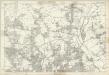
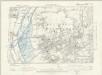
Middlesex XII - OS Six-Inch Map
1 : 10560 Topographic maps Ordnance Survey Ordnance Survey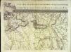
An exact survey of the city's of London Westminster , V
1 Blatt : 53 x 71 cm John Rocque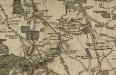
Map of the Country twelve miles round London. Engraved by W.R. Gardner.

A Survey of the Roads and Foot-paths in the Parish of ISLINGTON. From a plan in the Vestry Room, Drawn in the Year 1735
1 : 14400 This is a plan of footpaths and roads in the parish of Islington. It extends from Battle Bridge to Highgate and from ''Cruch End'' to Kings Land and the boundary to Shoreditch. An interesting feature on this map is Jack Straws House near Highbury. Jack Straw was a leader of one band of rebels who attacked the Treasurer's House at Highbury on June 14, 1381. The Peasants' Revolt over increasing taxation was largely due to the monarchy's prosectution of war against France. Toll gates are also marked in various places. Hawsworth, J.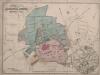
Plan of Alexandra Estate, Muswell Hill.
Tvernon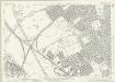
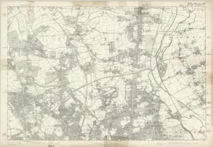
Essex (New Series 1913-) n LXXVII.12 (includes: Leyton; Walthamstow) - 25 Inch Map
1 : 2500 Topographic maps Ordnance Survey Ordnance Survey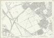
Essex (New Series 1913-) n LXXVII.12 (includes: Leyton; Walthamstow) - 25 Inch Map
1 : 2500 Topographic maps Ordnance Survey Ordnance Survey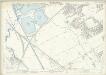
London (Edition of 1894-96) XXII (includes: Leyton; Walthamstow) - 25 Inch Map
1 : 2500 Topographic maps Ordnance Survey Ordnance Survey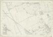
London (First Editions c1850s) VI (includes: Leyton; Walthamstow) - 25 Inch Map
1 : 2500 Topographic maps Ordnance Survey Ordnance Survey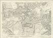
Middlesex XII.5 (includes: Hornsey St Mary) - 25 Inch Map
1 : 2500 Topographic maps Ordnance Survey Ordnance Survey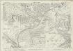
Middlesex XII.5 (includes: Hornsey St Mary) - 25 Inch Map
1 : 2500 Topographic maps Ordnance Survey Ordnance Survey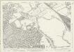
Essex (New Series 1913-) n LXXVII.16 (includes: Hackney; Leyton) - 25 Inch Map
1 : 2500 Topographic maps Ordnance Survey Ordnance Survey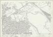
Essex (New Series 1913-) n LXXVII.16 (includes: Hackney; Leyton) - 25 Inch Map
1 : 2500 Topographic maps Ordnance Survey Ordnance Survey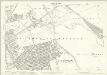
London (Edition of 1894-96) XXXI (includes: Hackney; Leyton) - 25 Inch Map
1 : 2500 Topographic maps Ordnance Survey Ordnance Survey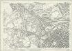
London (1915- Numbered sheets) II.9 (includes: Hornsey St Mary; Islington; St Pancras) - 25 Inch Map
1 : 2500 Topographic maps Ordnance Survey Ordnance Survey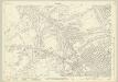
London (1915- Numbered sheets) II.9 (includes: Hornsey St Mary; Islington; St Pancras) - 25 Inch Map
1 : 2500 Topographic maps Ordnance Survey Ordnance Survey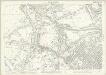
London (Edition of 1894-96) XIX (includes: Hornsey St Mary; Islington; St Pancras) - 25 Inch Map
1 : 2500 Topographic maps Ordnance Survey Ordnance Survey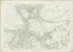
London (First Editions c1850s) III (includes: Hornsey St Mary; Islington; St Pancras) - 25 Inch Map
1 : 2500 Topographic maps Ordnance Survey Ordnance Survey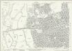
Essex (New Series 1913-) n LXXVII.8 (includes: Walthamstow) - 25 Inch Map
1 : 2500 Topographic maps Ordnance Survey Ordnance Survey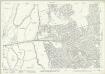
Essex (New Series 1913-) n LXXVII.8 (includes: Walthamstow) - 25 Inch Map
1 : 2500 Topographic maps Ordnance Survey Ordnance Survey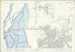
London (Edition of 1894-96) XIV (includes: Walthamstow) - 25 Inch Map
1 : 2500 Topographic maps Ordnance Survey Ordnance Survey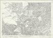
London (1915- Numbered sheets) II.13 (includes: Islington; St Pancras) - 25 Inch Map
1 : 2500 Topographic maps Ordnance Survey Ordnance Survey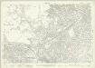
London (1915- Numbered sheets) II.13 (includes: Islington; St Pancras) - 25 Inch Map
1 : 2500 Topographic maps Ordnance Survey Ordnance Survey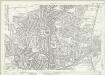
Essex (New Series 1913-) n LXXVII.7 (includes: Tottenham) - 25 Inch Map
1 : 2500 Topographic maps Ordnance Survey Ordnance Survey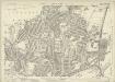
Essex (New Series 1913-) n LXXVII.7 (includes: Tottenham) - 25 Inch Map
1 : 2500 Topographic maps Ordnance Survey Ordnance Survey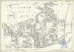
London (Edition of 1894-96) XIII (includes: Tottenham) - 25 Inch Map
1 : 2500 Topographic maps Ordnance Survey Ordnance Survey
London (First Editions c1850s) I (includes: Tottenham) - 25 Inch Map
1 : 2500 Topographic maps Ordnance Survey Ordnance Survey