Maps of East Lindsey
Yorkshire 269b - OS Six-Inch Map
1 : 10560 Topographic maps Ordnance Survey Ordnance Survey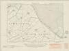
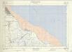
Lincolnshire XXXI.SE - OS Six-Inch Map
1 : 10560 Topographic maps Ordnance Survey Ordnance Survey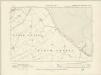
Lincolnshire XXXI.SE - OS Six-Inch Map
1 : 10560 Topographic maps Ordnance Survey Ordnance Survey
Lincolnshire XXXI.SE - OS Six-Inch Map
1 : 10560 Topographic maps Ordnance Survey Ordnance Survey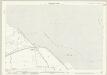
Lincolnshire XXXII.13 (includes: Grainthorpe; Marsh Chapel; North Somercotes) - 25 Inch Map
1 : 2500 Topographic maps Ordnance Survey Ordnance Survey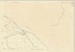
Lincolnshire XXXII.13 (includes: Grainthorpe; Marsh Chapel; North Somercotes) - 25 Inch Map
1 : 2500 Topographic maps Ordnance Survey Ordnance Survey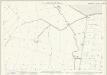
Lincolnshire XLI.1 (includes: Grainthorpe; North Somercotes) - 25 Inch Map
1 : 2500 Topographic maps Ordnance Survey Ordnance Survey
Lincolnshire XXXI.12 (includes: Marsh Chapel; North Coates) - 25 Inch Map
1 : 2500 Topographic maps Ordnance Survey Ordnance Survey
Lincolnshire XXXI.12 (includes: Marsh Chapel; North Coates) - 25 Inch Map
1 : 2500 Topographic maps Ordnance Survey Ordnance Survey
Lincolnshire XXXI.16 (includes: Grainthorpe; Marsh Chapel; North Coates; North Somercotes) - 25 Inch Map
1 : 2500 Topographic maps Ordnance Survey Ordnance Survey
Lincolnshire XXXI.16 (includes: Grainthorpe; Marsh Chapel; North Coates; North Somercotes) - 25 Inch Map
1 : 2500 Topographic maps Ordnance Survey Ordnance Survey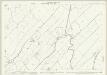
Lincolnshire XL.4 (includes: Grainthorpe; Marsh Chapel; North Somercotes) - 25 Inch Map
1 : 2500 Topographic maps Ordnance Survey Ordnance Survey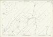
Lincolnshire XL.4 (includes: Grainthorpe; Marsh Chapel; North Somercotes) - 25 Inch Map
1 : 2500 Topographic maps Ordnance Survey Ordnance Survey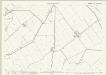
Lincolnshire XXXI.11 (includes: North Coates; Tetney) - 25 Inch Map
1 : 2500 Topographic maps Ordnance Survey Ordnance Survey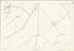
Lincolnshire XXXI.11 (includes: North Coates; Tetney) - 25 Inch Map
1 : 2500 Topographic maps Ordnance Survey Ordnance Survey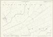
Lincolnshire XXXI.15 (includes: Marsh Chapel; North Coates) - 25 Inch Map
1 : 2500 Topographic maps Ordnance Survey Ordnance Survey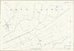
Lincolnshire XXXI.15 (includes: Marsh Chapel; North Coates) - 25 Inch Map
1 : 2500 Topographic maps Ordnance Survey Ordnance Survey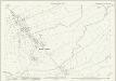
Lincolnshire XL.3 (includes: Grainthorpe; Marsh Chapel; North Coates) - 25 Inch Map
1 : 2500 Topographic maps Ordnance Survey Ordnance Survey
Lincolnshire XXXII.NW & XXXII.SW - OS Six-Inch Map
1 : 10560 Topographic maps Ordnance Survey Ordnance Survey
Lincolnshire XXXII.NW & XXXII.SW - OS Six-Inch Map
1 : 10560 Topographic maps Ordnance Survey Ordnance Survey
Lincolnshire XXXII.NW & XXXII.SW - OS Six-Inch Map
1 : 10560 Topographic maps Ordnance Survey Ordnance Survey
Lincolnshire XXXI.7 (includes: North Coates; Tetney) - 25 Inch Map
1 : 2500 Topographic maps Ordnance Survey Ordnance Survey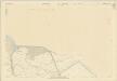
Lincolnshire XXXI.7 (includes: North Coates; Tetney) - 25 Inch Map
1 : 2500 Topographic maps Ordnance Survey Ordnance Survey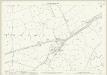
Lincolnshire XXXI.10 (includes: North Coates; Tetney) - 25 Inch Map
1 : 2500 Topographic maps Ordnance Survey Ordnance Survey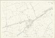
Lincolnshire XXXI.10 (includes: North Coates; Tetney) - 25 Inch Map
1 : 2500 Topographic maps Ordnance Survey Ordnance Survey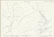
Lincolnshire XXXI.14 (includes: North Coates; North Thoresby; Tetney) - 25 Inch Map
1 : 2500 Topographic maps Ordnance Survey Ordnance Survey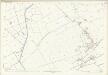
Lincolnshire XXXI.14 (includes: North Coates; North Thoresby; Tetney) - 25 Inch Map
1 : 2500 Topographic maps Ordnance Survey Ordnance Survey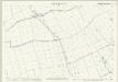
Lincolnshire XL.2 (includes: Fulstow; Marsh Chapel; North Coates; North Thoresby) - 25 Inch Map
1 : 2500 Topographic maps Ordnance Survey Ordnance Survey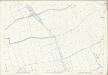
Lincolnshire XL.2 (includes: Fulstow; Marsh Chapel; North Coates; North Thoresby) - 25 Inch Map
1 : 2500 Topographic maps Ordnance Survey Ordnance Survey