Maps of North Yorkshire
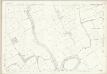
Yorkshire 70 - OS Six-Inch Map
1 : 10560 Topographic maps Ordnance Survey Ordnance Survey
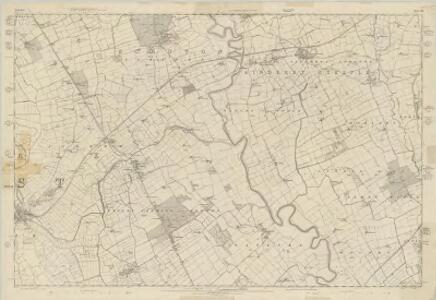
Yorkshire LXX.NW - OS Six-Inch Map
1 : 10560 Topographic maps Ordnance Survey Ordnance Survey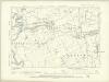
Yorkshire LXX.NW - OS Six-Inch Map
1 : 10560 Topographic maps Ordnance Survey Ordnance Survey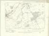
Yorkshire LXX.SW - OS Six-Inch Map
1 : 10560 Topographic maps Ordnance Survey Ordnance Survey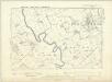
Yorkshire LXX.SW - OS Six-Inch Map
1 : 10560 Topographic maps Ordnance Survey Ordnance Survey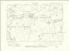
Yorkshire LXX.NE - OS Six-Inch Map
1 : 10560 Topographic maps Ordnance Survey Ordnance Survey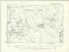
Yorkshire LXX.NE - OS Six-Inch Map
1 : 10560 Topographic maps Ordnance Survey Ordnance Survey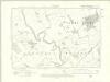
Yorkshire LXX.SE - OS Six-Inch Map
1 : 10560 Topographic maps Ordnance Survey Ordnance Survey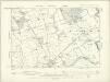
Yorkshire LXX.SE - OS Six-Inch Map
1 : 10560 Topographic maps Ordnance Survey Ordnance Survey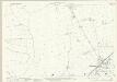
Yorkshire LXX.5 (includes: Ainderby Miers With Holtby; Aiskew; Crakehall; Langthorne; Rand Grange) - 25 Inch Map
1 : 2500 Topographic maps Ordnance Survey Ordnance Survey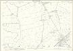
Yorkshire LXX.5 (includes: Ainderby Miers With Holtby; Aiskew; Crakehall; Langthorne; Rand Grange) - 25 Inch Map
1 : 2500 Topographic maps Ordnance Survey Ordnance Survey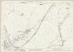
Yorkshire LXX.9 (includes: Aiskew; Bedale; Crakehall; Exelby Leeming And Newton; Rand Grange) - 25 Inch Map
1 : 2500 Topographic maps Ordnance Survey Ordnance Survey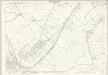
Yorkshire LXX.9 (includes: Aiskew; Bedale; Crakehall; Exelby Leeming And Newton; Rand Grange) - 25 Inch Map
1 : 2500 Topographic maps Ordnance Survey Ordnance Survey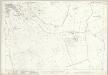
Yorkshire LXX.13 (includes: Aiskew; Bedale; Exelby Leeming And Newton; Firby) - 25 Inch Map
1 : 2500 Topographic maps Ordnance Survey Ordnance Survey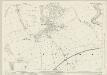
Yorkshire LXX.2 (includes: Aiskew; Kirkby Fleetham; Scruton; Thrintoft) - 25 Inch Map
1 : 2500 Topographic maps Ordnance Survey Ordnance Survey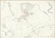
Yorkshire LXX.2 (includes: Aiskew; Kirkby Fleetham; Scruton; Thrintoft) - 25 Inch Map
1 : 2500 Topographic maps Ordnance Survey Ordnance Survey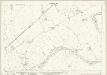
Yorkshire LXX.6 (includes: Aiskew; Exelby Leeming And Newton; Morton Upon Swale; Scruton) - 25 Inch Map
1 : 2500 Topographic maps Ordnance Survey Ordnance Survey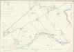
Yorkshire LXX.6 (includes: Aiskew; Exelby Leeming And Newton; Morton Upon Swale; Scruton) - 25 Inch Map
1 : 2500 Topographic maps Ordnance Survey Ordnance Survey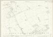
Yorkshire LXX.10 (includes: Aiskew; Exelby Leeming And Newton) - 25 Inch Map
1 : 2500 Topographic maps Ordnance Survey Ordnance Survey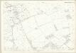
Yorkshire LXX.10 (includes: Aiskew; Exelby Leeming And Newton) - 25 Inch Map
1 : 2500 Topographic maps Ordnance Survey Ordnance Survey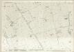
Yorkshire LXX.1 (includes: Ainderby Miers With Holtby; Aiskew; Kirkby Fleetham; Langthorne; Scruton) - 25 Inch Map
1 : 2500 Topographic maps Ordnance Survey Ordnance Survey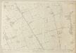
Yorkshire LXX.1 (includes: Ainderby Miers With Holtby; Aiskew; Kirkby Fleetham; Langthorne; Scruton) - 25 Inch Map
1 : 2500 Topographic maps Ordnance Survey Ordnance Survey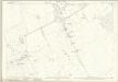
Yorkshire LXX.14 (includes: Exelby Leeming And Newton; Gatenby; Theakston) - 25 Inch Map
1 : 2500 Topographic maps Ordnance Survey Ordnance Survey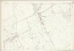
Yorkshire LXX.14 (includes: Exelby Leeming And Newton; Gatenby; Theakston) - 25 Inch Map
1 : 2500 Topographic maps Ordnance Survey Ordnance Survey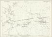
Yorkshire LXX.3 (includes: Ainderby Steeple; Morton Upon Swale; Scruton; Thrintoft; Yafforth) - 25 Inch Map
1 : 2500 Topographic maps Ordnance Survey Ordnance Survey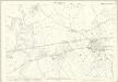
Yorkshire LXX.3 (includes: Ainderby Steeple; Morton Upon Swale; Scruton; Thrintoft; Yafforth) - 25 Inch Map
1 : 2500 Topographic maps Ordnance Survey Ordnance Survey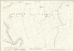
Yorkshire LXX.7 (includes: Ainderby Steeple; Exelby Leeming And Newton; Morton Upon Swale; Scruton; Warlaby) - 25 Inch Map
1 : 2500 Topographic maps Ordnance Survey Ordnance Survey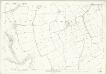
Yorkshire LXX.7 (includes: Ainderby Steeple; Exelby Leeming And Newton; Morton Upon Swale; Scruton; Warlaby) - 25 Inch Map
1 : 2500 Topographic maps Ordnance Survey Ordnance Survey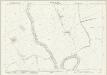
Yorkshire LXX.11 (includes: Exelby Leeming And Newton; Gatenby; Maunby; Morton Upon Swale; Newby Wiske; Warlaby) - 25 Inch Map
1 : 2500 Topographic maps Ordnance Survey Ordnance Survey