Maps of Fylde
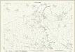
Lancashire LII - OS Six-Inch Map
1 : 10560 Topographic maps Ordnance Survey Ordnance Survey
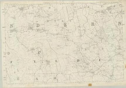
Lancashire LII.NW - OS Six-Inch Map
1 : 10560 Topographic maps Ordnance Survey Ordnance Survey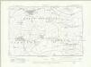
Lancashire LII.NW - OS Six-Inch Map
1 : 10560 Topographic maps Ordnance Survey Ordnance Survey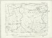
Lancashire LII.NW - OS Six-Inch Map
1 : 10560 Topographic maps Ordnance Survey Ordnance Survey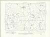
Lancashire LII.SW - OS Six-Inch Map
1 : 10560 Topographic maps Ordnance Survey Ordnance Survey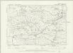
Lancashire LII.SW - OS Six-Inch Map
1 : 10560 Topographic maps Ordnance Survey Ordnance Survey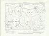
Lancashire LII.NE - OS Six-Inch Map
1 : 10560 Topographic maps Ordnance Survey Ordnance Survey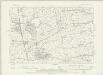
Lancashire LII.NE - OS Six-Inch Map
1 : 10560 Topographic maps Ordnance Survey Ordnance Survey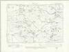
Lancashire LII.SE - OS Six-Inch Map
1 : 10560 Topographic maps Ordnance Survey Ordnance Survey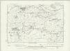
Lancashire LII.SE - OS Six-Inch Map
1 : 10560 Topographic maps Ordnance Survey Ordnance Survey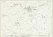
Lancashire LII.1 (includes: Elswick; Great Eccleston; Little Eccleston With Larbreck) - 25 Inch Map
1 : 2500 Topographic maps Ordnance Survey Ordnance Survey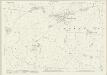
Lancashire LII.1 (includes: Elswick; Great Eccleston; Little Eccleston With Larbreck) - 25 Inch Map
1 : 2500 Topographic maps Ordnance Survey Ordnance Survey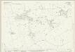
Lancashire LII.5 (includes: Elswick; Great Eccleston; Greenhalgh With Thistleton; Inskip With Sowerby; Treales Roseacre And Wharles) - 25 Inch Map
1 : 2500 Topographic maps Ordnance Survey Ordnance Survey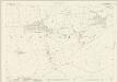
Lancashire LII.5 (includes: Elswick; Great Eccleston; Greenhalgh With Thistleton; Inskip With Sowerby; Treales Roseacre And Wharles) - 25 Inch Map
1 : 2500 Topographic maps Ordnance Survey Ordnance Survey
Lancashire LII.9 (includes: Elswick; Greenhalgh With Thistleton; Medlar With Wesham; Treales Roseacre And Wharles) - 25 Inch Map
1 : 2500 Topographic maps Ordnance Survey Ordnance Survey
Lancashire LII.13 (includes: Greenhalgh With Thistleton; Medlar With Wesham; Treales Roseacre And Wharles) - 25 Inch Map
1 : 2500 Topographic maps Ordnance Survey Ordnance Survey
Lancashire LII.2 (includes: Great Eccleston; Inskip With Sowerby; Upper Rawcliffe With Tarnacre) - 25 Inch Map
1 : 2500 Topographic maps Ordnance Survey Ordnance Survey
Lancashire LII.2 (includes: Great Eccleston; Inskip With Sowerby; Upper Rawcliffe With Tarnacre) - 25 Inch Map
1 : 2500 Topographic maps Ordnance Survey Ordnance Survey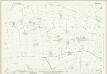
Lancashire LII.6 (includes: Great Eccleston; Inskip With Sowerby; Treales Roseacre And Wharles) - 25 Inch Map
1 : 2500 Topographic maps Ordnance Survey Ordnance Survey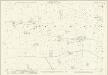
Lancashire LII.6 (includes: Great Eccleston; Inskip With Sowerby; Treales Roseacre And Wharles) - 25 Inch Map
1 : 2500 Topographic maps Ordnance Survey Ordnance Survey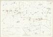
Lancashire LII.6 (includes: Great Eccleston; Inskip With Sowerby; Treales Roseacre And Wharles) - 25 Inch Map
1 : 2500 Topographic maps Ordnance Survey Ordnance Survey
Lancashire LII.10 (includes: Inskip With Sowerby; Treales Roseacre And Wharles; Woodplumpton) - 25 Inch Map
1 : 2500 Topographic maps Ordnance Survey Ordnance Survey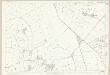
Lancashire LII.10 (includes: Inskip With Sowerby; Treales Roseacre And Wharles; Woodplumpton) - 25 Inch Map
1 : 2500 Topographic maps Ordnance Survey Ordnance Survey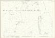
Lancashire LII.14 (includes: Treales Roseacre And Wharles; Woodplumpton) - 25 Inch Map
1 : 2500 Topographic maps Ordnance Survey Ordnance Survey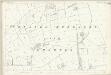
Lancashire LII.14 (includes: Treales Roseacre And Wharles; Woodplumpton) - 25 Inch Map
1 : 2500 Topographic maps Ordnance Survey Ordnance Survey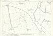
Lancashire LII.3 (includes: Inskip With Sowerby; Myerscough; Upper Rawcliffe With Tarnacre) - 25 Inch Map
1 : 2500 Topographic maps Ordnance Survey Ordnance Survey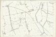
Lancashire LII.3 (includes: Inskip With Sowerby; Myerscough; Upper Rawcliffe With Tarnacre) - 25 Inch Map
1 : 2500 Topographic maps Ordnance Survey Ordnance Survey
Lancashire LII.7 (includes: Inskip With Sowerby; Woodplumpton) - 25 Inch Map
1 : 2500 Topographic maps Ordnance Survey Ordnance Survey
Lancashire LII.7 (includes: Inskip With Sowerby; Woodplumpton) - 25 Inch Map
1 : 2500 Topographic maps Ordnance Survey Ordnance Survey