Maps of Hertfordshire
Hertfordshire XXII - OS Six-Inch Map
1 : 10560 Topographic maps Ordnance Survey Ordnance Survey
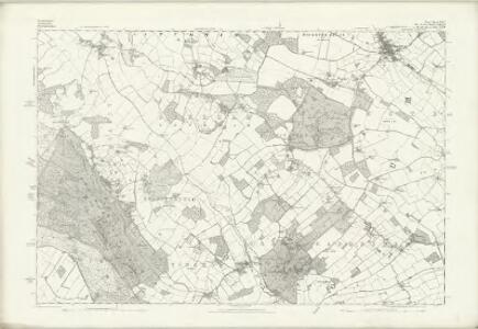
Hertfordshire XXII.NE - OS Six-Inch Map
1 : 10560 Topographic maps Ordnance Survey Ordnance Survey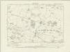
Hertfordshire XXII.NE - OS Six-Inch Map
1 : 10560 Topographic maps Ordnance Survey Ordnance Survey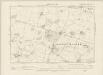
Hertfordshire XXII.NE - OS Six-Inch Map
1 : 10560 Topographic maps Ordnance Survey Ordnance Survey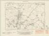
Hertfordshire XXII.SE - OS Six-Inch Map
1 : 10560 Topographic maps Ordnance Survey Ordnance Survey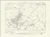
Hertfordshire XXII.SE - OS Six-Inch Map
1 : 10560 Topographic maps Ordnance Survey Ordnance Survey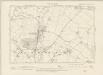
Hertfordshire XXII.SE - OS Six-Inch Map
1 : 10560 Topographic maps Ordnance Survey Ordnance Survey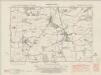
Hertfordshire XXII.NW - OS Six-Inch Map
1 : 10560 Topographic maps Ordnance Survey Ordnance Survey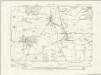
Hertfordshire XXII.NW - OS Six-Inch Map
1 : 10560 Topographic maps Ordnance Survey Ordnance Survey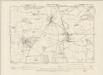
Hertfordshire XXII.NW - OS Six-Inch Map
1 : 10560 Topographic maps Ordnance Survey Ordnance Survey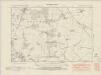
Hertfordshire XXII.SW - OS Six-Inch Map
1 : 10560 Topographic maps Ordnance Survey Ordnance Survey
Hertfordshire XXII.SW - OS Six-Inch Map
1 : 10560 Topographic maps Ordnance Survey Ordnance Survey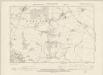
Hertfordshire XXII.SW - OS Six-Inch Map
1 : 10560 Topographic maps Ordnance Survey Ordnance Survey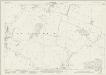
Hertfordshire XXII.8 (includes: Little Hadham) - 25 Inch Map
1 : 2500 Topographic maps Ordnance Survey Ordnance Survey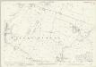
Hertfordshire XXII.8 (includes: Little Hadham) - 25 Inch Map
1 : 2500 Topographic maps Ordnance Survey Ordnance Survey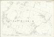
Hertfordshire XXII.8 (includes: Little Hadham) - 25 Inch Map
1 : 2500 Topographic maps Ordnance Survey Ordnance Survey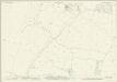
Hertfordshire XXII.12 (includes: High Wych; Little Hadham; Much Hadham; Thorley) - 25 Inch Map
1 : 2500 Topographic maps Ordnance Survey Ordnance Survey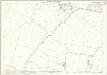
Hertfordshire XXII.12 (includes: High Wych; Little Hadham; Much Hadham; Thorley) - 25 Inch Map
1 : 2500 Topographic maps Ordnance Survey Ordnance Survey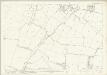
Hertfordshire XXII.12 (includes: High Wych; Little Hadham; Much Hadham; Thorley) - 25 Inch Map
1 : 2500 Topographic maps Ordnance Survey Ordnance Survey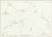
Hertfordshire XXII.16 (includes: High Wych; Much Hadham; Thorley) - 25 Inch Map
1 : 2500 Topographic maps Ordnance Survey Ordnance Survey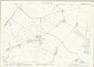
Hertfordshire XXII.16 (includes: High Wych; Much Hadham; Thorley) - 25 Inch Map
1 : 2500 Topographic maps Ordnance Survey Ordnance Survey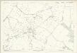
Hertfordshire XXII.16 (includes: High Wych; Much Hadham; Thorley) - 25 Inch Map
1 : 2500 Topographic maps Ordnance Survey Ordnance Survey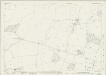
Hertfordshire XXII.3 (includes: Albury; Braughing; Little Hadham; Standon) - 25 Inch Map
1 : 2500 Topographic maps Ordnance Survey Ordnance Survey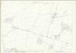
Hertfordshire XXII.3 (includes: Albury; Braughing; Little Hadham; Standon) - 25 Inch Map
1 : 2500 Topographic maps Ordnance Survey Ordnance Survey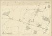
Hertfordshire XXII.3 (includes: Albury; Braughing; Little Hadham; Standon) - 25 Inch Map
1 : 2500 Topographic maps Ordnance Survey Ordnance Survey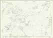
Hertfordshire XXII.7 (includes: Little Hadham; Much Hadham; Standon) - 25 Inch Map
1 : 2500 Topographic maps Ordnance Survey Ordnance Survey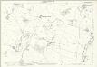
Hertfordshire XXII.7 (includes: Little Hadham; Much Hadham; Standon) - 25 Inch Map
1 : 2500 Topographic maps Ordnance Survey Ordnance Survey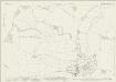
Hertfordshire XXII.11 (includes: Little Hadham; Much Hadham; Standon) - 25 Inch Map
1 : 2500 Topographic maps Ordnance Survey Ordnance Survey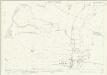
Hertfordshire XXII.11 (includes: Little Hadham; Much Hadham; Standon) - 25 Inch Map
1 : 2500 Topographic maps Ordnance Survey Ordnance Survey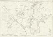
Hertfordshire XXII.15 (includes: Much Hadham) - 25 Inch Map
1 : 2500 Topographic maps Ordnance Survey Ordnance Survey