Maps of Lincolnshire
Lincolnshire CXLIV.NW - OS Six-Inch Map
1 : 10560 Topographic maps Ordnance Survey Ordnance Survey
Lincolnshire CXLIV.NW - OS Six-Inch Map
1 : 10560 Topographic maps Ordnance Survey Ordnance Survey
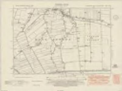
Lincolnshire CXLIV.NW - OS Six-Inch Map
1 : 10560 Topographic maps Ordnance Survey Ordnance Survey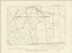
Lincolnshire CXLIV.NW - OS Six-Inch Map
1 : 10560 Topographic maps Ordnance Survey Ordnance Survey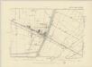
Lincolnshire CXLIV.NW - OS Six-Inch Map
1 : 10560 Topographic maps Ordnance Survey Ordnance Survey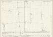
Lincolnshire CXLIV.6 (includes: Little Sutton; Long Sutton; Sutton Bridge; Tydd St Mary) - 25 Inch Map
1 : 2500 Topographic maps Ordnance Survey Ordnance Survey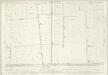
Lincolnshire CXLIV.6 (includes: Little Sutton; Long Sutton; Sutton Bridge; Tydd St Mary) - 25 Inch Map
1 : 2500 Topographic maps Ordnance Survey Ordnance Survey
Lincolnshire CXLIV.6 (includes: Little Sutton; Long Sutton; Sutton Bridge; Tydd St Mary) - 25 Inch Map
1 : 2500 Topographic maps Ordnance Survey Ordnance Survey
Lincolnshire CXLIV.2 (includes: Little Sutton; Long Sutton; Sutton Bridge) - 25 Inch Map
1 : 2500 Topographic maps Ordnance Survey Ordnance Survey
Lincolnshire CXLIV.2 (includes: Little Sutton; Long Sutton; Sutton Bridge) - 25 Inch Map
1 : 2500 Topographic maps Ordnance Survey Ordnance Survey
Lincolnshire CXLIV.5 (includes: Gedney; Long Sutton; Tydd St Mary) - 25 Inch Map
1 : 2500 Topographic maps Ordnance Survey Ordnance Survey
Lincolnshire CXLIV.5 (includes: Gedney; Long Sutton; Tydd St Mary) - 25 Inch Map
1 : 2500 Topographic maps Ordnance Survey Ordnance Survey
Lincolnshire CXLIV.5 (includes: Gedney; Long Sutton; Tydd St Mary) - 25 Inch Map
1 : 2500 Topographic maps Ordnance Survey Ordnance Survey
Lincolnshire CXLIV.1 (includes: Gedney; Long Sutton; Lutton) - 25 Inch Map
1 : 2500 Topographic maps Ordnance Survey Ordnance Survey
Lincolnshire CXLIV.1 (includes: Gedney; Long Sutton; Lutton) - 25 Inch Map
1 : 2500 Topographic maps Ordnance Survey Ordnance Survey
Lincolnshire CXLIV.1 (includes: Gedney; Long Sutton; Lutton) - 25 Inch Map
1 : 2500 Topographic maps Ordnance Survey Ordnance Survey
Norfolk XXXI.NE - OS Six-Inch Map
1 : 10560 Topographic maps Ordnance Survey Ordnance Survey
TF42 - OS 1:25,000 Provisional Series Map
1 : 25000 Topographic maps Ordnance Survey Ordnance Survey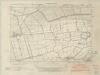
Cambridgeshire I.SW - OS Six-Inch Map
1 : 10560 Topographic maps Ordnance Survey Ordnance Survey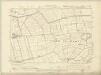
Cambridgeshire I.SW - OS Six-Inch Map
1 : 10560 Topographic maps Ordnance Survey Ordnance Survey
Cambridgeshire I.SW - OS Six-Inch Map
1 : 10560 Topographic maps Ordnance Survey Ordnance Survey
Cambridgeshire I.SE - OS Six-Inch Map
1 : 10560 Topographic maps Ordnance Survey Ordnance Survey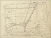
Cambridgeshire I.SE - OS Six-Inch Map
1 : 10560 Topographic maps Ordnance Survey Ordnance Survey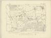
Norfolk XXXI.SE - OS Six-Inch Map
1 : 10560 Topographic maps Ordnance Survey Ordnance Survey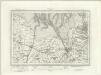
Kings Lynn (Outline) - OS One-Inch Revised New Series
1 : 63360 Topographic maps Ordnance Survey Ordnance Survey
Kings Lynn (Hills) - OS One-Inch Revised New Series
1 : 63360 Topographic maps Ordnance Survey Ordnance Survey
Leverington 12
1 : 31680 This drawing shows the estuary of the River Welland flowing into the Wash. Downstream of Stamford, towards the fens, the river is embanked to create high level; channels. Tidal exclusion sluices are indicated along the coast at the top of the sheet. These were constructed to maintain water levels for irrigation and to restrict saline water. Drains across fens and marshland are highlighted in blue in the lower part of the plan. At top right, the surveyor's notes on angular observations are clearly visible. Yeakell, Thomas Jr.
Kings Lynn - OS One-Inch Map
1 : 63360 Topographic maps Ordnance Survey Ordnance Survey
Lincoln Fens, Sheet 14 - Bartholomew's "Half Inch to the Mile Maps" of England & Wales
1 : 126720 Topographic maps Bartholomew, John George John Bartholomew & Co