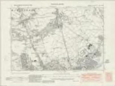
Maps of Willingdon and Jevington
Sussex LXXX.NW - OS Six-Inch Map
1 : 10560 Topographic maps Ordnance Survey Ordnance Survey
Sussex LXXX.NW - OS Six-Inch Map
1 : 10560 Topographic maps Ordnance Survey Ordnance Survey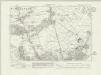
Sussex LXXX.NW - OS Six-Inch Map
1 : 10560 Topographic maps Ordnance Survey Ordnance Survey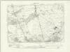
Sussex LXXX.NW - OS Six-Inch Map
1 : 10560 Topographic maps Ordnance Survey Ordnance Survey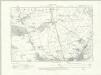
Sussex LXXX.NW - OS Six-Inch Map
1 : 10560 Topographic maps Ordnance Survey Ordnance Survey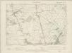
Sussex LXXX.NW - OS Six-Inch Map
1 : 10560 Topographic maps Ordnance Survey Ordnance Survey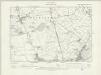
Sussex LXXX.NW - OS Six-Inch Map
1 : 10560 Topographic maps Ordnance Survey Ordnance Survey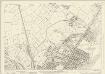
Sussex LXXX.6 (includes: Eastbourne) - 25 Inch Map
1 : 2500 Topographic maps Ordnance Survey Ordnance Survey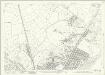
Sussex LXXX.6 (includes: Eastbourne) - 25 Inch Map
1 : 2500 Topographic maps Ordnance Survey Ordnance Survey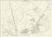
Sussex LXXX.6 (includes: Eastbourne) - 25 Inch Map
1 : 2500 Topographic maps Ordnance Survey Ordnance Survey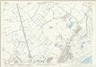
Sussex LXXX.6 (includes: Eastbourne) - 25 Inch Map
1 : 2500 Topographic maps Ordnance Survey Ordnance Survey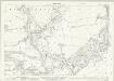
Sussex LXXX.1 (includes: Eastbourne; Willingdon) - 25 Inch Map
1 : 2500 Topographic maps Ordnance Survey Ordnance Survey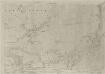
Sussex LXXX.1 (includes: Eastbourne; Willingdon) - 25 Inch Map
1 : 2500 Topographic maps Ordnance Survey Ordnance Survey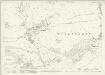
Sussex LXXX.1 (includes: Eastbourne; Willingdon) - 25 Inch Map
1 : 2500 Topographic maps Ordnance Survey Ordnance Survey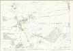
Sussex LXXX.1 (includes: Eastbourne; Willingdon) - 25 Inch Map
1 : 2500 Topographic maps Ordnance Survey Ordnance Survey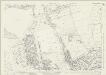
Sussex LXXX.5 (includes: Eastbourne) - 25 Inch Map
1 : 2500 Topographic maps Ordnance Survey Ordnance Survey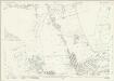
Sussex LXXX.5 (includes: Eastbourne) - 25 Inch Map
1 : 2500 Topographic maps Ordnance Survey Ordnance Survey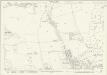
Sussex LXXX.5 (includes: Eastbourne) - 25 Inch Map
1 : 2500 Topographic maps Ordnance Survey Ordnance Survey
Sussex LXXX.5 (includes: Eastbourne) - 25 Inch Map
1 : 2500 Topographic maps Ordnance Survey Ordnance Survey
Sussex LXXX.5 (includes: Eastbourne) - 25 Inch Map
1 : 2500 Topographic maps Ordnance Survey Ordnance Survey
Sussex LXXX.2 (includes: Eastbourne) - 25 Inch Map
1 : 2500 Topographic maps Ordnance Survey Ordnance Survey
Sussex LXXX.2 (includes: Eastbourne) - 25 Inch Map
1 : 2500 Topographic maps Ordnance Survey Ordnance Survey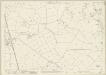
Sussex LXXX.2 (includes: Eastbourne) - 25 Inch Map
1 : 2500 Topographic maps Ordnance Survey Ordnance Survey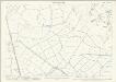
Sussex LXXX.2 (includes: Eastbourne) - 25 Inch Map
1 : 2500 Topographic maps Ordnance Survey Ordnance Survey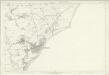
Sussex LXXX - OS Six-Inch Map
1 : 10560 Topographic maps Ordnance Survey Ordnance Survey
TQ60 - OS 1:25,000 Provisional Series Map
1 : 25000 Topographic maps Ordnance Survey Ordnance Survey
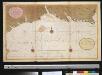
Eastbourne 2
1 : 31680 .This plan of the South Downs coastline runs from Newhaven Harbour at the bottom left to Pevensey Bay at the bottom right. The exposed south-coast region was heavily defended against invasion. Barracks are shown at Seaford, 'East Bourn', Pevensey and Hailsham, with a series of batteries at 'South Bourn'. Mount Caburn and Firle Beacon, are indicated to the central left of this drawing. From 1816, the recording of such archaeological sites would become obligatory. Budgen, Thomas
Eastbourne (Hills) - OS One-Inch Revised New Series
1 : 63360 Topographic maps Ordnance Survey Ordnance Survey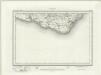
Eastbourne (Outline) - OS One-Inch Revised New Series
1 : 63360 Topographic maps Ordnance Survey Ordnance Survey