Maps of Northumberland

Northumberland nXXIII.SW - OS Six-Inch Map
1 : 10560 Topographic maps Ordnance Survey Ordnance Survey
Northumberland (Old Series) XXVII.5 (includes: Doxford; Embleton; Fallodon; North Charlton; Rock) - 25 Inch Map
1 : 2500 Topographic maps Ordnance Survey Ordnance Survey
Northumberland (Old Series) XXVII.5 (inset XXVII.9) (includes: Doxford; Embleton; Fallodon; North Charlton; Rock) - 25 Inch Map
1 : 2500 Topographic maps Ordnance Survey Ordnance Survey
Northumberland (New Series) XXIII.13 (includes: North Charlton; Rock; South Charlton) - 25 Inch Map
1 : 2500 Topographic maps Ordnance Survey Ordnance Survey
Northumberland (New Series) XXIII.9 (includes: Doxford; Ellingham; North Charlton) - 25 Inch Map
1 : 2500 Topographic maps Ordnance Survey Ordnance Survey
Northumberland (New Series) XXIII.10 (includes: Brunton; Doxford; Embleton; Fallodon; North Charlton; Rock) - 25 Inch Map
1 : 2500 Topographic maps Ordnance Survey Ordnance Survey
Northumberland (New Series) XXIII.14 (includes: Doxford; Embleton; Fallodon; North Charlton; Rock; Stamford) - 25 Inch Map
1 : 2500 Topographic maps Ordnance Survey Ordnance Survey
Northumberland (Old Series) XXVI.8 (includes: North Charlton; South Charlton) - 25 Inch Map
1 : 2500 Topographic maps Ordnance Survey Ordnance Survey
Northumberland (Old Series) XXVI.8 (includes: North Charlton; South Charlton) - 25 Inch Map
1 : 2500 Topographic maps Ordnance Survey Ordnance Survey
Northumberland (Old Series) XXVII.1 (includes: Brunton; Doxford; Ellingham; Fallodon; North Charlton; Preston) - 25 Inch Map
1 : 2500 Topographic maps Ordnance Survey Ordnance Survey
Northumberland (Old Series) XXVI.4 (includes: Doxford; Ellingham; North Charlton) - 25 Inch Map
1 : 2500 Topographic maps Ordnance Survey Ordnance Survey
Northumberland XXVII.NW - OS Six-Inch Map
1 : 10560 Topographic maps Ordnance Survey Ordnance Survey
Northumberland XXVI.NE - OS Six-Inch Map
1 : 10560 Topographic maps Ordnance Survey Ordnance Survey
Northumberland (Old Series) XXVII.9 (includes: Embleton; North Charlton; Rock; South Charlton) - 25 Inch Map
1 : 2500 Topographic maps Ordnance Survey Ordnance Survey
Northumberland (Old Series) XXVII.5 (inset XXVII.9) (includes: Embleton; North Charlton; Rock; South Charlton) - 25 Inch Map
1 : 2500 Topographic maps Ordnance Survey Ordnance Survey
Northumberland (Old Series) XXVII.9 (includes: Embleton; North Charlton; Rock; South Charlton) - 25 Inch Map
1 : 2500 Topographic maps Ordnance Survey Ordnance Survey
Northumberland (Old Series) XXVI.12 (includes: North Charlton; Rock; South Charlton) - 25 Inch Map
1 : 2500 Topographic maps Ordnance Survey Ordnance Survey
Northumberland (Old Series) XXVI.12 (inset XXVI.16) (includes: North Charlton; Rock; South Charlton) - 25 Inch Map
1 : 2500 Topographic maps Ordnance Survey Ordnance Survey
NU12 - OS 1:25,000 Provisional Series Map
1 : 25000 Topographic maps Ordnance Survey Ordnance Survey
Northumberland XXVII - OS Six-Inch Map
1 : 10560 Topographic maps Ordnance Survey Ordnance Survey
Northumberland XXVI - OS Six-Inch Map
1 : 10560 Topographic maps Ordnance Survey Ordnance Survey
Northumberland XXVII.SW - OS Six-Inch Map
1 : 10560 Topographic maps Ordnance Survey Ordnance Survey
Northumberland XXVI.SE - OS Six-Inch Map
1 : 10560 Topographic maps Ordnance Survey Ordnance Survey
Northumberland (Old Series) XXVII.2 (includes: Brunton; Embleton; Fallodon; Newton By The Sea) - 25 Inch Map
1 : 2500 Topographic maps Ordnance Survey Ordnance Survey
Alnwick (Hills) - OS One-Inch Revised New Series
1 : 63360 Topographic maps Ordnance Survey Ordnance Survey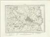
Alnwick (Outline) - OS One-Inch Revised New Series
1 : 63360 Topographic maps Ordnance Survey Ordnance Survey
Alnwick - OS One-Inch Map
1 : 63360 Topographic maps Ordnance Survey Ordnance Survey
Northumberland, North, Sheet 1 - Bartholomew's "Half Inch to the Mile Maps" of England & Wales
1 : 126720 Topographic maps Bartholomew, John George John Bartholomew & Co
Sheets 68-69. (Cary's England, Wales, and Scotland).
1 : 360000 Cary, John, ca. 1754-1835


