Maps of West Yorkshire
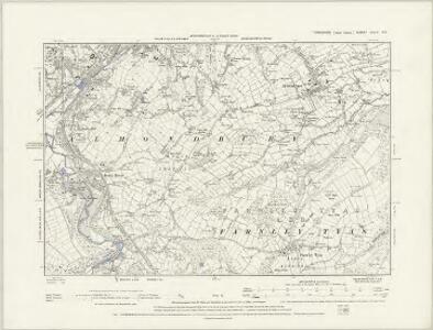
Yorkshire CCLX.NW - OS Six-Inch Map
1 : 10560 Topographic maps Ordnance Survey Ordnance Survey
Yorkshire CCLX.NW - OS Six-Inch Map
1 : 10560 Topographic maps Ordnance Survey Ordnance Survey
Yorkshire CCLX.NW - OS Six-Inch Map
1 : 10560 Topographic maps Ordnance Survey Ordnance Survey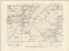
Yorkshire CCLX.NW - OS Six-Inch Map
1 : 10560 Topographic maps Ordnance Survey Ordnance Survey
Yorkshire CCLX.NW - OS Six-Inch Map
1 : 10560 Topographic maps Ordnance Survey Ordnance Survey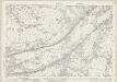
Yorkshire CCLX.1 (includes: Colne Valley; Huddersfield) - 25 Inch Map
1 : 2500 Topographic maps Ordnance Survey Ordnance Survey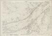
Yorkshire CCLX.1 (includes: Colne Valley; Huddersfield) - 25 Inch Map
1 : 2500 Topographic maps Ordnance Survey Ordnance Survey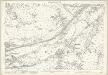
Yorkshire CCLX.1 (includes: Colne Valley; Huddersfield) - 25 Inch Map
1 : 2500 Topographic maps Ordnance Survey Ordnance Survey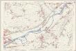
Yorkshire CCLX.1 (includes: Colne Valley; Huddersfield) - 25 Inch Map
1 : 2500 Topographic maps Ordnance Survey Ordnance Survey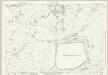
Yorkshire CCLX.5 (includes: Colne Valley; Meltham) - 25 Inch Map
1 : 2500 Topographic maps Ordnance Survey Ordnance Survey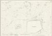
Yorkshire CCLX.5 (includes: Colne Valley; Meltham) - 25 Inch Map
1 : 2500 Topographic maps Ordnance Survey Ordnance Survey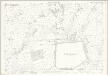
Yorkshire CCLX.5 (includes: Colne Valley; Meltham) - 25 Inch Map
1 : 2500 Topographic maps Ordnance Survey Ordnance Survey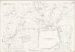
Yorkshire CCLX.5 (includes: Colne Valley; Meltham) - 25 Inch Map
1 : 2500 Topographic maps Ordnance Survey Ordnance Survey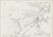
Yorkshire CCLX.6 (includes: Colne Valley; Holmfirth; Huddersfield; Meltham) - 25 Inch Map
1 : 2500 Topographic maps Ordnance Survey Ordnance Survey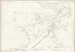
Yorkshire CCLX.6 (includes: Colne Valley; Holmfirth; Huddersfield; Meltham) - 25 Inch Map
1 : 2500 Topographic maps Ordnance Survey Ordnance Survey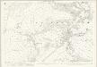
Yorkshire CCLX.6 (includes: Colne Valley; Holmfirth; Huddersfield; Meltham) - 25 Inch Map
1 : 2500 Topographic maps Ordnance Survey Ordnance Survey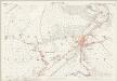
Yorkshire CCLX.6 (includes: Colne Valley; Holmfirth; Huddersfield; Meltham) - 25 Inch Map
1 : 2500 Topographic maps Ordnance Survey Ordnance Survey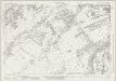
Yorkshire CCLX.2 (includes: Colne Valley; Huddersfield; Meltham) - 25 Inch Map
1 : 2500 Topographic maps Ordnance Survey Ordnance Survey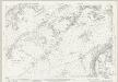
Yorkshire CCLX.2 (includes: Colne Valley; Huddersfield; Meltham) - 25 Inch Map
1 : 2500 Topographic maps Ordnance Survey Ordnance Survey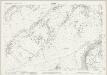
Yorkshire CCLX.2 (includes: Colne Valley; Huddersfield; Meltham) - 25 Inch Map
1 : 2500 Topographic maps Ordnance Survey Ordnance Survey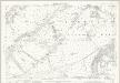
Yorkshire CCLX.2 (includes: Colne Valley; Huddersfield; Meltham) - 25 Inch Map
1 : 2500 Topographic maps Ordnance Survey Ordnance Survey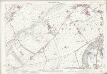
Yorkshire CCLX.2 (includes: Colne Valley; Huddersfield; Meltham) - 25 Inch Map
1 : 2500 Topographic maps Ordnance Survey Ordnance Survey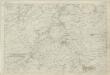
Yorkshire 260 - OS Six-Inch Map
1 : 10560 Topographic maps Ordnance Survey Ordnance Survey
SE11 - OS 1:25,000 Provisional Series Map
1 : 25000 Topographic maps Ordnance Survey Ordnance Survey
Huddersfield - OS One-Inch Map
1 : 63360 Topographic maps Ordnance Survey Ordnance Survey
Leeds and Bradford - OS One-Inch Map
1 : 63360 Topographic maps Ordnance Survey Ordnance Survey
Leeds Carriers' Warehouse District: Key Plan
1 : 126720 This "key plan" indicates coverage of the Goad 1896 series of fire insurance maps of Leeds that were originally produced to aid insurance companies in assessing fire risks. The building footprints, their use (commercial, residential, educational, etc.), the number of floors and the height of the building, as well as construction materials (and thus risk of burning) and special fire hazards (chemicals, kilns, ovens) were documented in order to estimate premiums. Names of individual businesses, property lines, and addresses were also often recorded. Together these maps provide a rich historical shapshot of the commercial activity and urban landscape of towns and cities at the time. The British Library holds a comprehensive collection of fire insurance plans produced by the London-based firm Charles E. Goad Ltd. dating back to 1885. These plans were made for most important towns and cities of the British Isles at the scales of 1:480 (1 inch to 40 feet), as well as many foreign towns at 1:600 (1 inch to 50 feet). Chas E Goad Limited Chas E Goad Limited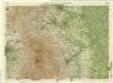
Sheffield, Sheet 9 - Bartholomew's "Half Inch to the Mile Maps" of England & Wales
1 : 126720 Topographic maps Bartholomew, John George John Bartholomew & Co
Comitatus Palatinus Cestriae
This is a map of Cheshire by William Smith. It dates from 1585. William Smith was Rouge Dragon at the College of Heralds/College of Arms, an institution that specialised in genealogical work, increasingly more so during the Elizabethan age as the gentry class rose in importance. The Rouge Dragon is the name of one of the Pursuivants, a heraldic officer attendant on the heralds, often attached to a particular nobleman, named so because of their badges. The prominent coat of arms on this plan reveals Smiths heraldic interests. In 1588 Smith completed "The Particuler Description of England. With the portratures of certaine of the cheiffest citties & townes". This work consisted of drawings of English cities and towns in a traditional bird's eye view style, drawings amalgamating bird's eye and plan. In the years 1602-03, William Smith anonymously published maps of Chester, Essex, Hertfordshire Lancashire, Leicester, Norfolk, Northamptonshire, Staffordshire, Suffolk, Surrey, Warwickshire and Worcestershire. These were probably engraved in Amsterdam and were intended to form sheets of a new atlas. After the publication of Saxton’s county maps in the 1570s, cartographers attempted to improve on Saxton’s atlas and replicate its success. Unfortunately for Smith, another cartographer, John Speed, was also preparing county maps at this time and competition proved too great, Speed being the victor. Smith, William