Maps of Durham
Yorkshire IIA.SW & V.NW - OS Six-Inch Map
1 : 10560 Topographic maps Ordnance Survey Ordnance Survey
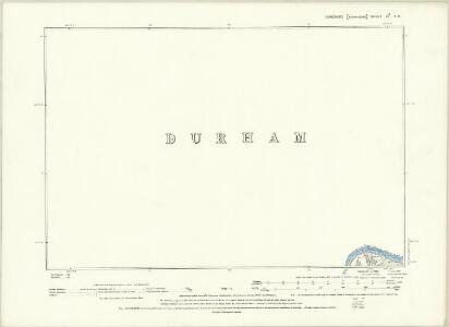
Durham XL.SW - OS Six-Inch Map
1 : 10560 Topographic maps Ordnance Survey Ordnance Survey
Yorkshire II.16 (inset IIA.13) (includes: Eggleston; Holwick; Mickleton; Middleton In Teesdale) - 25 Inch Map
1 : 2500 Topographic maps Ordnance Survey Ordnance Survey
Yorkshire IIA.13 (includes: Eggleston; Mickleton; Middleton In Teesdale) - 25 Inch Map
1 : 2500 Topographic maps Ordnance Survey Ordnance Survey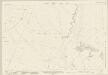
Durham XL.9 (includes: Eggleston; Middleton In Teesdale) - 25 Inch Map
1 : 2500 Topographic maps Ordnance Survey Ordnance Survey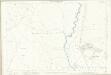
Durham XL.9 (includes: Eggleston; Middleton In Teesdale) - 25 Inch Map
1 : 2500 Topographic maps Ordnance Survey Ordnance Survey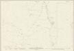
Durham XL.5 (includes: Eggleston; Middleton In Teesdale) - 25 Inch Map
1 : 2500 Topographic maps Ordnance Survey Ordnance Survey
Durham XL.5 (includes: Eggleston; Middleton In Teesdale) - 25 Inch Map
1 : 2500 Topographic maps Ordnance Survey Ordnance Survey
Durham XL - OS Six-Inch Map
1 : 10560 Topographic maps Ordnance Survey Ordnance Survey
Durham XL - OS Six-Inch Map
1 : 10560 Topographic maps Ordnance Survey Ordnance Survey
Durham XL.NW - OS Six-Inch Map
1 : 10560 Topographic maps Ordnance Survey Ordnance Survey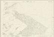
Durham XL.14 (includes: Eggleston; Marwood) - 25 Inch Map
1 : 2500 Topographic maps Ordnance Survey Ordnance Survey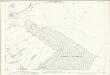
Durham XL.14 (includes: Eggleston; Marwood) - 25 Inch Map
1 : 2500 Topographic maps Ordnance Survey Ordnance Survey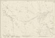
Durham XL.13 (includes: Eggleston; Mickleton; Middleton In Teesdale) - 25 Inch Map
1 : 2500 Topographic maps Ordnance Survey Ordnance Survey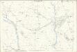
Durham XL.13 (includes: Eggleston; Mickleton; Middleton In Teesdale) - 25 Inch Map
1 : 2500 Topographic maps Ordnance Survey Ordnance Survey
NY92 - OS 1:25,000 Provisional Series Map
1 : 25000 Topographic maps Ordnance Survey Ordnance Survey
NZ02 - OS 1:25,000 Provisional Series Map
1 : 25000 Topographic maps Ordnance Survey Ordnance Survey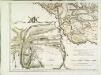
The county palatine of Durham, 3
1 Blatt : 53 x 71 cm R. Sayer & T. Jefferys
Teesdale - OS One-Inch Map
1 : 63360 Topographic maps Ordnance Survey Ordnance Survey

An accurate map of the county palatine of Durham
1 Karte : Kupferdruck ; 50 x 66 cm Kitchin; Hinton printed for J. Hinton at the Kings Arms in St. Pauls Church Yard
DUNELMIENSIS Episcopatus f.68
This is a map of County Durham by Christopher Saxton dating from 1577. It forms part of an atlas that belonged to William Cecil Lord Burghley, Elizabeth I’s Secretary of State. Burghley used this atlas to illustrate domestic matters. This map is actually a proof copy of one which forms part of Christopher Saxton’s Atlas of England and Wales. This atlas was first published as a whole in 1579. It consists of 35 coloured maps depicting the counties of England and Wales. The atlas is of great significance to British cartography as it set a standard of cartographic representation in Britain and the maps remained the basis for English county mapping, with few exceptions, until after 1750. During the reign of Elizabeth I, map use became more common, with many government matters referring to increasingly accurate maps with consistent scales and symbols, made possible by advances in surveying techniques. Illustrating the increasing use of maps in government matters, Lord Burghley, who had been determined to have England and Wales mapped in detail from the 1550s, selected the cartographer Christopher Saxton to produce a detailed and consistent survey of the country. The financier of the project was Thomas Seckford, Master of Requests at the Court of Elizabeth I, whose arms appear, along with the royal crest, on each map. Burghley has annotated this map, adding several place names. The map was engraved by Augustinus Ryther, the most accomplished member of a team of seven English and Flemish engravers employed to produce the copper plates for the atlas. Saxton, Christopher Ryther, Augustinus
Durham, Sheet 4 - Bartholomew's "Half Inch to the Mile Maps" of England & Wales
1 : 126720 Topographic maps Bartholomew, John George John Bartholomew & Co
County Durham
This is a manuscript map of County Durham. It forms part of an atlas that belonged to William Cecil Lord Burghley, Elizabeth I’s Secretary of State. Burghley used this atlas to illustrate domestic matters. The map dates from 1569 and is by John Rudd, the man to whom Christopher Saxton was an apprentice to in 1570. John Rudd was Vicar of Dewsbury from 1554 to 1570. Rudd had a keen interest in cartography and had been engaged in the 1550s in making a "platt" of England. In 1561 Rudd was granted leave to travel further to map the country and it is likely that Saxton accompanied him, acquiring his skills for surveying. This map is contemporary with the uprising of the northern peers in defence of Mary Queen of Scotts. A dotted line inserted on the map between the end of one river tributary and the start of another neatly illustrates how they were used as communication routes, the fastest way to transport men and arms. Knowledge of breaks in this route system was essential. Rudd, John William Cecil, Lord Burghley
Episcopatvs Dvnelmensis vulgo the bishoprike of Dvrham
1 Karte : Kupferdruck ; 36 x 48 cm Blaeu Joan Blaeu
DUNELMIENSIS Episcopatus Sheet 29
This map ofCounty Durham is from the 1583 edition of the Saxton atlas of England and Wales.This atlas was first published as a whole in 1579. It consists of 35 coloured maps depicting the counties of England and Wales. The atlas is of great significance to British cartography as it set a standard of cartographic representation in Britain and the maps remained the basis for English county mapping, with few exceptions, until after 1750. During the reign of Elizabeth I map use became more common, with many government matters referring to increasingly accurate maps with consistent scales and symbols, made possible by advances in surveying techniques. Illustrating the increasing used of maps in government matters, Lord Burghley, Elizabeth I’s Secretary of State, who had been determined to have England and Wales mapped in detail from the 1550s, selected the cartographer Christopher Saxton to produce a detailed and consistent survey of the country. The financier of the project was Thomas Seckford Master of Requests at the Court of Elizabeth I, whose arms appear, along with the royal crest, on each map. Saxton, Christopher Ryther, Augustine
EPISCOPATVS | DVNELMENSIS. | Vulgo | The Bishoprike of | DVRHAM.
[Amsterdam : Joan Blaeu]
Episcopatus Dunelmensis vulgo the Bishoprike of Durham
1 : 200000 Amstelodami : apud Joannem Janssonium
Episcopatus Dunelmensis, Vulgo The Bishoprike of Durham. [Karte], in: Theatrum orbis terrarum, sive, Atlas novus, Bd. 4, S. 469.
1 Karte aus Atlas Blaeu, Joan Blaeu, Willem Janszoon