Maps of Huntingdonshire
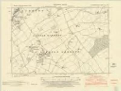
Huntingdonshire XIII.NW - OS Six-Inch Map
1 : 10560 Topographic maps Ordnance Survey Ordnance Survey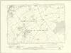
Huntingdonshire XIII.NW - OS Six-Inch Map
1 : 10560 Topographic maps Ordnance Survey Ordnance Survey
Huntingdonshire XIII.NW - OS Six-Inch Map
1 : 10560 Topographic maps Ordnance Survey Ordnance Survey
Huntingdonshire XIII.NW - OS Six-Inch Map
1 : 10560 Topographic maps Ordnance Survey Ordnance Survey
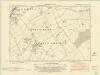
Huntingdonshire XIII.1 (includes: Great Gidding; Little Gidding; Steeple Gidding; Winwick) - 25 Inch Map
1 : 2500 Topographic maps Ordnance Survey Ordnance Survey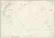
Huntingdonshire XIII.1 (includes: Great Gidding; Little Gidding; Steeple Gidding; Winwick) - 25 Inch Map
1 : 2500 Topographic maps Ordnance Survey Ordnance Survey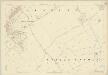
Huntingdonshire XIII.1 (includes: Great Gidding; Little Gidding; Steeple Gidding; Winwick) - 25 Inch Map
1 : 2500 Topographic maps Ordnance Survey Ordnance Survey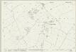
Huntingdonshire XIII.5 (includes: Great Gidding; Hamerton; Little Gidding; Steeple Gidding; Winwick) - 25 Inch Map
1 : 2500 Topographic maps Ordnance Survey Ordnance Survey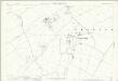
Huntingdonshire XIII.5 (includes: Great Gidding; Hamerton; Little Gidding; Steeple Gidding; Winwick) - 25 Inch Map
1 : 2500 Topographic maps Ordnance Survey Ordnance Survey
Huntingdonshire XIII.5 (includes: Great Gidding; Hamerton; Little Gidding; Steeple Gidding; Winwick) - 25 Inch Map
1 : 2500 Topographic maps Ordnance Survey Ordnance Survey
Huntingdonshire XIII.6 (includes: Hamerton; Sawtry; Steeple Gidding; Upton and Coppingford) - 25 Inch Map
1 : 2500 Topographic maps Ordnance Survey Ordnance Survey
Huntingdonshire XIII.6 (includes: Hamerton; Sawtry; Steeple Gidding; Upton and Coppingford) - 25 Inch Map
1 : 2500 Topographic maps Ordnance Survey Ordnance Survey
Huntingdonshire XIII.6 (includes: Hamerton; Sawtry; Steeple Gidding; Upton and Coppingford) - 25 Inch Map
1 : 2500 Topographic maps Ordnance Survey Ordnance Survey
Huntingdonshire XIII.2 (includes: Great Gidding; Little Gidding; Sawtry; Steeple Gidding) - 25 Inch Map
1 : 2500 Topographic maps Ordnance Survey Ordnance Survey
Huntingdonshire XIII.2 (includes: Great Gidding; Little Gidding; Sawtry; Steeple Gidding) - 25 Inch Map
1 : 2500 Topographic maps Ordnance Survey Ordnance Survey
Huntingdonshire XIII.2 (includes: Great Gidding; Little Gidding; Sawtry; Steeple Gidding) - 25 Inch Map
1 : 2500 Topographic maps Ordnance Survey Ordnance Survey
Northamptonshire XXVII.8 (includes: Great Gidding; Hamerton; Little Gidding; Luddington; Steeple Gidding; Winwick) - 25 Inch Map
1 : 2500 Topographic maps Ordnance Survey Ordnance Survey
Northamptonshire XXVII.8 (includes: Great Gidding; Hamerton; Little Gidding; Luddington; Steeple Gidding; Winwick) - 25 Inch Map
1 : 2500 Topographic maps Ordnance Survey Ordnance Survey
Northamptonshire XXVII.4 (includes: Great Gidding; Luddington) - 25 Inch Map
1 : 2500 Topographic maps Ordnance Survey Ordnance Survey
Northamptonshire XXVII.4 (includes: Great Gidding; Luddington) - 25 Inch Map
1 : 2500 Topographic maps Ordnance Survey Ordnance Survey
TL18 - OS 1:25,000 Provisional Series Map
1 : 25000 Topographic maps Ordnance Survey Ordnance Survey
Northamptonshire XXVII.NE - OS Six-Inch Map
1 : 10560 Topographic maps Ordnance Survey Ordnance Survey
Northamptonshire XXVII.NE - OS Six-Inch Map
1 : 10560 Topographic maps Ordnance Survey Ordnance Survey
Northamptonshire XXVII.NE - OS Six-Inch Map
1 : 10560 Topographic maps Ordnance Survey Ordnance Survey
Oundle
1 : 31680 This drawing describes the boundary of Northamptonshire with Huntingdonshire, the border being indicated by a red dotted line near the right margin of the sheet. The River Nene is highlighted in blue at the upper left. North of the river valley, Rockingham Forest is represented by stippled treetops. The landscape between the Nene and Welland Valleys comprises farmland, open pasture, villages and pockets of woodland. Boyce
Ramsey (Hills) - OS One-Inch Revised New Series
1 : 63360 Topographic maps Ordnance Survey Ordnance Survey
Ramsey (Outline) - OS One-Inch Revised New Series
1 : 63360 Topographic maps Ordnance Survey Ordnance Survey
Wellingborough
1 : 31680 This drawing covers part of the valley of the River Nene as it meanders through farmland and the cottage industries of Wellingborough and Irthlingborough. Mills are depicted throughout the area, especially along the course of the Nene. With coal absent from the area, natural resources, predominantly wind and water, were used for industrial processing. Hyett, William
Whittlesea
1 : 31680 This drawing covers the fens of Cambridgeshire, Huntingdonshire, Lincolnshire and Northamptonshire with the county borders indicated by a red dotted line. Characteristic fenland features such as dykes, canals and ancient cattle droves are clearly depicted on the plan. In the 17th century, the Dutch engineer Cornelius Vermuyden was appointed by James I to direct the drainage of the wetlands. As a result of Vermuyden's work, the fens took on a very different appearance, changing from an area of flooded marshes to one of extensively farmed agricultural land. Yeakell, T.