Maps of okres Jihlava
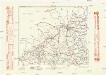
Müllerova mapa Čech
1 : 132000
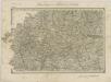
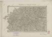
Der Iglauer Kreis
1 : 199000 Jihlava-oblast (Česko) Schenkl, Conrad Philipp Winiker, Karel von Carl Winiker
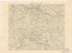
[Die Markgraftschaft Mähren]
1 : 200000 Jihlava-oblast (Česko) Schenkl, Conrad Philipp Carl Winiker
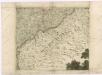
Die Markgraftschaft Mähren
1 : 22000 Jihlava-oblast (Česko) Schenkl, Conrad Philipp Carl Viniker
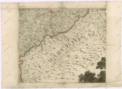
Marchionatvs Moraviae Circvlvs Iglaviensis
1 : 233300 Mollova mapová sbírka Müller, Johann Christoph Homann, Johann Baptista
Karte der Iglauer Sprachinsel und der südwestmährischen Sprachgrenze auf Grund der Volkszählung v. 31. Dec. 1880
1 : 300000 Jihlava-oblast (Česko) Held, Franz Historisch-statistische Section der k. k. mährisch-schlesische Ackerbaugesellschaft
Karte der Gemeindegrenzen
Politický okres Jihlavský
Komunikační mapa země Moravskoslezské
1 : 100000 Jihlava (Česko : oblast) Morslez. zem. výbor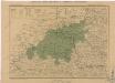
Generální mapa okresních hejtmanství

Iglau.
from Spezialkarte der osterreichisch-ungarischen Monarchie.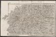
Umgebungen von Teltsch und Trebitsch
1 : 144000 K.K. Militärisches Geographisches Institut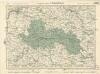
Soubor map politických okresů
II. vojenské mapování 12
1 : 144000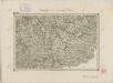
II. vojenské mapování 27
1 : 144000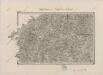
II. vojenské mapování 12
1 : 144000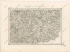
Special - Karte des Koenigreiches Boehmen
II. vojenské mapování 12
1 : 144000
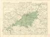
Okres Třebický
Podrobná místopisná mapa Království Českého

Podrobná mapa Markrabství moravského a Vévodství slezkého
1 : 100000 Havlíčkův Brod (Česko : oblast) Srp, Jan Jos. R. Vilímek
Der Iglauer Kreis
1 : 200000 Jihlava-oblast (Česko) Schenkl, Conrad Philipp Winiker, Karel Carl Winiker
Podrobná mapa Království českého
1 : 100000 Havlíčkův Brod (Česko : oblast) Srp, Jan Jaroslav Bursík
[Vilímkovy místopisné mapy zemí Koruny české]
1 : 100000 Havlíčkův Brod (Česko : oblast) Srp, Jan Jos. R. Vilímek
Podrobná mapa Markrabství moravského a Vévodství slezského
1 : 100000 Dačice (Česko : oblast) Srp, Jan Jos. R. Vilímek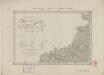
II. vojenské mapování 7
1 : 144000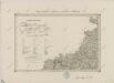
II. vojenské mapování 7
1 : 144000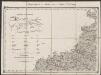
Umgebungen von Iglau nebst Zeichen Erklärung
1 : 144000 K.K. Militärisches Geographisches Institut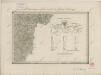
II. vojenské mapování 32
1 : 144000