Maps of Comunidad Foral de Navarra


Navarra Regnum. [Karte], in: Novus atlas absolutissimus, Bd. 6, S. 25.
1 Karte aus Atlas Janssonius Offizin

NAVARRA | REGNVM
G. Blaeu exc.
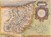
Navarra Regnum. [Karte], in: Theatrum orbis terrarum, sive, Atlas novus, Bd. 2, S. 214.
1 Karte aus Atlas Blaeu, Joan Blaeu, Willem Janszoon
Navarra regnum
1 Karte : Kupferdruck ; 51 x 44 cm Güssefeld; López Homännische Erben
Mapa del reyno de Navarra
1 Karte auf 4 Blättern : Kupferdruck ; 76 x 76 cm López; Horta s.n.
Navarra Regnum. [Karte], in: Novus Atlas, das ist, Weltbeschreibung, Bd. 2, S. 214.
1 Karte aus Atlas Blaeu, Joan Blaeu, Willem Janszoon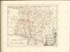

Mapa de la provincia de Guipuzcoa / construido segun las noticias de sus naturales por Dn. Tomás Lopez
1 Mapa, b/n. Full 89 de: Atlas geográfico de España. Madrid, 1830 (1a ed. 1804). Editat pels fills de T. López Datació aproximada. López, Tomás en la calle de Atocha
Mapa del m. n. y m. l. provincia de Guipuzcoa
1 Karte : Kupferdruck ; 36 x 36 cm López s.n.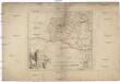
Des Königreichs Navarra südwestlicher Theil
1 : 240000 Navarra (Španělsko)
Guipus Coae Regionis Typus. [Karte], in: Theatrum orbis terrarum, S. 60.
1 Karte aus Atlas Ortelius, Abraham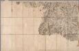
No. 140 [ St. Jean Pied de Port], uit: Carte géométrique de la France dite "Carte de Cassini" ou "de l'Académie"
1 : 86400 titelvariant: Carte de Cassini; Annotatie: Incompleet; Voor aanwezige bladen zie overzichtsblad Cassini de Thury, C.-F. Paris : [s.n.]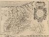
Guipus Coae Regionis Typus. [Karte], in: Theatrum orbis terrarum, S. 107.
1 Karte aus Atlas Ortelius, Abraham Vrients, Jan Baptista
[Saint-Jean-Pied-de-Port]
1 Blatt : 57 x 90 cm Aldring s.n.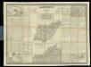
Guipúzcoa
1 : 200000 1 Mapa, b/n. Dins: Atlas de España y sus posesiones de ultramar Coello, Francisco ; Madoz, Pascual [Imprenta del Atlas de España]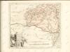

Guipuzcoa
1 : 200000 Coello, Francisco [Verlag nicht ermittelbar]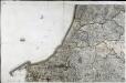
[Bayonne]
1 Blatt : 56 x 90 cm s.n.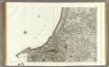
139 Bayonne.
1 : 86400 Cassini family; Cassini, Cesar-Francois, 1714-1784
Mapa geográfico del nuevo obispado de Tudela
1 Karte : Kupferdruck ; 25 x 37 cm, Bildgrösse 36 x 39 cm López s.n.
Govvernement de Bayonne
1 Karte : Kupferdruck ; 11 x 15 cm Sebastian Cramoisy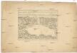
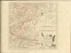
Plan du port du passage en Espagne
1 : 16000 Biskajský záliv (Francie a Španělsko) Fer, Nicolas de de Fer
Plan de lisle de la Conference
1 Vogelschauplan : Kupferdruck ; 41 x 51 cm Beaulieu S. de Pontault de Beaulieu
Plan of the town and port of San Sebastian in the bay of Biscay and province of Guipuscoa.- Plan of the port of passages in the bay ofbiscay and province of Guipuscoa
Tofiño de San Miguel, Vicente
Plan de St. Jean de Luz avec les différents projets d'agrandissem.t du port


