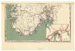
Maps of Västra Götalands län
Folketetthetskart over Sør-Norge (sør)
1 : 1000000 Alfred Söderlund Statistiske Centralbyrå, Kristiania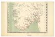
Spesielle kart 88-2: Rikstelegrafens og private telefonselskapers linjeruter i det sydlige Norge
Kristian Petersen Ukjent
Statistikk kart 2-2: Folkemængdekart over Norge
1 : 800000
Spesielle kart 42-1: Rigstelegraf- og Telefonkart over det sydlige Norge
1 : 800000
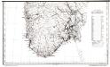
Norge 109: Det Sydlige Norge; sør
1 : 800000 Christian Jochum Pontoppidan | I. Erichsen
Nova et accurata Tabula Episcopatuum Stavangriensis, Bergensis et Asloiensis Vicinarumque aliquot territoriorum. [Karte], in: Novus atlas absolutissimus, Bd. 1, S. 51.
1 Karte aus Atlas Janssonius Offizin
Spesielle kart 8: Postkart over de 5 sydlige Stifter. Sydlig del.
1 : 800000
Diocesis Stavangriensis, & partes aliquot vicinae [Karte], in: Novus Atlas, das ist, Weltbeschreibung, Bd. 1, S. 30.
1 Karte aus Atlas Blaeu, Joan Blaeu, Willem Janszoon
Dioecesis Stavangriensis, & partes aliquot vicinae [Karte], in: Le théâtre du monde, ou, Nouvel atlas contenant les chartes et descriptions de tous les païs de la terre, Bd. 1, S. 46.
1 Karte aus Atlas Blaeu, Willem Janszoon und Blaeu, Joan Blaeu, Willem Janszoon
DIOECESIS | STAVANGRIENSIS | & partes aliquot vicinæ | operâ L. SCAVENII, S.S.
Apud Joh. et Cornel. Blaeu.
Dioecesis Stavangriensis, & partes aliquot vicinae [Karte], in: Theatrum orbis terrarum, sive, Atlas novus, Bd. 1, S. 44.
1 Karte aus Atlas Blaeu, Joan Blaeu, Willem Janszoon
Nova et accurata Tabula Episcopatuum Stavangriensis, Bergensis et Asloiensis Vicinarumque aliquot territoriorum. [Karte], in: Gerardi Mercatoris et I. Hondii Newer Atlas, oder, Grosses Weltbuch, Bd. 1, S. 115.
1 Karte aus Atlas Mercator, Gerhard und Hondius, Jodocus Jansson, Jan
[126][129] Norvegiae Maritimae ... Pascaert van Noorwegen ..., uit: Atlas sive Descriptio terrarum orbis
Annotatie: Gedigitaliseerde versie. Amsterdam. Heiloo : Picturae (vervaardiger), 2015. tiff-bestand. Gedigitaliseerd: 07-01-2015; Origineel: Universiteitsbibliotheek Vrije Universiteit (XL.05127.-) ; Netherlands; Titelpagina ontbreekt Wit, Frederik de Amsterdam : Frederick de Wit
Spesielle kart 10: Kart over en befaret Jernbanelinie mellem Kongsberg og Stavanger
1 : 800000 J. Sejersted
Regnum Norwegiae accurata et novissima delineatione
Norsko Lotter, Tobias Conrad Zatta, Antonio sumptibus Tobiae Conradi Lotter
Regnum Norwegiae accurata et novissima delineatione
Norsko Lotter, Tobias Conrad Zatta, Antonio sumptibus Tobiae Conradi Lotter
Norge 160: Kart over det sydlige Norge
1 : 700000 P. A. Munch | B. Herders
Regnum Norwegiae accurata et novissima delineatione
1 : 1460000 Norsko Lotter, Tobias Conrad T. C. Lotter
Spesielle kart 8: Postkart over de 5 sydlige Stifter. Sydlig del.
1 : 800000
Spesielle kart 64: Norvège Carte Zoo-Géographique, blad 2
1 : 2400000 Robert Collett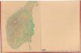
Statistikk kart 27 sør: Norvège. Kart udvisende skov, dyrket og udyrket mark
1 : 1000000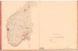
Statistikk kart 5 sør: Norvége. La Population en 1801
1 : 1000000

Spesielle kart 73: Dialektformers udbredelse i Kristianssands stift
1 : 2000000 A. B. Larsen Norges Geografiske Opmaaling
Spesielle kart 180: Skitseret Skovkart over det Sydlige Norge
1 : 1000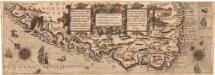
Museumskart 167: Kysten fra Osterøy til Langesund
1 : 750000 Lucas Janszoon Waghenaer
Spesielle kart 2-3: Norges jernbaner i 1863
1 : 1000000
Spesielle kart 94-2: Riks-telegraf og telefonkart over det sydlige Norge 1916
1 : 600000