Maps of Ringerike

Spesielle kart 123-5: Kart over Drammensvassdraget
1 : 100000 Toralf à ̃yen
Spesielle kart 58-2: Kart over Drammenselvens Flødningsdistrikt
1 : 100000 Thurmann | Seip
Kartblad 6 Cart over det Ringerigske Compagnie District
C. F. Møllerop
Portefølje nr 31
1 : 100000 Aubert
Portefølje nr 31
1 : 100000 Aubert
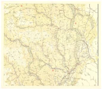
F33 Flaa
1 : 100000 Ole Engh | Torgrim Lundtvedt
F33 Flaa
1 : 100000 Torgrim Lundtvedt | Ole Engh
F33 Flaa
1 : 100000 Torgrim Lundtvedt | Ole Engh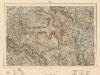
F33 Flaa
1 : 100000 Torgrim Lundtvedt | Ole Engh
F33 Flaa
1 : 100000 Ole Engh | Torgrim Lundtvedt
F33 Flaa
1 : 100000 Torgrim Lundtvedt | Ole Engh
19D Gran
1 : 100000 Arnt Magnus Andreassen Øgaard | C. Pedersen | Ole Tolstad
F33 aust Sperillen
1 : 100000
F33 aust Sperillen
1 : 100000
F33 vest Flå
1 : 100000
5427 Randsfjord
1 : 100000
F34 Krøderen
1 : 100000 Ole Tolstad | Ellef Nilsen
F34 Krøderen
1 : 100000 Ole Tolstad | Ellef Nilsen
Kartblad 64: Cart over det Hadelandske Compagnie District
von Leffelmann
19D Gran
1 : 100000 Arnt Magnus Andreassen Øgaard | Ole Tolstad | C. Pedersen
19D Gran
1 : 100000 Carl Christian Olberg | Arnt Magnus Andreassen Øgaard
19D Gran
1 : 100000 Arnt Magnus Andreassen Øgaard | Carl Christian Olberg
19D Gran
1 : 100000
19D Gran
1 : 100000 Arnt Magnus Andreassen Øgaard | Carl Christian Olberg
1715-1 Strömsåttbygda
1 : 50000 Statens kartverk
1815-4 Sperillen
1 : 50000 Statens kartverk
F33 vest Flå
1 : 100000
1715-1 Strömsåttbygda
1 : 50000 Norges Geografiske Oppmåling
G34-7
1 : 50000 Toralf Øyen