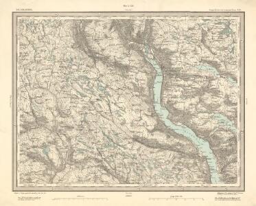
Maps of Lillehammer

25D Lillehammer
1 : 100000 Johan Ferdinand Normann
25D Lillehammer
1 : 100000 Einar Sigurd Ween | Johan Ferdinand Normann
25D Lillehammer
1 : 100000 Johan Ferdinand Normann
25D Lillehammer
1 : 100000 Johan Ferdinand Normann | Ole Engh
25D Lillehammer
1 : 100000
25D Lillehammer
1 : 100000
1817-3 Follebu
1 : 50000 Norges Geografiske Oppmåling
1817-3 Follebu
1 : 50000 Statens kartverk
1817-2 Lillehammer
1 : 50000 Norges Geografiske Oppmåling
1817-2 Lillehammer
1 : 50000 Statens kartverk
1817-2 Lillehammer
1 : 50000 Statens kartverk
1817-2 Lillehammer
1 : 50000 Statens kartverk
25D 2; 25D 3; 25D 6
1 : 50000 Holmboe
25D 3; 25D 4; 25D 7; 25D 8
1 : 50000 Schilling
Kartblad 5 Vey-Cart over det Nordre Hedemarkiske Capt. Von Weyhes Compagnie District
Johan Henrik Ramm
Kartblad 62: Charte over det Faabergske Compagnie District

1817-2 Lillehammer
1 : 50000 Statens kartverk
1817-2 Lillehammer
1 : 50000 Norges Geografiske Oppmåling
1817-3 Follebu
1 : 50000 Norges Geografiske Oppmåling
1817-2 Lillehammer
1 : 50000 Statens kartverk
Spesielle kart 182: Vannressurskart Lillehammer
1 : 50000 Tidemann Klemetsrud | Amund Gaut
1817-3 Follebu
1 : 50000 Statens kartverk
1817-2 Lillehammer
1 : 50000 Norges Geografiske Oppmåling
1817-3 Follebu
1 : 50000 Statens kartverk
1817-2 Lillehammer
1 : 50000 Norges Geografiske Oppmåling
1817-3 Follebu
1 : 50000 Statens kartverk
Finmarkens amt 54-3: HÃ¥ndtegnet kopi/skisse av kartlinje
1 : 200000 Gerhard Munthe, Fredrik Rode
G31-2; G31-3
1 : 40000 Alf Hattestad
G31-1
1 : 40000 Alf Hattestad