Maps of Roan

49D 8; 49D 12
1 : 50000 Carl Wilhelm August Prydz
1623-3 Roan
1 : 50000 Norges Geografiske Oppmåling
1623-3 Roan
1 : 50000 Statens kartverk
1623-3 Roan
1 : 50000 Statens kartverk
1623-3 Roan
1 : 50000 Norges Geografiske Oppmåling
1623-3 Roan
1 : 50000 Statens kartverk
49D Bjørnør
1 : 100000
49D Bjørnør
1 : 100000 Holm | Carl Christian Olberg
49D Bjørnør
1 : 100000
49D Bjørnør
1 : 100000 Nicolai Franck | Holm
49D Bjørnør
1 : 100000
49D Bjørnør
1 : 100000 H. C. Wanggård | Holm
50C Stenkjær
1 : 100000 Johan Gulbrandsen Natrud | Carl Christian Olberg
50C 5; 50C 6; 50C 9; 50C 10
1 : 50000 Johan Ferdinand Normann | Løjtnant Prytz
49D 6; 49D 7
1 : 50000 Thorvald Johan Randin Johannessen
1623-4 Osen
1 : 50000 Norges Geografiske Oppmåling
1623-4 Osen
1 : 50000 Norges Geografiske Oppmåling
1623-4 Osen
1 : 50000 Norges Geografiske Oppmåling
1623-4 Osen
1 : 50000 Statens kartverk
Kartblad 98: Situations-Cart over det Biørnørsche Compagnie District
Grønn
Namsos
1 : 250000
Namsos
1 : 250000
Trigonometrisk grunnlag, Squelet-Cart 37: Trigonometrisk Kart for 1828
1 : 400000 Vibe
Museumskart 118: Trøndelagskysten, sør-øst
1 : 200000 Paus
Kartblad 71a øst: Carte over det 1. Trondhiemsche Regiment tillige med de 3 Nordenfi: Skieløber Compagniers Situation; kopi østre del
Isach Jørgen Coldevin
Norge 55-1 Accurat landcaart over Norges Rige anden Part
1 : 3000000 G. Bordin
Kartblad 9 Situations Carte over Nummedahls Fogderi. Med Nærøeske; Fosnæske og Overhaldske Kartblad : Compagnie Districter
Henrich Christopher Sommerschield
Kartblad 71a vest: Carte over det 1. Trondhiemsche Regiment tillige med de 3 Nordenfi: Skieløber Compagniers Situation; kopi vestre del
Isach Jørgen Coldevin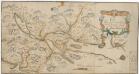
Kartblad 74: Carta over Eendeel af det Trondhiemske Primo-Regiement
Christian Wilhelm Klüwer