Maps of Scandinavia

Norge 77: Kort over alle Post Tourer i Norge
1 : 1000000 Jens Schanch
Spesielle kart 5-2: Telegraf Kart over Norge
1 : 2000000
Spesielle kart 5-1: Telegraf Kart over Kongeriget Norge
1 : 1600000
Statistikk kart 19-4: Fremstilling af Norges Agerbrug. Engdyrkning. Eng beregnet i procent af dyrket areal
1 : 2400000
Statistikk 26-4c: Gjeder. Antal Dyr pr 1000 maal høstet Areal
1 : 2400000
Statistikk 26-9c: Husdyrene reduceret til Hornkvæg for hver Gaard
1 : 2400000
Statistikk kart 11- Norvége
1 : 2400000
Statistikk 28- Le royaume de Norvège
1 : 2400000
Statistikk 26-4b: Avling reduceret til Bygværdi.
1 : 2400000
Statistikk kart 3: Folkemængdekart over Norge
1 : 1600000
Statistikk 28-2: Le royaume de Norvège
1 : 2400000
Statistikk 26-3c: Faar. Antal Dyr pr 1000 Maal høstet Areal
1 : 2400000
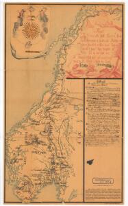
Norge 78: Regni Norvegici Delineationovissima Finitimarumque Sveciæ Provinciarum
1 : 200000 S. O. de Falckenskiold
Spesielle kart 66-1: Kart udvisende de med bidrag af Statskassen understøttende Dampskibsrouter
1 : 2400000
Statistikk kart 17: Kart udvisende Forholdet mellem Fjeld og dyrket Mark
1 : 2400000
Spesielle kart 66-2: Kart udvisende de med bidrag af Statskassen understøttende Dampskibsrouter
1 : 2400000
Statistikk 26-6b: Udsæd af Korn
1 : 2400000
Spesielle kart 5-3: Telegraf Kart over Norge
1 : 2000000
Statistikk kart 14: Norvège. Division médicale
1 : 2400000
Spesielle kart 66-3: Kart udvisende de med bidrag af Statskassen understøttende Dampskibsrouter
1 : 2400000
Statistikk 26-5b: Udsæd af korn i tønder, reduceret til bygværdi pr. 1000 maal
1 : 2400000
Statistikk 26-5c: Heste. Middeltal pr Gaard
1 : 2400000
Spesielle kart nr 74: Strandfladen langs Norges kyst
1 : 2400000 Dr. Hans Reusch
Statistikk kart 12-b: Norvège. Division administrative
1 : 2400000
Statistikk kart 15a: Norvège. Division militaire
1 : 2400000
Statistikk 26-6c: Hornkvæg. Middeltal pr Gaard
1 : 2400000
Statistikk kart 15b: Norvège. Division militaire
1 : 2400000
Statistikk 26-10b: Eng i Procent af den dyrkede Jord, fogderivis
1 : 2400000
Statistikk kart 20-4: Fremstilling af den norske Fædrift. Faaret. Dyrenes antal pr 1000 maal afhøstet areal
1 : 2400000