Maps of Dovre

Fra Hjerkinn til Porten
1 : 20000 J. H. Reichborn
37C 7; 37C 8
1 : 100000 Johannes Sejersted
37C 7
1 : 25000 Adler Gleditsch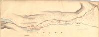
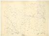
Fra Lissætre til Hjerkinn
1 : 20000 J. H. Reichborn
37C 3; 37C 4; 37C 7; 37C 8
1 : 50000 Niels Sire
1519-4 Snøhetta
1 : 50000 Statens kartverk
37C Dovrefjell
1 : 100000
37C Dovrefjell
1 : 100000
37C Dovrefjell
1 : 100000
37C Dovrefjell
1 : 100000
37C 2; 37C 3; 37C 4; 37C 6; 37C 7; 37C 8; 37C 10; 37D 1; 37D 5
1 : 100000 C. Lund
Kartblad 110: Carte over det Opdalske Compagnie District
M. F. Dons
Spesielle kart 111-2: Oversigtskart til Kaptejn J. Sejersted's Indberetning angaaende Grænsen mellem Trondhjem's og Hamar's Stifter
1 : 100000 J. Sejersted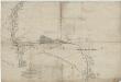
Kartblad 53 sør: Militair Vej-Cart over det Læssøeske Compagnie District; søndre del
P. T. Coucheron
Spesielle kart 113-2: Oversigtskart over de forskjellige Grænsealternativer mellem Trondhjems Stift og Hamar og Bergens Stifter
1 : 100000 J. Sejersted
Spesielle kart 103-3: Flötningskart over Glommens vassdrag
1 : 1000 Einar Sigurd Ween
Kartblad 166b-1a: Wej-Cart over det Aamodske Compagnie; 166b-1a
Spesielle kart 103-13: Flötningskart over Glommens vassdrag
1 : 1000 Einar Sigurd Ween
[Romsdals Amt]
1 : 200000 Norsko Norges geografiske Opmaling
Norge 55-9: Accurat landcaart over Norges Rige anden Part
1 : 300000 G. Bordin
Trigonometrisk grunnlag, Squelet-Cart 65-13

Trigonometrisk grunnlag, Squelet-Cart 35: Skelet-kart over de trigonometrisk bestemte Punkter Sommeren 1826
Th. Broch
Trigonometrisk grunnlag, Squelet-Cart 36: Skelet-kart over de trigonometrisk bestemte Punkter Sommeren 1827
Th. Broch
Geologisk kart over det Söndenfjeldske Norge
1 : 400000 Nordwest-Blatt Kjerulf, Theodor ; Dahll, Tellef Carl Schwenzens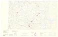
Statistikk _43-14-2: Bosettingskart over Røros. Blad 14.
1 : 250000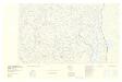
Spesielle kart: Tyngdeanomalikart, RÃ ̧ros
1 : 250000 NGO
Bl. XI Molde
1 : 300000
Midt-Jotunheimen
1 : 50000 Norsko Norges geografiske Opmaling
XI
1 : 400000 N. Franck