Maps of Göteborg
Museumskart 152: Carte über Gotteburg, Bahuus und Marstrand
1 : 200000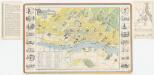
Göteborg, uit: Pictorial map of Göteborg and Western Sweden = Plan illustré de Göteborg et l'ouest de la Suède
1 : 12000 titelvariant: Plan illustré de Göteborg et l'ouest de la Suède [Göteborg : Göteborgs & Bohusläns Turisttrafikförening]
III
1 : 400000 L. Arentz
III
1 : 400000 L. Arentz
Museumskart 148: Pass Kaart over Kattegatet
1 : 200000
Spesielle kart 124-2: Telefonkart SÃ ̧r-Norge
1 : 200000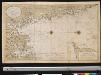
Nieuwen afteekening van t Land van Noord Oosten van de Bogt van Anselo tot Warbergh int groodt
Norway Gerard van Keulen
Museumskart 6: Accurateste Søe Cart Ofuer Denne betengede destrect
1 : 500000 Jens Sørensen
Tractus Norvegiae Suecicus praefecturam Bahusiae finitimaeqve Daliae provinciae partem sistens
1 : 460000 Bohuslän (Švédsko) Homann, Johann Baptist a Ioh. Bap. Homanno S.C.M. geographo ejusqve filio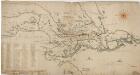
Norge 12: Kart over Smaalenenes Amt med Bahus Len samt Dele af Akershus og Hedemarkens Amter
1 : 400000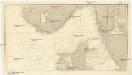
Die Nord- und Ostsee zwischen Texel und Arkona
1 : 590000 Baltské moře Reichs-Marine-amt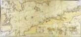
Söe=kaart over Kattegattet
1 Karte auf 2 Blatt : Kupferdruck ; 60 x 135 cm Akeleye; Schmidt s.n.
Denmark.
1 : 630000 Pinkerton, John, 1758-1826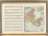
Denmark, Iceland.
1 : 1490000 Rand McNally and Company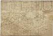
Norgesavdelingen 38c sør: Græntse-Carte imellom Norge og Swerrige
1 : 800000 Jens Christian Spidberg
Norgesavdelingen 227-3: Vægkart over Norge - sydlige blad
1 : 600000 J. Sejersted | P. Dybdahl A. Bruns Forlag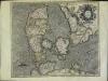
Daniae regnv[m]
1 Karte : Kupferdruck ; 36 x 43 cm Mercator; Hondius Henricus Hondius
Totius Iutiae Generalis Accurata delincatio. [delineatio] [Karte], in: Novus atlas absolutissimus, Bd. 1, S. 134.
1 Karte aus Atlas Janssonius Offizin
Denmark (with) inset map of Iceland.
1 : 855360 Arrowsmith, John
Denmark.
1 : 3500000 Fenner, Rest.
Denmark.
1 : 1900800 Lucas, Fielding Jr.
Kongeriget Danmark med Hertugdömmet Slesvig
1 : 480000 Olsen, O.N. ; Seehusen, P.J. Generalstab
Dänemark und seine Nebenländer
Adolf Stieler's Handatlas über alle Theile der Erde und über das Weltgebäude Stieler, Adolf Justus Perthes
Cimbricae Chersonesi nun Iutiae descirptio [Karte], in: Theatrum orbis terrarum, S. 205.
1 Karte aus Atlas Ortelius, Abraham Vrients, Jan Baptista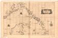
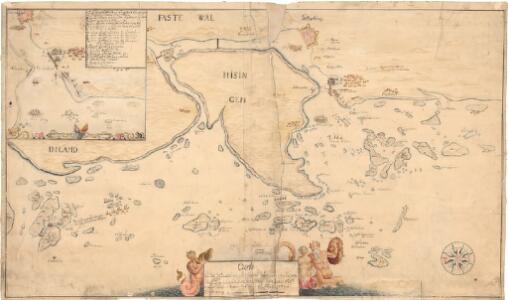
Museumskart 169: Kart over kysten fra Gøteborg til Arendal med nordspissen av Jylland
1 : 500000 Robert Dudley
Charte von Daenemark
Dánsko
CHARTE von DAENEMARK
1 : 1280000 Bornholm (Dánsko)
Charte von Daenemark
1 : 1280000 Bornholm (Dánsko)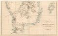
Trigonometrisk grunnlag, vedlegg 64a: Ort-Bestämmelsen i Södra Delen af Swerige
1 : 500000