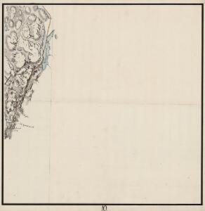
Maps of Aremark

Mil nr 10
1 : 10000
2013-3 Aspern
1 : 50000 Norges Geografiske Oppmåling
2013-3 Aspern
1 : 50000 Norges Geografiske Oppmåling
Jegerkorps nr 19: Kart over Idd, Enningdal og Aremark sogn, del 4 østre del
1 : 13330 Jean Henri Spørck
10D 1
1 : 20000 Jacob Friderich Schilling
Mil nr 9
1 : 10000
2013-3 Aspern
1 : 50000 Norges Geografiske Oppmåling
10B 5; 10B 9
1 : 50000 David Ebbesen | Oluf Gabriel Lund
2013-3 Aspern
1 : 50000 Statens kartverk
2013-3 Aspern
1 : 50000 Statens kartverk
2013-3 Aspern
1 : 50000 Statens kartverk
H37 Halden
1 : 50000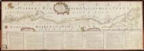
NRA GA 1
Marelius | Thodal | Friedenreich | Bautz | Holm | Ratkind
10B Boksjø
1 : 100000 Arnt Magnus Andreassen Øgaard | Ellef Nilsen
Kartblad 1-2: Vei-Cart over det Iddeske Compagnie District, versjon 2
Schielderup
Kartblad 1- Vei-Cart over det Iddeske Compagnie District; versjon 1
Schielderup
10B Boksjø
1 : 100000 H. N. Bergh | E. Heiberg
Norge 2: Geometriscks Afritningh
U. J. From
Kart over Smaalehnenes amt
1 : 200000 Norsko jižní Ramm, N. Munthe, G.
Kristiania
1 : 250000
Oslo
1 : 250000
Spesielle kart 144-a: Flykart 1917 laget på grunnlag av Langeneralkart Oslo LV 1915 og 1936
1 : 250000 NGO
Østfold
1 : 200000
Geologisk kart over det Söndenfjeldske Norge
1 : 400000 Südost-Blatt Kjerulf, Theodor ; Dahll, Tellef Carl Schwenzens
Norge 28: Geographiske Carte over en Deel af Norge. Fra Fredrikshald til Mangen med tilgrænsende Dele av Sverige
1 : 300000
Enningdalen
1 : 250000 Scott Ruud | C. Pedersen
Geologiske kart 121-A Kart med magnetisk totalfelt. Oslo
1 : 250000 Norges geologiske undersøkelse
Oslo
1 : 250000
Trigonometrisk grunnlag, Squelet-Cart 65-4