Maps of Nissedal

1613-3 Nissedal
1 : 50000 Norges Geografiske Oppmåling
1613-3 Nissedal
1 : 50000 Norges Geografiske Oppmåling
1613-3 Nissedal
1 : 50000 Statens kartverk
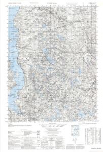
1613-3 Nissedal
1 : 50000 Statens kartverk
1613-3 Treungen
1 : 50000 Statens kartverk
E37-3, E37-4
1 : 50000 Toralf Øyen | Adler Gleditsch
8D 6 8D 9 8D 10
1 : 50000 H. Lassen
E37 aust Nisser
1 : 100000
E37 aust Nisser
1 : 100000
E37 aust Nisser
1 : 100000
E37-4, E37-5
1 : 50000 Hans Knagenhjelm Hertzberg
E37-10
1 : 50000 Toralf Øyen
E37-8, E37-9
1 : 50000 Toralf Øyen
E37-1, E37-2
1 : 50000 Gustav Adolf Tajet | Erling Bjørstad
E37-5
1 : 50000 Thorleif Dagfinn Unneberg | Hans Knagenhjelm Hertzberg
E38-10, E38-11
1 : 50000 Hans Knagenhjelm Hertzberg
E38-8, E38-9
1 : 50000 Per Tang | Adler Gleditsch
1612-4 Vegår
1 : 50000 Statens kartverk
1612-4Vegår
1 : 50000 Norges Geografiske Oppmåling
1612-4 Vegår
1 : 50000 Statens kartverk
1612-4 Vegår
1 : 50000 Statens kartverk
8A 8 8A 12 8B 5 8B 6 8B 9 8B 10 8C 4 8C 8 8C 12 8D 1 8D 2 8D 3 8D 5
1 : 100000 P. Paasche
Trigonometrisk grunnlag, Squelet-Cart 44: Kart for 1848
C. Bassøe
Trigonometrisk grunnlag, Squelet-Cart 42: Kart over de i sommeren 1847 av Lieut: F. Næser trigonometrisk bestemte punkter
F. Næser
Kartblad 149: Oculair Cart over det 1ste Nedenæsske Compagnie District
E. G. Jebe
Kartblad 146: Geographisk Cart over det 3die Vestfieldske Compagnie District
Hans Ibsen
Portefølje nr 14
1 : 100000 Kaurin
Portefølje nr 14
1 : 100000 Kaurin
Trigonometrisk grunnlag, Squelet-Cart 19- Kysten fra Kragerø til Tromøy
B. Aubert | Niels Andreas Wibe