Maps of Rindal

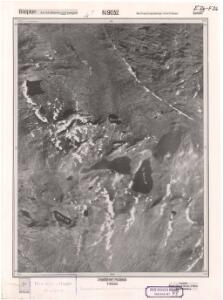
Romsdals amt nr 48: E26 og F26, N9032
1 : 25000
42C 6; 42C 7; 42C 10; 42C 11
1 : 50000 Abraham Ludvig Amundsen
42C Trollhetta
1 : 100000
42C Troldhetta
1 : 100000 Ole Engh | Oluf Lier
Trollheimen
Ugland IT group
42C Trollhetta
1 : 100000
42C Troldhetta
1 : 100000 H. Hagen | Oluf Lier
42C Troldhetta
1 : 100000 H. Hagen | Oluf Lier
42C Troldhetta
1 : 100000 Oluf Lier | C. Pedersen
1520-4 Trollhøtta
1 : 50000 Statens kartverk
1520-4 Trollhetta
1 : 50000 Norges Geografiske Oppmåling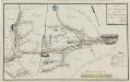
Kartblad 109: Carte over det Meldahlske Compagnie District
Rosbach
1520-4 Trollhetta
1 : 50000 Statens kartverk
1520-4 Trollhetta
1 : 50000 Norges Geografiske Oppmåling
1520-4 Trollhetta
1 : 50000 Statens kartverk
1420-1 Snota
1 : 50000 Statens kartverk
1521-3 Løkken
1 : 50000 Statens kartverk
1420-1 Snota
1 : 50000 Norges Geografiske Oppmåling
1420-1 Snota
1 : 50000 Statens kartverk
1420-1 Snota
1 : 50000 Norges Geografiske Oppmåling
42C Trollhetta
1 : 100000
42C Troldhetta
1 : 100000 Oluf Lier | C. Pedersen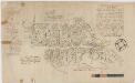
Kartblad 112: Carte over det Wigsche-Nordmørsche Compagnie District
Johan Thomas Hornemann
Trigonometrisk grunnlag, Squelet-Cart 65-13

Trigonometrisk grunnlag, Squelet-Cart 56: kart over de i Sommeren 1859 bestemte Punkter
A. Heiberg
Norge 55-14: Accurat landcaart over Norges Rige anden Part
1 : 3000000 G. Bordin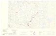
Statistikk _43-14-2: Bosettingskart over Røros. Blad 14.
1 : 250000
Spesielle kart: Tyngdeanomalikart, RÃ ̧ros
1 : 250000 NGO
Norge 55-10: Accurat landcaart over Norges Rige anden Part
1 : 300000 G. Bordin