Maps of York County
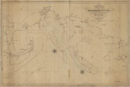
A new chart of Massachusetts Bay, and part of the coast of Maine : drawn from the latest authorities
1 : 200000 Lambert, Samuel, 1768-1832 Whipple
A new chart of Massachusetts Bay drawn from the latest authorities
1 : 235000 Lambert, Samuel Lambert, Samuel
A new and correct chart of the sea coast of New-England from Cape Codd to Casco Bay
1 : 142560 Barnsley, Henry Sold by W. & I. Mount & T. Page on Tower hill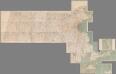
Composite Map: (Massachusetts).
1 : 63680 Walker, O.W.
Massachusetts Bay with the coast from Cape Ann to Cape Cod
1 : 80000 U.S. Coast and Geodetic Survey U.S. Coast and Geodetic Survey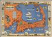
Cape Cod, Barnstable County, Mass. Inc. 1639. Drawn by C.W. Holliday
1 : 150000 Holliday, C.W.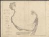
Cape Cod Bay, Massachusetts
1 : 80000 U.S. Coast and Geodetic Survey U.S. Coast and Geodetic Survey
Saco, Biddeford.
1 : 7920 George N. Colby & Co.
York Co., Maine.
1 : 253440 J.H. Stuart & Co.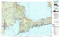
New Bedford
1 : 100000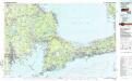
New Bedford
1 : 100000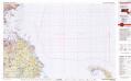
Provincetown
1 : 100000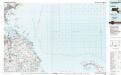
Provincetown
1 : 100000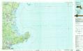
Gloucester
1 : 100000
Kittery
1 : 100000
Kittery
1 : 100000
Map of the county of Plymouth, Massachusetts : from actual surveys
1 : 47520 Walling, Henry Francis, 1825-1888 D.R. Smith & Co.
Plymouth County.
1 : 158400 Gray, Ormando Willis; Walling, H. F.
Cape Cod Bay
1 : 80000 U.S. Coast and Geodetic Survey U.S. Coast and Geodetic Survey
Boston
1 : 250000
Boston
1 : 250000
Boston
1 : 250000
Boston
1 : 250000
Boston
1 : 250000
Boston
1 : 250000
Boston
1 : 250000
Boston
1 : 250000
Essex & Norfolk counties.
1 : 158400 Gray, Ormando Willis; Walling, H. F.
The county of Essex : from actual survey
1 : 90000 Hales, John Groves [s.n.]