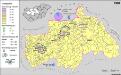
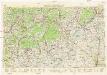
Maps of Észak-Magyarország
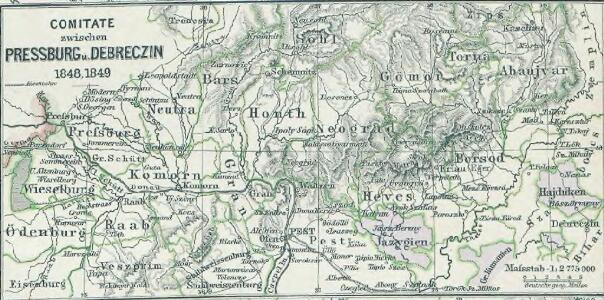
Comitate zwischen Pressburg u. Debreczin 1848, 1849
1 : 2775000 Ungarn Ungarn / Revolution <1848-1849>
Deß Konigreichs Ungern Fürnembster theil, Geographische beschreibung
1 : 650000 Mollova mapová sbírka Hulsius, Levinus Hulsius, Levinus
Übrige Länder der ehemaligen Österreich-Ung. Monarchie
1 : 900000 Maďarsko Koch, Wilhelm Opitz, Carl Arnd
Strassen- und Eisenbahnkarte des oesterreichischen Kaiserthumes
1 : 864000 Blatt 7 Schaller, G. K.K. Militärisch-Geografisches Institut, Karten-Evidenthaltungs-Abteilung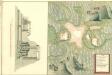
Plan Der Unter Bergstadt Feketa Bania
Mollova mapová sbírka Geyer
Ungarn. Comitate: Raab, Comorn, Stuhlweißenburg, Weszprim, Zolna, Pesth, Neograd, Hont, Gran, Bars, Neutra, Gömör, Heves, Borsod, Lorna, Abanjvár, Zemplin, Szabolcs, Bihar, Békes, Csongrad, Arad. Jazigien, klein und groß. Kumanien, Hajduken Städte
Ungarn Verkehrsweg
A Dunavölgy vizszabályozasi átnézeti térképe

Freytag & Berndt ́s: Auto-Strassenkarten
Neubertova generální automapa Republiky československé
1 : 200000 Bratislava (Slovensko : oblast) Soukup, Jan V. Neubert a synové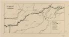
Sbírka map a diagramů použitých na mírových konferencích v Paříži v letech 1919 - 1920
Sbírka map a diagramů použitých na mírových konferencích v Paříži v letech 1919 - 1920
Neubertova generální automapa Republiky československé
1 : 200000 Debrecín (Maďarsko : oblast) Soukup, Jan V. Neubert a synové
Vermehrte und Verbesserte Landkarten des Königreichs Ungarn :
1 : 500000 Mollova mapová sbírka Stier, Martin Böner, Johann-Alexander Endter, Martin
Podrobný přehled politického rozdělení Slovenska a Podkarp. Rusi
Vojenský zeměpisný ústav
A szlovákok településterülete a szomszédsági mutató alapján Közép-Dunántúlon 1941-ban
Ungarn, Zentralungarn, Slowaken, Siedlung Bottlik, Zsolt
Nieder-Ungern
Slovensko západní Kipferling, Karl Joseph Berken von Ottendorff, Johann im Verlage des Kunst- und Industrie Comptoirs
Nieder-Ungern
Slovensko západní Kipferling, Karl Joseph Berken von Ottendorff, Johann im Verlage des Kunst- und Industrie Comptoirs
Podrobný přehled politického rozdělení země Slovenské a Podkarpatoruské
Vojenský zeměpisný ústav
A szlovákok településterülete a szomszédsági mutató alapján Közép-Dunántúlon 1880-ban
Ungarn, Zentralungarn, Slowaken, Siedlung Bottlik, Zsolt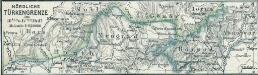
Nördliche Türkengrenze im 16ten u. 17ten Jhdt.
1 : 1850000 Osmanisches Reich / Europäischer Teil Grenze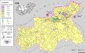
A szlovákok településterülete a szomszédsági mutató alapján Közép-Dunántúlon 1980-ban
Ungarn, Zentralungarn, Slowaken, Siedlung Bottlik, Zsolt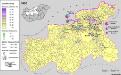
Siedlungsgebiet der Slowaken nach dem Nachbarschaftsindex für Mittel-Transdanubien 1880
Ungarn, Zentralungarn, Slowaken, Siedlung Bottlik, Zsolt
Siedlungsgebiet der Slowaken nach dem Nachbarschaftsindex für Mittel-Transdanubien 1980
Ungarn, Zentralungarn, Slowaken, Siedlung Bottlik, Zsolt
Nástěnná mapa hejtmanství Čáslavského
Siedlungsgebiet der Slowaken nach dem Nachbarschaftsindex für Mittel-Transdanubien 1941
Ungarn, Zentralungarn, Slowaken, Siedlung Bottlik, Zsolt
Generalkarte von Zentraleuropa

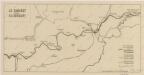
Die Donau, der Fürst aller Europaeischen Flüsse :
Mollova mapová sbírka Hoffmann, Johannes Hoffmann, Johann
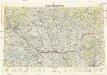
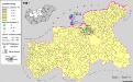
Comitat Abaúj-Torna
1 : 290000 Košice (Slovensko : oblast)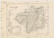
Comitat Abaúj-Torna
1 : 288000 Košice-oblast jižní (Slovensko)