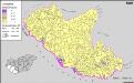
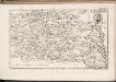
Maps of Pécsváradi járás

Battaszék
1 : 75000 Komitat Tolna
Bataszek und Pecsvarad.
from Spezialkarte der osterreichisch-ungarischen Monarchie.
Fulna - Mohacz
Mollova mapová sbírka Marsili, Luigi Ferdinando
A Dunavölgy Átnézeti Térképe, Carte d ́ensemble del la Vallée du Danube XIX.

Mohač - Pečuj
1 : 200000 Pécs (Maďarsko) Kartografska radionica
Comitat Baranya
1 : 290000 Baranya (Maďarsko : župa)
Comitat Baranya
1 : 288000 Baranya (Maďarsko : župa)
C. Baranyiensis
Ungarn Komitat Baranya
Baranya vármegye térképe
1 : 385000 Baranya (Maďarsko : župa) Kogutowicz, Manó Magyar Földrajzi Intézet
Comitat Tolna
1 : 350000
Comitat Tolna
1 : 280000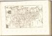

C. Tolnensis
Ungarn Komitat Tolna
Tolna vármegye térképe
1 : 355000 Kogutowicz, Manó Magyar Földrajzi Intézet
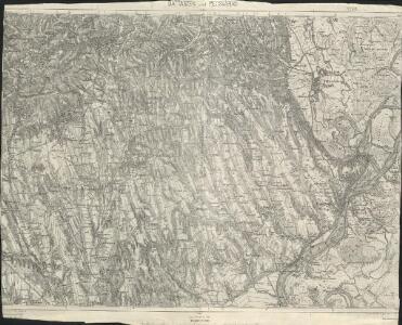
Mohacs und Villany.
from Spezialkarte der osterreichisch-ungarischen Monarchie.
Funfkirchen.
from Spezialkarte der osterreichisch-ungarischen Monarchie.
Baja.
from Spezialkarte der osterreichisch-ungarischen Monarchie.
Bataille de Mohacz
Nouvel atlas physique politique et historique de l'Empire ottoman et des états limitrophes en Europe, en Asie et en Afrique, en quarante feuilles Hellert, J.J. Bellizard, Dufour et Cie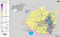
Siedlungsgebiet der Deutschen nach dem Nachbarschaftsindex für Süd-Transdanubien 1880
Ungarn (Süd) Deutsche, Siedlung Bottlik, Zsolt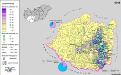
Siedlungsgebiet der Deutschen nach dem Nachbarschaftsindex für Süd-Transdanubien 1941
Ungarn (Süd) Deutsche, Siedlung Bottlik, Zsolt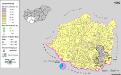
Siedlungsgebiet der Deutschen nach dem Nachbarschaftsindex für Süd-Transdanubien 1980
Ungarn (Süd) Deutsche, Siedlung Bottlik, Zsolt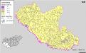
Kroaten in Südwest-Ungarn 1941
Transdanubien (Süd) Kroaten, Siedlung Bottlik, Zsolt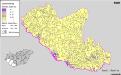
Kroaten in Südwest-Ungarn 1880
Transdanubien (Süd) Kroaten, Siedlung Bottlik, Zsolt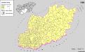
Serben in Süd-Transdanubien und im Komitat Bács-Kiskun 1980
Transdanubien (Süd), Bács-Kiskun, Serben, Siedlung Bottlik, Zsolt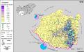
A németek településterülete a szomszédsági mutató alapján Dél-Dunántúlon 1941-ban
Ungarn (Süd) Deutsche, Siedlung Bottlik, Zsolt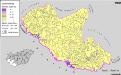
Kroaten in Südwest-Ungarn 1980
Transdanubien (Süd) Kroaten, Siedlung Bottlik, Zsolt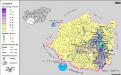
A németek településterülete a szomszédsági mutató alapján Dél-Dunántúlon 1880-ban
Ungarn (Süd) Deutsche, Siedlung Bottlik, Zsolt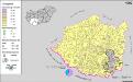
A németek településterülete a szomszédsági mutató alapján Dél-Dunántúlon 1980-ban
Ungarn (Süd) Deutsche, Siedlung Bottlik, Zsolt