Maps of Arad
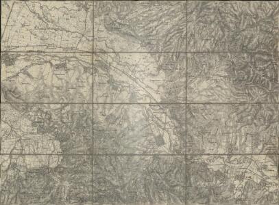
Borosjenö
1 : 75000 Ineu (Arad, Rumänien)
[Manöver des 7. Corps 1893]
1 : 75000 K. u. k. militär-geographisches Institut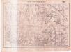
Lambert-Cholesky sheet 2165 (Bârsa)
1 : 20000 Romanian military topographic map sheet under Lambert-Cholensky projection Serviciul Geografic al Armatei geo-spatial.org Serviciul Geografic al Armatei
Lambert-Cholesky sheet 2265 (Şuşani Sebiş)
1 : 20000 Romanian military topographic map sheet under Lambert-Cholensky projection Direcția Topografică Militară geo-spatial.org Direcția Topografică Militară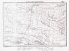
Lambert-Cholesky sheet 2166 (Beliul)
1 : 20000 Romanian military topographic map sheet under Lambert-Cholensky projection Institutul Geografic Militar geo-spatial.org Institutul Geografic Militar
Lambert-Cholesky sheet 2266 (Susani)
1 : 20000 Romanian military topographic map sheet under Lambert-Cholensky projection Institutul Geografic al Armatei geo-spatial.org Institutul Geografic al Armatei
Lambert-Cholesky sheet 2264 (Almaş)
1 : 20000 Romanian military topographic map sheet under Lambert-Cholensky projection Serviciul Geografic al Armatei geo-spatial.org Serviciul Geografic al Armatei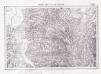
Lambert-Cholesky sheet 2164 (Chişindia)
1 : 20000 Romanian military topographic map sheet under Lambert-Cholensky projection Serviciul Geografic al Armatei geo-spatial.org Serviciul Geografic al Armatei
Borosjeno und Buttyin.
from Spezialkarte der osterreichisch-ungarischen Monarchie.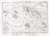
Lambert-Cholesky sheet 2065 (Mocrea)
1 : 20000 Romanian military topographic map sheet under Lambert-Cholensky projection Direcția Topografică Militară geo-spatial.org Direcția Topografică Militară
Lambert-Cholesky sheet 2066 (Ineu)
1 : 20000 Romanian military topographic map sheet under Lambert-Cholensky projection Direcția Topografică Militară geo-spatial.org Direcția Topografică Militară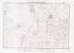
Lambert-Cholesky sheet 2064 (Agriş)
1 : 20000 Romanian military topographic map sheet under Lambert-Cholensky projection Institutul Geografic al Armatei geo-spatial.org Institutul Geografic al Armatei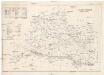
Arader Comitat
1 : 290000
Arader Comitat
1 : 288000 Arad (Rumunsko)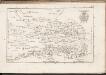
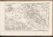
C. Aradiensis
Rumänien Komitat Arad (Rumänien)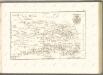
C. Bihariensis. Tab. II
Ungarn Rumänien Komitat Bihar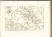

Okros.
from Spezialkarte der osterreichisch-ungarischen Monarchie.
Nada und Soborsin.
from Spezialkarte der osterreichisch-ungarischen Monarchie.
Apatelek und Simano.
from Spezialkarte der osterreichisch-ungarischen Monarchie.
Vaskoh und Nagy-Halmagy.
from Spezialkarte der osterreichisch-ungarischen Monarchie.
Lambert-Cholesky sheet 2365 (Poiana)
1 : 20000 Romanian military topographic map sheet under Lambert-Cholensky projection Institutul Geografic Militar geo-spatial.org Institutul Geografic Militar
Lambert-Cholesky sheet 2366 (Vaşcău)
1 : 20000 Romanian military topographic map sheet under Lambert-Cholensky projection Direcția Topografică Militară geo-spatial.org Direcția Topografică Militară
Lambert-Cholesky sheet 2364 (Pleşcuţa)
1 : 20000 Romanian military topographic map sheet under Lambert-Cholensky projection Direcția Topografică Militară geo-spatial.org Direcția Topografică Militară
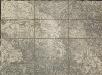
Generalkarte von Zentraleuropa

Plan von Bergwerg Laposneck
Mollova mapová sbírka Geyer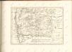

Szeged és Debrecen
1 : 750000 Debrecín (Maďarsko : oblast) M. Kir. Állami Térképészet