Maps of Ráckevei járás
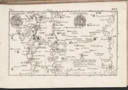
C. Pilisiensis ; C. Solthensis
Ungarn Komitat Pest-Pilis-Solt-Kiskun
Duna
1 : 25000 Budapešť (Maďarsko : oblast) M. Kir. Állami Térképészet
2 Ofen-Pest
Budapest
Budapest und Teteny.
from Spezialkarte der osterreichisch-ungarischen Monarchie.
Obuda, (Budapest).
from Spezialkarte der osterreichisch-ungarischen Monarchie.
Dunaadony und Kunszentmiklos.
from Spezialkarte der osterreichisch-ungarischen Monarchie.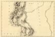
St. Andre - Ertsin
Mollova mapová sbírka Marsili, Luigi Ferdinando
Pilis hegység
1 : 50000 M. Kir. Állami Térképeszet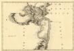
Sectio. IV, Barkan - Sz. André
Mollova mapová sbírka Marsili, Luigi Ferdinando
Budapest székes-föváros egész területének térképe
1 : 25000 Budapešť (Maďarsko) Kogutowicz, Manó Magyar földrajzi intézet
[Gradkartenblatt]
1 : 25000 Maďarsko Vojenský zeměpisný ústav
Budapest

Budapest...

Óbuda, (Budapest)
1 : 75000 Budapest-Óbuda Geripp: Offiz. Leitner, Assist. Scharre u. Fldw. Kostrba. Terrain: Vorst. Adler, Offiz. Leitner u. J. Fitz
Übersichts Karte der Umgebung von Ofen und Pesth
1 : 125000 Budapešť (Maďarsko : oblast) Mathiowitz
Rác-Adony
1 : 75000 Adony, Adony (Region)
Budapest székesföváros térképe
1 : 25000 Budapešť (Maďarsko) M. Kir. Állami Térképészet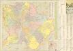
Budapest Térképe

Buda-Pest
1 : 150000 Budapest
Budapest székes-fövaros és környékének térképe
1 : 20000 Budapešť (Maďarsko) Homolka, Josef Hoffmann Alfréd
Budapest székes-fövaros és környékének térképe
1 : 20000 Budapešť (Maďarsko) Homolka, Josef Hoffmann és Molnár
Budapest székes-főváros és környékének térképe
Homolka, József
Budapest tervrajza
Budapešť (Maďarsko : oblast) Posner Károly Lajos és Fia
Budapest fö- és székváros legujabb térképe
Budapešť (Maďarsko) Barta Lajos
Buda-Pest
1 : 150000 Budapest
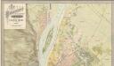
Plan der Ueberschwemmung von Ofen und Pesth: bei dem Eisgang des höchsten Wasserstandes vom 15ten auf den 16ten März 1838 zum Besten der durch die Ueberschwemmung Verunglückten

Plan der Ueberschwemmung von Ofen und Pesth
1 : 30000 Budapešť (Maďarsko) 5ten feld Artill. Regiment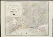
Grundriss der König Ungrischen Freien Hauptstadt Ofen samt ihrer Angrenzung
1 : 15000 gezeich. u. zusammengesetzt von Tiller Pesth : beij Joseph Müller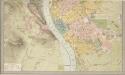
Budapest fö- és Székváros térképe
Homolka, József