Maps of Mediterranean Sea
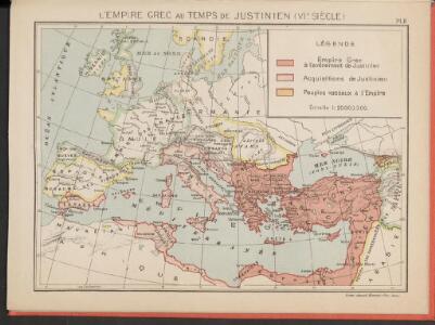
L'Empire Grec au temps de Justinien (VI.e siècle)
Byzantinisches Reich Justinian I.
Das Römische Reich
Malá Asie
Europa zur Zeit der Kreuzzüge
Europa, Byzantinisches Reich, Kreuzzüge
Europa zu Anfang des 6ten Jahrhunderts
Europa Völkerwanderung
Die nach der Völkerwanderung entstandenen neuen Reiche. Anfang des 6ten Jahrh
Europa Völkerwanderung
Romanum Imperium.
1 : 13000000 Darton, William
Roman Empire.
1 : 9000000 Young, James H.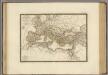
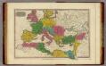
Empire Romain sous Constantin.
1 : 11300000 Brue, Adrien Hubert, 1786-1832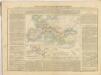
Romanum Imperium.
1 : 13000000 Finley, Anthony

Europa 1812
Europa Kunz, Andreas ; Moeschl, Joachim Robert
33. Europa im Jahre 1808
Europa Napoleon I., Frankreich, Kaiser
Europa 1839
Europa Kunz, Andreas ; Röss, Wolf ; Moeschl, Joachim Robert
Europa 1861
Europa Kunz, Andreas ; Röss, Wolf ; Moeschl, Joachim Robert
Europa 1867
Europa Kunz, Andreas ; Röss, Wolf ; Moeschl, Joachim Robert
Europa 1881
Europa Kunz, Andreas ; Röss, Wolf ; Moeschl, Joachim Robert
Geognostische Karte der Alpen in Savoyen und der Schweitz in einem Theile von Deutschland, Frankreich, Piemont und der Lombardei
1 : 1300000 1 Karte gez. von F. Schoedinger ; gest. von J. Scheurman [Orell, Füssli und Compagnie], [Zürich]
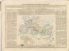
L'Europe au Temps des Croisades.
Andriveau-Goujon, J.
TABLEAU DE L'EMPIRE ROMIN
Afrika severní Las Cases, Emmanuel-Auguste-Dieudonné Didot, Pierre Jules Didot Ainé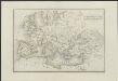
[Historisch-geographischer Atlas zu den allgemeinen Geschichtswerken von C. v. Rotteck, Pölitz u. Becker] : Uebersichts-Karte der nach der Völkerwanderung entstandenen neuen Reiche
von Julius Loewenberg Lithographie von B. Herder in Freiburg im Breisg. [Freiburg im Breisgau] : [Herder]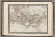
Empire Romain.
1 : 14400000 Monin, C.V.
Europa 1913
Europa Kunz, Andreas ; Röss, Wolf ; Moeschl, Joachim Robert
Europa 1793
Europa Kunz, Andreas ; Moeschl, Joachim Robert
Europa 1789
Europa Kunz, Andreas ; Moeschl, Joachim Robert
Europa 1848
Europa Kunz, Andreas ; Röss, Wolf ; Moeschl, Joachim Robert
Europa 31.12.1806
Europa Kunz, Andreas ; Moeschl, Joachim Robert
Europa 1795
Europa Kunz, Andreas ; Moeschl, Joachim Robert