Maps of Borski

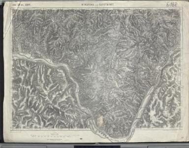
Berzászka und Óasszonyrét
1 : 75000 Banat Geripp: Offiz. E. Schill u. Offiz. M. Jakupec. Terrain: Oberlt. C. Mirilović u. Oberlt. R. Machold
Berzaszka und O-Ogradina.
from Spezialkarte der osterreichisch-ungarischen Monarchie.
Lambert-Cholesky sheet 2146 (Bigăr)
1 : 20000 Romanian military topographic map sheet under Lambert-Cholensky projection Direcția Topografică Militară geo-spatial.org Direcția Topografică Militară
Lambert-Cholesky sheet 2145 (Eibenthal)
1 : 20000 Romanian military topographic map sheet under Lambert-Cholensky projection Direcția Topografică Militară geo-spatial.org Direcția Topografică Militară
Lambert-Cholesky sheet 2246 (Ogradena Veche)
1 : 20000 Romanian military topographic map sheet under Lambert-Cholensky projection Serviciul Geografic al Armatei geo-spatial.org Serviciul Geografic al Armatei
Lambert-Cholesky sheet 2245 (Plavişeviţa)
1 : 20000 Romanian military topographic map sheet under Lambert-Cholensky projection Direcția Topografică Militară geo-spatial.org Direcția Topografică Militară
Lambert-Cholesky sheet 2046 (Liubcova)
1 : 20000 Romanian military topographic map sheet under Lambert-Cholensky projection Direcția Topografică Militară geo-spatial.org Direcția Topografică Militară
Lambert-Cholesky sheet 2144 (Şviniţa)
1 : 20000 Romanian military topographic map sheet under Lambert-Cholensky projection Direcția Topografică Militară geo-spatial.org Direcția Topografică Militară
Lambert-Cholesky sheet 2244 (Tişoviţa)
1 : 20000 Romanian military topographic map sheet under Lambert-Cholensky projection Direcția Topografică Militară geo-spatial.org Direcția Topografică Militară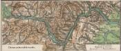
Donaudurchbruch
1 : 500000 Eisernes Tor, Donau (Region)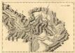
Sectio XIV Widdin - Stanna
Mollova mapová sbírka Marsili, Luigi Ferdinando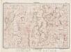
Lambert-Cholesky sheet 2147 (Chiacovatul)
1 : 20000 Romanian military topographic map sheet under Lambert-Cholensky projection Direcția Topografică Militară geo-spatial.org Direcția Topografică Militară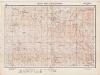
Lambert-Cholesky sheet 2247 (Valea Ieşelniţa)
1 : 20000 Romanian military topographic map sheet under Lambert-Cholensky projection Institutul Geografic Militar geo-spatial.org Institutul Geografic Militar
Lambert-Cholesky sheet 2047 (Gârnic)
1 : 20000 Romanian military topographic map sheet under Lambert-Cholensky projection Direcția Topografică Militară geo-spatial.org Direcția Topografică Militară
Blatt XII, [Geologisch overzicht], uit: Geologische Übersichts-Karte der Österreichisch-Ungarischen Monarchie / nach den Aufnahmen der K.K. Geologischen Reichsanstalt bearb. von Franz Ritter von Hauer ; gezeichn. von Eduard Jahn
1 : 576000 Annotatie geografische gegevens: Gebaseerd op veldwerk in de jaren 1850 tot 1865 Hauer, Franz Ritter von; Jahn, Eduard; Kaiserlich-Königliche Geologische Reichsanstalt, Wenen Wien : Beck
Jižní část krašovské stolice s českými osadami
Banat Tschechen
Serbisch-rumänische Grenze
1 : 600000 Banat Grenze
Oršava
1 : 200000 Oršava (Rumunsko) Kartografska radionica
Alt-Moldova.
from Spezialkarte der osterreichisch-ungarischen Monarchie.
Orsova und Turnu-Severin.
from Spezialkarte der osterreichisch-ungarischen Monarchie.
Dolnij Milanovac
1 : 75000 Donji Milanovac
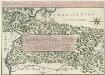
Action de Mehadia Gagne Svr les Infideles par les Trouppes Imperiales le 15. Iuillet 1738
Mollova mapová sbírka Geyer

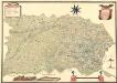
Krassó - Szörény Vármegye
Theatre de la Guerre sur la Timock 1737
Mollova mapová sbírka Briffaut, Etienne Briffaut, Stephan
Nordost-Serbien
Serbien
Bulgaria
Mollova mapová sbírka Hoffmann, Johannes Hoffmann, Johann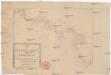
Die Shiffahrt auf der Donau von der Spitze Syrmiens bis in das Schwarze Meer
Bělehrad (Srbsko)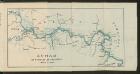
Dunav od Beograda do Radujevca
1 : 750000 Belgrad, Radujevac