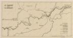
Maps of Verpelét

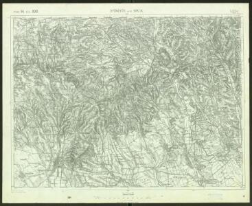
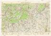
Gyöngyös und Bakta
1 : 75000 Gyöngyös Geripp: Fwkr. Suchanek. Terrain: Hauptm. Peraković u. Oberlt. Kuźmin
Mátra hegység
1 : 50000 Mátra (Maďarsko : pohoří) M. Kir. Állami Térképészet
Gyongyos und Bakta (Ungarn).
from Spezialkarte der osterreichisch-ungarischen Monarchie.
Heves vármegye térképe
1 : 390000 Kogutowicz, Manó Magyar Földrajzi Intézet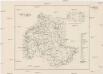
Comitat Heves
1 : 288000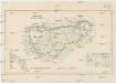
Comitat Gran
1 : 288000 Ostřihom (Maďarsko)
Gömörer Comitat
1 : 288000 Gemer (Slovensko : oblast)
Gömörer Comitat
1 : 290000 Revúca (Slovensko : oblast)
Gömörer Comitat
1 : 288000 Revúca-oblast (Slovensko)
Comitat Heves
1 : 290000
Gömör vármegye és a' vele törvényesen egyesült Kis-Honti kerület
1 : 240000 Gemer (Slovensko : oblast) Ráisz, Christ. Benedicti, Hieronymus Görög
Jász-Berény 149, uit: Special-Karte von Mittel-Europa / nach amtlichen Quellen bearbeitet von W. Liebenow
1 : 300000 titelvariant: W. Liebenow's Mittel-Europa; Annotatie: Titel boven de bladen: W. Liebenow's Mittel-Europa Johannes Wilhelm Liebenow 1822-1897 Frankfurt a. M. : Ludwig Ravenstein
Heves és Külsö-Szölnok törv. egyesült vármegyek
1 : 540000 Szolnok-oblast (Maďarsko) Litzner, Joannes Baptist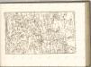

Mappa Comitatus Pesthiensis Methodo Astronomico-Geometrica, concinnata.
1 : 166600 Mollova mapová sbírka Mikoviny, Sámuel Nicolaï, Georg David Christoph
Stolice Novohrad
Komitat Nógrád ethnische Gruppe
Mappa Comitatvs Neogradiensis Methodo Astronomico-Geometrica concinnata
1 : 166600 Mollova mapová sbírka Mikoviny, Sámuel Nicolaï, Georg David Christoph
Borsoder Comitat
1 : 288000
Borsoder Comitat
1 : 288000
Borsod vármegye
1 : 410000 Görög, Demeter Biller, Bernhard Görög
A Dunavölgy Átnézeti Térképe, Carte d ́ensemble del la Vallée du Danube VIII.

Nógrád vármegye
1 : 376000 Novohrad (Slovensko a Maďarsko) Görög, Demeter Festetics, György Görög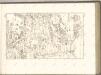

Arlo und K.Terenne (Ungarn).
from Spezialkarte der osterreichisch-ungarischen Monarchie.
Erlau und Mezo-Keresztes..
from Spezialkarte der osterreichisch-ungarischen Monarchie.
Paszto und Apcz (Ungarn).
from Spezialkarte der osterreichisch-ungarischen Monarchie.
C. Heves und Szólnok
Ungarn Komitat Heves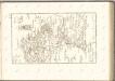
Neubertova generální automapa Republiky československé
1 : 200000 Debrecín (Maďarsko : oblast) Soukup, Jan V. Neubert a synové