Maps of Oder-Spree

Frankfurt 61, uit: Special-Karte von Mittel-Europa / nach amtlichen Quellen bearbeitet von W. Liebenow
1 : 300000 titelvariant: W. Liebenow's Mittel-Europa; Annotatie: Titel boven de bladen: W. Liebenow's Mittel-Europa Johannes Wilhelm Liebenow 1822-1897 Frankfurt a. M. : Ludwig Ravenstein
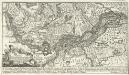
Marchionatus Lusatiae inferioris Bohemiae olim regno jam elect. Saxoniae subject in circulos, dynastias et praefect. accuratissime distinctus
1 : 180000 Horní Lužice (Německo) Seutter, Matthäus Lotter, Tobias Conrad sumtibus Matth. Seutteri
Marchionatus Lusatiae inferioris Bohemiae olim regno iam elect. Saxoniae subject. in circulos, dynastias et praefect. accuratisssime distinctus
1 : 185000 Dolní Lužice (Německo) Lotter, Tobias Conrad Tob. Conr. Lotter
Marchionatus Lusatiae inferioris Bohemiae olim regno jam elect. Saxoniae subject. in circulos, dynastias et praefect. accuratissime distinctus
1 : 185000 Dolní Lužice (Německo) Lotter, Tobias Conrad T. C. Lotter
Marchionatus Lusatiae Inferioris Bohemiae olim Regno jam Elect. Saxoniae subjectus in Circulos, Dynastias et Praefect accuratissime distinctus
1 : 180000 Mollova mapová sbírka Seutter, Matthäus Lotter, Tobias Conrad Seutter, Matthäus
Lusatia Inferior
1 : 250000 Mollova mapová sbírka Weigel, Christoph Weigel, Christoph I.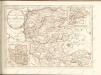

91. Frankfurt a/O., uit: Topographische Uebersichtskarte des Deutschen Reiches / herausgegeben v. d. Kartogr. Abt. d. Königl. Preuß. Landesaufnahme
1 : 200000 titelvariant: Topogr. Übersichtskarte des Deutschen Reiches; Annotatie: Titel boven bladen ook: Topogr. Übersichtskarte des Deutschen Reiches; Annotatie geografische gegevens: Op elk blad twee maatstokken: 10 Kilometer = 5,5 cm; 1 geogr. Meile = 3,6 cm; Legenda onder op elk blad Königlich Preußische Landesaufnahme. Kartographische Abtheilung [S.l : Königlich Preußische Landesaufnahme, Kartographische Abtheilung]
Der Sternbergsche Creis
1 : 292000 Sotzmann, Daniel Friedrich
Der Lebusische Creis
1 : 296000 Lubušsko (Německo a Polsko) Oesfeld, Karl Ludwig von Sotzmann, Daniel Friedrich
Der Lebusische Creis
1 : 296000 Lubušsko (Německo a Polsko) Oesfeld, Karl Ludwig von Sotzmann, Daniel Friedrich
Der Lebusische Creis
1 : 296000 Lubušsko (Německo a Polsko) Oesfeld, Karl Ludwig von Sotzmann, Daniel Friedrich
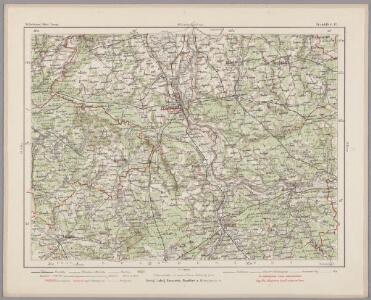
295. Furstenwalde.
1 : 100000 Reichsamt fur Landesaufnahme
Composite: 295. Furstenwalde.
1 : 100000 Reichsamt fur Landesaufnahme
297.1 Zielenzig.
1 : 100000 Reichsamt fur Landesaufnahme
Composite: 320. Furstenberg.
1 : 100000 Reichsamt fur Landesaufnahme
Composite: 297 Zielenzig.
1 : 100000 Reichsamt fur Landesaufnahme
319. Beeskow.
1 : 100000 Reichsamt fur Landesaufnahme
Composite: 321. Krossen a. d. Oder.
1 : 100000 Reichsamt fur Landesaufnahme
297. Zielenzig.
1 : 100000 Reichsamt fur Landesaufnahme
Composite: 319. Beeskow.
1 : 100000 Reichsamt fur Landesaufnahme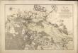
Plan von der Battaille bey Cunersdorf am 12ten August 1759

90. Berlin (Süd), uit: Topographische Uebersichtskarte des Deutschen Reiches / herausgegeben v. d. Kartogr. Abt. d. Königl. Preuß. Landesaufnahme
1 : 200000 titelvariant: Topogr. Übersichtskarte des Deutschen Reiches; Annotatie: Titel boven bladen ook: Topogr. Übersichtskarte des Deutschen Reiches; Annotatie geografische gegevens: Op elk blad twee maatstokken: 10 Kilometer = 5,5 cm; 1 geogr. Meile = 3,6 cm; Legenda onder op elk blad Königlich Preußische Landesaufnahme. Kartographische Abtheilung [S.l : Königlich Preußische Landesaufnahme, Kartographische Abtheilung]
Okrestnosti Kunnersdorfa
Polen Kunersdorf Siebenjähriger Krieg
Blatt VIII Strausberg, uit: Karte von Berlin und Umgebung in 12 Blättern
1 : 50000 Annotatie: Toelichtingen opgeborgen bij kaart; Annotatie geografische gegevens: Met schaalstokken: Meter, Schritt, geographische Meile Paul Schneider Berlin : Reichsamt für Landesaufnahme
Blatt XII Fürstenwalde, uit: Karte von Berlin und Umgebung in 12 Blättern
1 : 50000 Annotatie: Toelichtingen opgeborgen bij kaart; Annotatie geografische gegevens: Met schaalstokken: Meter, Schritt, geographische Meile Paul Schneider Berlin : Reichsamt für Landesaufnahme
Bataille de Cunersdorf

Sraženīe pri Kunnersdorfě 1 avgusta 1759 g.
Polen Kunersdorf Siebenjähriger Krieg Schlacht bei Kunersdorf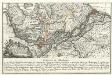
Plan der Bataille welche zwischen der Kaysl. Russischen u. König. Preuss. Armeen den 25. Aug. 1758 bey Zorndorf in der neuen Markt Brandenburg vorgefallen
Mollova mapová sbírka