Maps of Italy
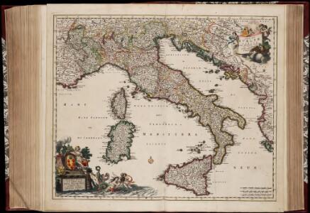
Totius Italiæ tabula / per Nicolaum Visscher
1 : 3000000 Annotatie: Cum privilegio Ordinum Holland[iæ] et West-Fris[iæ]; Met opdracht van N. Visscher aan Cosmo III van Toscane; Origineel is Blad 151 in atlas factice; Annotatie geografische gegevens: Met 3 schaalstokken; Legenda Nicolaes Jansz. Visscher jr. 1649-1702 [Amsterdam : N. Visscher]

Italia, Gallia citerior, Illyricum, Sicilia, Sardinia, Corsica.
1 : 3900000 Menke, Th.
Italien 1847
Italien Kunz, Andreas ; Moeschl, Joachim Robert
Italien 1865
Italien Kunz, Andreas ; Moeschl, Joachim Robert
Italien 1829
Italien Kunz, Andreas ; Moeschl, Joachim Robert

Italien 1815
Italien Kunz, Andreas ; Treiling, Thomas ; Moeschl, Joachim
Italien 1814
Italien Kunz, Andreas ; Treiling, Thomas ; Moeschl, Joachim
Italien 1804
Italien Kunz, Andreas ; Treiling, Thomas ; Moeschl, Joachim
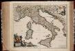
Totius Italiae Tabula. [Karte], in: Novus atlas absolutissimus, Bd. 5, S. 14.
1 Karte aus Atlas Janssonius Offizin
Italien 1866
Italien Kunz, Andreas ; Moeschl, Joachim Robert
Italien Oktober 1797
Italien Kunz, Andreas ; Treiling, Thomas ; Moeschl, Joachim
Map of Italy.
1 : 6050000 Bowen, Emanuel
Italien 1871
Italien Kunz, Andreas ; Moeschl, Joachim Robert
Italien 1870
Italien Kunz, Andreas ; Moeschl, Joachim Robert
Italien 1820
Italien Kunz, Andreas ; Moeschl, Joachim Robert
Italien 1861
Italien Kunz, Andreas ; Moeschl, Joachim Robert
Italien 1768
Italien Kunz, Andreas ; Treiling, Thomas ; Moeschl, Joachim
Italien 1809
Italien Kunz, Andreas ; Treiling, Thomas ; Moeschl, Joachim
Italien März 1799
Italien Kunz, Andreas ; Treiling, Thomas ; Moeschl, Joachim
Italien
Neuester Schul-Atlas Walch, Johann im Verlag bei Joh. Walch
Italien
Allgemeiner Atlas [Walch, Johannes] im Verlag bei Johannes Walch
Italy.
1 : 3000000 Cary, John, ca. 1754-1835
ITALIA cum Insulis dependentib[us]
1 : 8800000 Itálie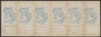
Tabula Europae VI. [Karte], in: Claud. Ptolemaeus. Geographia lat. cum mappis [...], S. 269.
1 Karte aus Atlas Münster, Sebastian [und Ptolemaeus, Claudius]

Italien
E. von Sydow's Schul-Atlas in sechs und dreissig Karten Sydow, Emil von bei Justus Perthes