Maps of Cologne Government Region
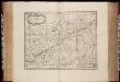
Coloniensis Archiepiscopatus / [Henricus Hondius]
1 : 550000 Annotatie: Rechtsboven: XXXVIII; Verschenen in: The English atlas volume III ... - Amsterdam : J. Jansonius a Waesberg and S. Swart, 1683; Origineel is Blad 71 in atlas factice; Oorspr. uitg.: Amstelodami : apud Henricum Hondium, [1630]; Annotatie geografische gegevens: West boven Hondius, Henricus [Amsterdam : J. Jansonius van Waesberge etc.]
Coloniensis Archiepiscopatus [Karte], in: Gerardi Mercatoris et I. Hondii Newer Atlas, oder, Grosses Weltbuch, Bd. 1, S. 194.
1 Karte aus Atlas Mercator, Gerhard und Hondius, Jodocus Jansson, Jan
Coloniensis Archiepiscopatus [Karte], in: Le théâtre du monde, ou, Nouvel atlas contenant les chartes et descriptions de tous les païs de la terre, Bd. 1, S. 305.
1 Karte aus Atlas Blaeu, Willem Janszoon und Blaeu, Joan Blaeu, Willem Janszoon
Coloniensis Archiepiscopatus [Karte], in: Novus Atlas, das ist, Weltbeschreibung, Bd. 1, S. 276.
1 Karte aus Atlas Blaeu, Joan Blaeu, Willem Janszoon
Coloniensis Archiepiscopatus [Karte], in: Novus atlas absolutissimus, Bd. 2, S. 142.
1 Karte aus Atlas Janssonius Offizin
Coloniensis Archiepiscopatus [Karte], in: Theatrum orbis terrarum, sive, Atlas novus, Bd. 1, S. 233.
1 Karte aus Atlas Blaeu, Joan Blaeu, Willem Janszoon
COLONIENSIS | Archiepiscopatus.
[Amsterdam : Joan Blaeu]
Coloniensis Archiepiscopatus
1 : 470000 Erzbistum Köln Merian, Matthäus Merianische Erben
[57][57] Novissima et accuratissima Archiepiscopatus Coloniensis ..., uit: Atlas sive Descriptio terrarum orbis
Annotatie: Gedigitaliseerde versie. Amsterdam. Heiloo : Picturae (vervaardiger), 2015. tiff-bestand. Gedigitaliseerd: 07-01-2015; Origineel: Universiteitsbibliotheek Vrije Universiteit (XL.05127.-) ; Netherlands; Titelpagina ontbreekt Wit, Frederik de Amsterdam : Frederick de Wit
Coloniensis Archiepiscopatus
1 : 350000 Mollova mapová sbírka Hondius, Henricus Hondius, Henricus
Coloniensis Archiepiscopatus
1 : 350000 Mollova mapová sbírka Gigas, Johann Michael Blaeu, Willem Jansz.

Coloniensis Archiepiscopatus
1 : 560000 Mollova mapová sbírka Merian, Matthaeus Merian, Matthäus
Archiepiscopatus et electoratus Coloniensis, ducatuum Iuliacensis, Montensis Limburgensis comitatus Meursiae et Geldriae hispanicae, novissima descriptio
1 : 300000 1 Karte : Kupferdruck ; 47 x 56 cm Danckerts, Justus [Danckerts]
La Basse Partie de L'Archevesché et Eslectorat de Cologne [Karte], in: Atlas nouveau, contenant toutes les parties du monde [...], Bd. 1, S. 205.
1 Karte aus Atlas Sanson, Nicolas Jaillot, Alexis Hubert und Mortier, Pieter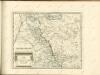

Mappa geographica, continens archiepiscopatum et electoratum Coloniensem, cum conterminis ducatibus Juliacensi et Montensi, nec non comitatu Mursano
1 : 280000 Aug. Vind : cura et sumtibus Tob. Conrad Lotter
Ducatus Iuliaci & Bergensis Tabula Geographica
1 : 340000 Mollova mapová sbírka Homann, Johann Baptist Homann, Johann Baptista - dědici
Archiepiscopatus et electoratus coloniensis ducatuum Iuliacensis montensis Limburgensis comitatus Meursiae et Geldriae Hispanicae
1 : 330000 Belgie Danckerts, Justus I. Danckerts

Archiepiscopatus Coloniensis Ducatibus Iuliacensi et Montensi Intermedius
1 : 300000 Mollova mapová sbírka Valk, Gerhard Valck, Gerard
Mappa geographica, continens archiepiscopatum et electoratum Coloniensem, cum conterminis ducatibus Juliacensi et Montensi, nec non comitatu Mursano
1 : 280000 Aug. Vind : cura et sumtibus Tob. Conrad Lotter

Regionum Coloniense Electoratu et Archiepiscopatu Subditarum Peraccurata Tabula
1 : 260000 Mollova mapová sbírka Visscher, Nicolaes Schenk, Peter II
Mappa geographica, continens archiepiscopatum et electoratum Coloniensem
1 : 300000 Kolín nad Rýnem-oblast (Německo) Lotter, Tobias Conrad Tob. Conrad Lotter
Mappa geographica, continens archiepiscopatum et electoratum Coloniensem
1 : 300000 Kolín nad Rýnem-oblast (Německo) Seutter, Matthäus cura et sumtibus Matth. Seutteri
Mappa Geographica, continens Archiepiscopatum et Electoratum Coloniensem
1 : 300000 Mollova mapová sbírka Seutter, Matthäus Seutter, Matthäus
Archiepiscopatus et Electoratus Coloniensis ut et Ducatuum Iuliacensis Et Montensis nec non Comitatus Meursiae Nova Tabula excudente
1 : 320000 Mollova mapová sbírka Homann, Johann Baptist Homann, Johann Baptista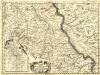
Parte Meridionale degli Stati dell'Elet. di Colonia
1 : 175000 Mollova mapová sbírka Coronelli, Vincenzo Maria
![Coloniensis Archiepiscopatus / [Henricus Hondius]](https://images-2.georeferencer.com/images/iiif/943351571874/full/,300/0/native.jpg)

