Maps of Micronesia

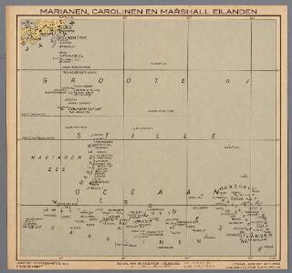
Marianen, Carolinen en Marshall eilanden
1 : 20000000 Annotatie: Vrijgegeven door W.B.N. 29-3 '44 Den Haag : Kompas
CHARTE der Insel-Kette RADACK UND RALICK
1 : 2100000 Marshallovy ostrovy Aichinger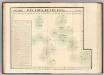
Iles Radak, Iles Ralik. Oceanique no. 10.
1 : 1641836 Vandermaelen, Philippe, 1795-1869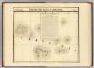
Partie, Iles Carolines. Oceanique no. 9.
1 : 1641836 Vandermaelen, Philippe, 1795-1869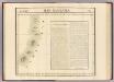
Iles Mariannes. Oceanique no. 5.
1 : 1641836 Vandermaelen, Philippe, 1795-1869
Partie, Iles Mariannes. Oceanique no. 2.
1 : 1641836 Vandermaelen, Philippe, 1795-1869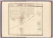
Archipel de Magellan. Oceanie no. 1.
1 : 1641836 Vandermaelen, Philippe, 1795-1869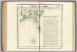
Partie du Japon. Asie 76.
1 : 1641836 Vandermaelen, Philippe, 1795-1869
Geological survey of Japan reconnaissance map
1 : 400000 Kochibe, T. ; Aarada, Toyokitsi [Geological Survey of Japan]
西国順礼絵図

西国順礼細見絵図
絵図屋 庄八
The automobile map
1 : 500000 Japonsko Nippon automobile club
西国順礼道中絵図
大坂屋 長三郎
Bigini or Pescadores Island ; Radogala and Korsakoff Islands
1 : 87000 United States. Hydrographic Office Hydrographic Office
Agronomic map of the Sagami-Province and the southern part of Musashi-Province
1 : 100000 Watanabe, H. Agronomic Section of the Imperial Geological Office of Japan
Agronomic map of the Shimotsuke Province (eastern part)
1 : 100000 Aoyama, H. Toyodo-Engraving-Office
Agronomic map of the Kai-Province
1 : 100000 Tsuneto, N. Agronomic Section of the Imperial Geological Office of Japan
Commonwealth of the Northern Mariana Islands Sheet 3 of 3
1 : 25000
Commonwealth of the Northern Mariana Islands Sheet 1 of 3
1 : 25000
125. Tokyo and Yokohama. Kobe and Osaka. The World Atlas.
1 : 250000 USSR (Union of Soviet Socialist Republics).
大内峠より天橋立眺望図
弓木版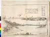
大内峠より天橋立眺望図
峰山版
丹後国図
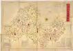
丹後全国明細図
南波 庄兵衛
宮津藩領地内石高明細図

細見丹後国大絵図
藤屋 弥兵衛、山城屋 佐兵衛、吉野屋 仁兵衛
細見丹後国大絵図
藤屋 弥兵衛、山城屋 佐兵衛、吉野屋 仁兵衛
Mapia-eilanden / Topografische Dienst
Topografische Dienst Delft [Delft] : Topografische Dienst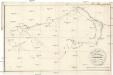
Plan der Insel-Gruppe Romanzoff
1 : 89000 Aichinger