Maps of Honshu

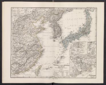
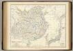
China (Östl. Theil), Korea und Japan
Handatlas über alle Theile der Erde und über das Weltgebäude Stieler, Adolf Justus Perthes
[Ost-China, Korea und Japan]
Adolf Stieler's Handatlas über alle Theile der Erde und über das Weltgebäude Stieler, Adolf Justus Perthes
China (Östl. Theil), Korea und Japan
Hand-Atlas über alle Theile der Erde und über das Weltgebäude Stieler, Adolf Justus Perthes
China (Ostl. Theil), Korea Und Japan.
1 : 7500000 Petermann, A.
Ostasien
1 : 4500000 Asie východní Herrich, Alwin Carl Flemming
Ostasien
1 : 4500000 Asie východní Herrich, Alwin Carl Flemming
Ostasien
1 : 4500000 Asie východní Herrich, Alwin Carl Flemming
Chine.
1 : 9300000 Bonne, Rigobert, 1727-1794
Chine, Japon.
1 : 16500000 Lattre, Jean
China, Japan.
1 : 7500000 Playfair, Principal
The empire of China and island of Iapan
1 : 18600000 Japonsko Moll, Herman
China.
1 : 13400000 Finley, Anthony
Russisch - Japanische Kriegsschauplatz

Maps of the Far East, illustrating Russo-Japanese War
1 : 6000000
China.
1 : 13000000 Darton, William
99-100. Cina Propria, Corea.
1 : 5000000 Touring club italiano
JAPANESE EMPIRE-POLITICAL
China, Japan.
1 : 6198319 Johnston, Alexander Keith, 1804-1871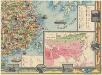
Map of China
Diakoff, John A.
Iaponia [Karte], in: Gerardi Mercatoris Atlas, sive, Cosmographicae meditationes de fabrica mundi et fabricati figura, S. 541.
1 Karte aus Atlas Mercator, Gerhard Montanus, Petrus
Japanese Empire - political.
1 : 6000000 John Bartholomew and Son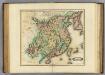
China.
1 : 7500000 Lizars, Daniel
Asia 1:4 000 000
1 : 4000000 Asie War Office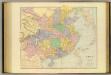
China.
1 : 5702400 Stanford, Edward

Korea, Nordost-China und Süd-Japan
1 : 4500000 Korea Carl Flemming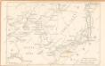
Russisch - Japanische Kriegsschauplatz

Kaart van Oost-Azië / J. Wackie
1 : 5000000 Annotatie: Met versterkte plaatsen (door landmacht en zeemacht); Gegevens verzameld over de periode/Data collected over the period: 1904; Annotatie geografische gegevens: Legenda J. Wackie Amsterdam : J.H. de Bussy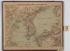
Korea, Nordost-China und Süd-Japan
1 : 4500000 Annotatie geografische gegevens: 3 schaalstokken; 3 inzetkrt.: Peking en omgeving. - 1:1.000.000. Tokio en omgeving. - 1:1.000.000. Söul en omgeving. - 1:1.666.666 Glogau : Carl Flemming