Maps of Appennini

Ober- und Mittel-Italien
Handatlas über alle Theile der Erde und über das Weltgebäude Stieler, Adolf Justus Perthes
Ober- und Mittel-Italien
Hand-Atlas über alle Theile der Erde und über das Weltgebäude Stieler, Adolf Justus Perthes
Ober-Und Mittel-Italien.
1 : 1850000 Petermann, A.
Italie Septentriole.
1 : 1940000 Migeon, J.
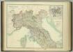
Ober, Mittel-Italien.
1 : 1200000 Kiepert, Heinrich, 1818-1899
Ober und Mittel-Italien
1 : 1200000 Itálie severní Kiepert, Heinrich Gräf, C. Geographisches Institut
Ober und Mittel-Italien
1 : 1200000 Itálie severní Kiepert, Heinrich Gräf, Carl Geographisches Institut
Gallia Cisalpina et Italia Propria
1 : 2200000 Mollova mapová sbírka Weigel, Christoph Weigel, Christoph I.
Italiae pars borealis.
1 : 6000000 Fenner, Rest.
Northn. Italy.
1 : 6000000 Fenner, Rest.
Italy North.
1 : 1550000 Hall, S. (Sidney)
Northern Italy.
1 : 2400000 Colton, G.W.
Nördliches Italien
1 : 1480000 Benátky-oblast (Itálie) Weiland, Karl Ferdinand im Verlage des Geograph. Instituts
Ober und Mittel Italien

Northern Italy.
1 : 2400000 Colton, G.W.
[Historisch-geographischer Atlas zu den allgemeinen Geschichtswerken von C. v. Rotteck, Pölitz u. Becker] : Italien und Spanien zur Uebersicht der Napoleonischen Feldzüge
von Julius Loewenberg [Freiburg im Breisgau] : [Herder]
Charte von Ober- und Mittel-Italien
1 Karte : Kupferdruck ; 47 x 56 cm Götze im Verlage des Landes Industrie Comptoirs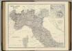
Italy N., central.
1 : 1500000 Johnston, Alexander Keith, 1804-1871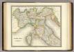
North Italy.
1 : 1950000 Teesdale, Henry
Ober und Mittel Italien

Northern Italy.
1 : 2400000 Colton, G.W.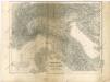
Ober und Mittel Italien

Northern Italy.
1 : 2400000 Colton, G.W.
Ober und Mittel Italien
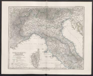
North & Central Italy and Corsica.
1 : 1500000 Johnston, W. & A.K.
Noerdliches Italien
Hand-Atlas über alle Theile der Erde nach dem neuesten Zustande und über das Weltgebäude Stieler, Adolf bei Justus Perthes
Italia Superior et Corsica
Schul-Atlas der alten Welt bei Justus Perthes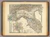
Italiae regiones IIII-XI.
1 : 1900000 Menke, Th.
Special-Karte von Ober- und Mittel-Italien
1 : 811000 Itálie severní Kiepert, Heinrich Kraatz, Leopold D. Reimer