Maps of Kärnten
Militair Karte von Süd-Deutschland in 20 Sectionen
1 : 400000 20. Section Coulon, Alois von A. von Coulon
Orographisch-hidrographische Carte des Herzogthums Steyermark
Štýrsko (Rakousko) Schmutz, Carl Hartwig, Eduard Joseph Franz Kaiser
Orographisch-hidrographische Carte des Herzogthums Steyermark
Štýrsko (Rakousko) Schmutz, Carl Hartwig, Eduard Joseph Franz Kaiser
Generalkarte von Zentraleuropa
Karte des Herzogthums Kaernten
1 : 232000 Klagenfurt (Rakousko : oblast) Bayer, Michael Ferdinand v. Kleinmayr
Unterkaernten oder der Klagenfurter Kreis
1 : 250000 Klagenfurt-oblast (Rakousko) Kindermann, Joseph Karl Junker, Christoph Franz Xaver Miller
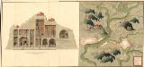
Plan der Bergwerg, Stain, und Schwamburg
Mollova mapová sbírka Geyer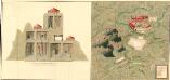
Plan der Bergwergs Schwarz Rappen, in der Gosniz
Mollova mapová sbírka Geyer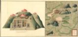
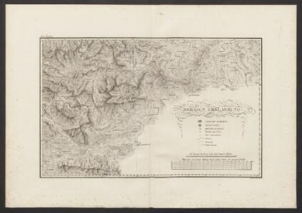
Plan deren Gebirgen Sent-Kopf, und Wurtzkopf
Mollova mapová sbírka Geyer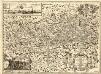
Novissima Carinthiae Tabula
1 : 260000 Mollova mapová sbírka Zauchenberg, Johann Baptist Zeuchenberg, Johann Baptist
Ducatus Carinthiae Tabula
1 : 740000 Mollova mapová sbírka Engelbrecht, Martin Engelbrecht, Martin
Ducatus Carinthiae Tabula
1 : 740000 Mollova mapová sbírka Engelbrecht, Martin Engelbrecht, Martin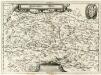
Ertzhertzogthum Kärnten
1 : 600000 Mollova mapová sbírka Valvasor, Janez Vajkard Endter, Wolfgang Moritz
Carinthiae Ducatvs Hertzogthum Cärnten
1 : 560000 Mollova mapová sbírka Merian, Matthaeus Merian, Matthäus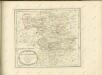

Unterkærnten oder der Klagenfurter Kreis
1 Karte : Kupferdruck ; 46 x 55 cm Kindermann; Miller; Junker verlegt bey Franz Xaver Miller Buchhændlern
Celovec
1 : 200000 Klagenfurt (Rakousko : oblast) Kartografska radionica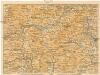
[Graz und Umgebung]
1 : 500000 Štýrský Hradec (Rakousko : oblast) Wagner & Debes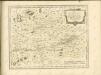

Spezial Karte des Marburger Kreises im Herzogthum Steyermark
1 : 220000 Maribor-oblast (Slovinsko) Kaiser, Joseph Franz Jos. Fr. Kaiser
Special Karte des Marburger Kreises im Herzogthume Steyermark
1 : 200000 Maribor-oblast (Slovinsko) Kaiser, Jos. Fr. Jos. Fr. Kaiser
Spezial Karte des Marburger Kreises im Herzogthum Steyermark
1 : 220000 Maribor-oblast (Slovinsko) Kaiser, Joseph Franz Jos. Fr. Kaiser
Gradec
1 : 200000 Štýrský Hradec (Rakousko : oblast) Kartografska radionica
Hittenberg und Eberstein.
from Spezialkarte der osterreichisch-ungarischen Monarchie.
D. Landsberg und Wolfsberg.
from Spezialkarte der osterreichisch-ungarischen Monarchie.
Murau.
from Spezialkarte der osterreichisch-ungarischen Monarchie.
Gurk-Thal.
from Spezialkarte der osterreichisch-ungarischen Monarchie.
Yugoslavia 1:100,000, Slovenji Gradec
Yugoslavia 1:100,000 , Series GSGS 4396. Great Britain. War Office. [London] : War Office