Maps of Lower Saxony

[Hannover, Braunschweig, Kurhessen, Gr. Herz. Hessen, Hess. Homburg]
Schul-Atlas in 36 Karten Völter, Daniel Verlag der J.M. Dannheimer'schen Buchhandlung
Eisenbahnkarte von Nordwest-Deutschland
1 : 2000000 Německo severozápadní Geograph. Anstalt von Wagner & Debes
82-83. West Germany. The World Atlas.
1 : 1250000 USSR (Union of Soviet Socialist Republics).
Northern and Central Germany.
1 : 2154240 Fullarton, A. & Co.
Germany north.
1 : 2800000 Arrowsmith, Aaron; Lewis, Samuel
Germany north.
1 : 2800000 Arrowsmith, Aaron; Lewis, Samuel
German Empire 1.
1 : 1774080 Letts, Son & Co.
W. Germany.
1 : 1300000 Arrowsmith, John
German Federal Republic. Pergamon World Atlas.
Polish Army Topography Service
German Federal Republic. Pergamon World Atlas.
Polish Army Topography Service
Western Germany 22
1 : 1700000 Appleton, D. & Co.
Germany (Deutschland)
1 : 1776000 Hannover (Německo) Walker, C. Baldwin & Cradock
The North West Part of Germany
1 : 2500000 Mollova mapová sbírka Moll, Herman Moll, Hermann
Weiland's Specialkarte der west-norddeutschen Bundesstaaten
Bavorsko (Německo) Weiland, Karl Ferdinand Beck'schen Univ. Buchh. (A. Hölder)
Special-Karte der west-norddeutschen Bundesstaaten

Karte von Deutschland in IV Blättern
1 : 825000 Nordwest-Blatt Sotzmann, Daniel Friedrich im Verlage der A. G. Schneider und Weigels
CIRCULUS WESTPHALICUS IN SUAS PROVINCIAS ET DITIONES accurate distinctus et recentissime delineat
1 : 1100000 Vestfálsko (Německo) Seutter, Matthäus cura et caelo Matth. Seutteri
Circulus Westphalicus in suas provincias et dittiones
1 : 1040000 Vestfálsko (Německo) Seutter, Matthäus cura et caelo Matth. Seutteri
Circulus Westphalicus in suas provincias et dittiones
1 : 1040000 Vestfálsko (Německo) Seutter, Matthäus cura et caelo Matth. Seutteri
Weiland ́s Specialkarte der west-norddeutschen Bundesstaaten

Germany.
1 : 1500000 Colton, G.W.
Die Herzogthuemer Saxonia und Lotharingia inferior; dann Thuringia, Osterland, Massia &c.
1 : 1900000 Spruner von Merz, Karl
Nordwest-Deutschland
1 : 2000000 Německo severozápadní Kocen, Blaž E. Hölzel
Possessions du roi de Prusse a l'ouest du Weser
1 : 1730000 Neuchâtel (Švýcarsko) Mentelle, Edme Tardieu, Pierre François
NW Deutschland, Niederlande, Belgien.
1 : 5500000 Brudin, J. L.; Stieler, Adolf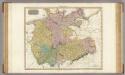
Germany north of the Mayn.
1 : 1180000 Pinkerton, John, 1758-1826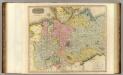
Germany N. of Mayne.
1 : 1200000 Thomson, John
Westphalen
Allgemeiner Atlas [Walch, Johannes] im Verlag bei Johannes Walch
Nordwestliches Deutschland, Niederlande und Belgien

![[Hannover, Braunschweig, Kurhessen, Gr. Herz. Hessen, Hess. Homburg]](https://images-2.georeferencer.com/images/iiif/122565519973/full/,300/0/native.jpg)

