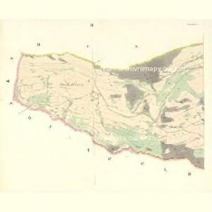
Maps of Olšany

Olleschau (Ollssany) - m2136-1-002 - Kaiserpflichtexemplar der Landkarten des stabilen Katasters
1 : 2880
Olleschau (Ollssany) - m2136-1-003 - Kaiserpflichtexemplar der Landkarten des stabilen Katasters
1 : 2880
Olleschau (Ollssany) - m2136-1-001 - Kaiserpflichtexemplar der Landkarten des stabilen Katasters
1 : 2880
Buschin - m0303-1-004 - Kaiserpflichtexemplar der Landkarten des stabilen Katasters
1 : 2880
Buschin - m0303-1-005 - Kaiserpflichtexemplar der Landkarten des stabilen Katasters
1 : 2880
Buschin - m0303-1-003 - Kaiserpflichtexemplar der Landkarten des stabilen Katasters
1 : 2880
Buschin - m0303-1-001 - Kaiserpflichtexemplar der Landkarten des stabilen Katasters
1 : 2880
Buschin - m0303-1-002 - Kaiserpflichtexemplar der Landkarten des stabilen Katasters
1 : 2880
Bartelsdorf (Bartonow) - m0034-1-002 - Kaiserpflichtexemplar der Landkarten des stabilen Katasters
1 : 2880
Bartelsdorf (Bartonow) - m0034-1-001 - Kaiserpflichtexemplar der Landkarten des stabilen Katasters
1 : 2880
Studinke (Studinky) - m0826-1-004 - Kaiserpflichtexemplar der Landkarten des stabilen Katasters
1 : 2880
Studinke (Studinky) - m0826-1-001 - Kaiserpflichtexemplar der Landkarten des stabilen Katasters
1 : 2880
Studinke (Studinky) - m0826-1-003 - Kaiserpflichtexemplar der Landkarten des stabilen Katasters
1 : 2880
Studinke (Studinky) - m0826-1-002 - Kaiserpflichtexemplar der Landkarten des stabilen Katasters
1 : 2880
Studinke (Studinky) - m0826-1-005 - Kaiserpflichtexemplar der Landkarten des stabilen Katasters
1 : 2880
Eisenberg an der March - m2630-1-001 - Kaiserpflichtexemplar der Landkarten des stabilen Katasters
1 : 2880
Eisenberg an der March - m2630-1-002 - Kaiserpflichtexemplar der Landkarten des stabilen Katasters
1 : 2880
Eisenberg an der March - m2630-1-003 - Kaiserpflichtexemplar der Landkarten des stabilen Katasters
1 : 2880
Klösterle (Klassterek) - m1186-1-001 - Kaiserpflichtexemplar der Landkarten des stabilen Katasters
1 : 2880
Klösterle (Klassterek) - m1186-1-002 - Kaiserpflichtexemplar der Landkarten des stabilen Katasters
1 : 2880
Bohutin - m0148-1-002 - Kaiserpflichtexemplar der Landkarten des stabilen Katasters
1 : 2880
Bohutin - m0148-1-001 - Kaiserpflichtexemplar der Landkarten des stabilen Katasters
1 : 2880


Podrobná mapa Království českého
1 : 100000 Králíky (Ústí nad Orlicí, Česko : oblast) Srp, Jan Jaroslav Bursík
[Vilímkovy místopisné mapy zemí Koruny české]
1 : 100000 Králíky (Ústí nad Orlicí, Česko : oblast) Srp, Jan Jos. R. Vilímek
Landskorn und Mhr. Trubau.
from Spezialkarte der osterreichisch-ungarischen Monarchie.
II. vojenské mapování 4
1 : 144000