Maps of Vlašim

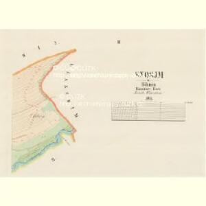
Snosjm - c9293-1-001 - Kaiserpflichtexemplar der Landkarten des stabilen Katasters
1 : 2880
Snosjm - c9293-1-002 - Kaiserpflichtexemplar der Landkarten des stabilen Katasters
1 : 2880
Dub - c1577-1-004 - Kaiserpflichtexemplar der Landkarten des stabilen Katasters
1 : 2880
Dub - c1577-1-001 - Kaiserpflichtexemplar der Landkarten des stabilen Katasters
1 : 2880
Dub - c1577-1-003 - Kaiserpflichtexemplar der Landkarten des stabilen Katasters
1 : 2880
Dub - c1577-1-002 - Kaiserpflichtexemplar der Landkarten des stabilen Katasters
1 : 2880
Hražena Lhotta - c2339-1-001 - Kaiserpflichtexemplar der Landkarten des stabilen Katasters
1 : 2880
Hražena Lhotta - c2339-1-002 - Kaiserpflichtexemplar der Landkarten des stabilen Katasters
1 : 2880
Gradkartenblatt
1 : 25000 Vlašim-oblast (Česko) Bernhauer, Clemens
III. vojenské mapování 4154/1
1 : 25000

[Gradkartenblatt]
1 : 25000 Vlašim-oblast (Česko) Vojenský zeměpisný ústav
Podrobné mapy zemí Koruny české v měřítku 1:75.000 a mapa vzdáleností všech míst při silnici ležících
1 : 75000 Načeradec (Česko : oblast) Bělohlav, Josef F. Topič
Podrobné mapy zemí Koruny české v měřítku 1:75.000 a mapa vzdáleností všech míst při silnici ležících - Divišov - Vlašim - Načeradec. Průvodce statisticko-historický po všech místech na těchto mapách uvedených a rejstřík věcný názvů hor, potoků, řek, rybníků atd. Sešit 17. List 70,
1 : 75000
Vlašim
1 : 75000 Vlašim (Česko : oblast) Vojenský zeměpisný ústav
Bystřický vikariát
Bystřice (Benešov, Česko)
Ledeč und Wlaschim
1 : 75000 Ledeč nad Sázavou (Česko : oblast) Bednarowski, Alex K. u. k. militär-geographisches Institut
Ledeč und Wlaschim
1 : 75000 Ledeč nad Sázavou (Česko : oblast) Bednarowski, Alex K. u. k. Militärgeographisches Institut
Ledeč und Wlaschim
1 : 75000 Ledeč nad Sázavou (Česko : oblast) K. u. k. Militärgeographisches Institut
III. vojenské mapování 4154
1 : 75000
Podrobná mapa Království českého
1 : 100000 Ledeč nad Sázavou (Česko : oblast) Srp, Jan Jaroslav Bursík
[Vilímkovy místopisné mapy zemí Koruny české]
1 : 100000 Ledeč nad Sázavou (Česko : oblast) Srp, Jan Jos. R. Vilímek
Politický okres Benešov
1 : 100000 Benešov-oblast (Česko) Kratochvíl, M. Josef Richard Vilímek
Politický okres Vlašim
1 : 100000 Vlašim-oblast (Česko) Kratochvíl, M. Josef Richard Vilímek
[Beneschau und Umgebung]
1 : 144000 Benešov-oblast (Česko) Kořistka, Karel František Edvard
Situační mapka rudního terrainu v Sedlčanské vysočině
Benešov-oblast (Česko)
Konigsaal und Beneschau.
from Spezialkarte der osterreichisch-ungarischen Monarchie.
Selcan und Junc-Woschitz.
from Spezialkarte der osterreichisch-ungarischen Monarchie.
Politický okrec Benešovský